 The state of Karnataka is located in the south western part of India. The geographical terrain of this state is characterized by rivers, hill ranges, lakes, forests, waterfalls and beaches. It"s natural beauty, along with monuments, world heritage sites, temples etc draw tourists to this state and add value to its tourism industry. To reach Karnataka, international as well as domestic airports have been established in the state.
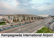
Kempegowda International Airport
Kempegowda International Airport is located in Devanahalli. This public airport is owned and operated by Bangalore International Airport Limited (BIAL). It was opened on 24th of May, 2008. This airport has one runway and passenger terminal, which is responsible for domestic and international operations.
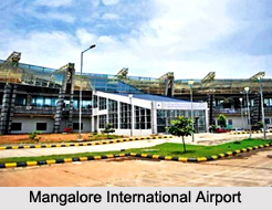
Mangalore International Airport
Mangalore International Airport is located near Bajpe, 13 km northeast of Mangalore city centre. This public airport is owned and operated by Airports Authority of India. It was opened on 25th of December, 1951. For the year 2014, a 54 percent growth in international passenger traffic was recorded at Mangalore Airport. This airport has been successful in attaining one of highest year-over-year passenger growth rates in India.
Mysore Airport
Mysore Airport is located near the village of Mandakalli, 10 kilometers south of Mysore. This public airport is owned and operated by the Airports Authority of India. It is equipped with a single runway, one passenger terminal and an apron with three parking stands, which is connected to the runway by a single perpendicular taxiway.
Jindal Vijaynagar Airport
Jindal Vijaynagar Airport is located in the village of Toranagallu. This public airport is owned and operated by a company called JSW Steel. It has one runway which is connected to the apron by two perpendicular taxiways. The terminal of this airport is spread over an area of about 190 square meters.
Sedam Airport
Sedam Airport is situated in Sedam. This private airstrip which was established in 1986 is managed by Vasavadatta Cement, a unit of BK Birla Group.
Harihar Airport
Harihar Airport looks after the transportation needs of the people living in Harihar. This private airport is operated by Grasim Industries Ltd.
Yelahanka Air Force Station
Yelahanka Air Force Station is situated in Yelahanka, Bengaluru. This military airport is operated by the Indian Air Force. It is engaged in training pilots to fly transport planes and conducting type-conversion of navigators on the Antonov An-32. A biennial air show named Aero India is also conducted here in every two years.
Other Airports in Karnataka
Belgaum Airport, Koppal Airport, Hindustan Airport and Jakkur Aerodrome are some of the other Airports in Karnataka.


