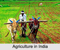
 Agriculture in India is the basis of the economy of the country. It accounts for the maximum portion of the total income of the country. More specifically, agriculture and associated activities contribute about 13.7 percent to the gross domestic product (GDP) of India. Agriculture acts as a source of raw materials for the principal industries of India such as sugar industry, jute textiles and cotton textiles. Agriculture in India is the principal occupation of the people of the country. The livelihood of more than 50 percent of the working population of India depends on agriculture. Majority of the rural population in India depends on agriculture for a living and over 600 million farmers are involved in agriculture and related activities. Agriculture in India significantly affects lifestyles of the Indians. With passing decades, agriculture in India has gained multi-functional success in generating food, nutritional and ecological securities and employment. India ranks second after United States with regards to agricultural activities. Indian agriculture by its complete size and quantum of activities can control the global markets directly and indirectly.
History of Agriculture in India
History of Agriculture in India is 10,000 years old. Agriculture in India began during 9000 BCE as a result of early cultivation of plants and domestication of crops and animals. During middle ages in India, irrigation channels reached a new level of sophistication. Land and water management systems were developed with an objective of providing uniform growth of crops. The Indian agricultural sector employed about 60 percent of the total workforce, despite a steady decline in its share in the GDP. Agriculture is still the largest economic sector in India and plays a significant role in the overall socio-economic development of the country.
Factors Affecting Agriculture in India
 Agriculture in India depends on a variety of factors. Arable land area in India is about 168 million hectares. Agriculture in India has an advantage of about 52 percent of cultivable land and variety in Indian climate. India enjoys sunshine round the year. It is regarded as the world`s best country to grow crops throughout the year. Due to urbanization and rapid population growth in the metropolitan cities of India, there is an increased demand for food supply. A well-developed agricultural research system, a significant area of almost 60 million hectares under irrigation and increased production of major crops has enabled Indian agriculture to become a globally competitive participant.
Output of Agriculture in India
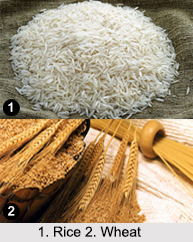
Output of agriculture in India relates to crops. India is a large country with uneven rainfall distribution, varied soils and marked seasons (like mildly cool winters and hot summers in north India). Regional contrasts favor diversity in crop production. In areas of perennial supply of water, two or more crops are raised in a year. However, crop yield per hectare in India is the poorest in the world. India produces large quantities of rice, tea, jute, cotton, wheat and sugarcane despite low per hectare yields. India leads the world in the production of jute and tea. Food grain crops are dominant everywhere in India. They cover as much as three fourth of the total cropped area in the country. Uncertain rainfall, floods and droughts sometimes ruin crops. Indian soils have been found to be deficient in important nutrients like nitrogen and phosphorus. Therefore, the usage of chemical fertilizers has become popular among the farmers, to make up for the deficiency.


