 The name old name for Kannur district was `Cannanore` which was the anglicized form of the Malayalam word Kannur. According to popular belief `Kannur` is a derivation from Kanathur, an ancient village. This village survives even today in one of the wards of Kannur Municipality. On other hand, there is another belief that associates the district name with Lord Krishna. `Kannur` refers to the place of Lord Krishna as because `Kannan` means Lord Krishna and `Ur` means place, in this context, it is worth mentioning that the deity of the Katalayi Sreekrishna temple was originally installed in a shrine at Katalayi Kotta in the South-Eastern part of the present Kannur town.
Geography of Kannur District
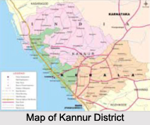
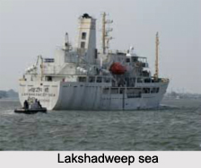
The Kannur district in Kerala is located between latitudes 11 degrees 40 minutes to 12 degrees and 48 minutes North and longitudes 74degrees 52 minutes to 76degrees 07 minutes East. The district is bound by the Western Ghats in the East i.e. Coorg district of Karnataka, Kozhikkode and Wayanad districts in the South, Lakshadweep sea in the West and Kasaragod in the North. Predominantly, the Kannur district experiences a humid climate with summer ushering in March and continuing till May. The Southwest Monsoon arrives and continues till September. Kannur district is also rich in vegetation.
 Administration of Kannur District
Kannur district came into existence as an administrative unit on first January 1957, when the former Malabar district and Kasaragod taluk of Madras State were reconstituted into three revenue districts, namely, Kannur, Kozhikode and Palakkad town. At the time of its formation, the district consisted of seven taluks, viz, Kasaragod, Hosdurg, Thaliparamba, Kannur, Thalassery, North Wayanad and South Wayanad. Subsequently, the South Wayanad taluk was included in Kozhikode district with effect from 15th March 1957. Later, on first November 1980, Wayanad district was formed carving out South Wayanad and North Wayanad taluks. Two northern most taluks of Kannur district, viz; Kasaragod and Hosdurg were separated on 24th May 1984 for the formation of Kasaragod district.
Presently Kannur district has three taluks, viz., Kannur Thaliparamba and Thalassery. The taluks are subdivided into 129 villages.
Demography of Kannur District
Out of the total population of Kannur district, which is 2251727, 1098838 are males and 1152889 are females. A total of 1106251 comprise the rural population while 1145476 are the urban population.
Tourism in Kannur District
There are numerous tourist spots in Kannur district. The St. Angelos Fort in the Kannur Cantonment, which was constructed in 1505, is a symbol of Portuguese architecture and attracts plenty of tourists. The Thalassery Fort is an important tourist centre. Kannur beach and Ezhimala are known for scenic beauty. Places of historic importance, like the house of Gulldert, who composed the first Malayalam- English Dictionary and the mosque at Madayi constructed in 1124, using marble brought from Mecca attract many tourists. In addition to these, there are beaches and parks in Kannur district as well.


