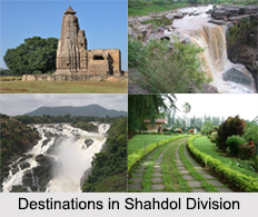
 Districts in Shahdol Division in Madhya Pradesh include Shahdol District, Umaria District and Anuppur District.
Shahdol District
Shahdol District is a district of Madhya Pradesh. Shahdol District has total area of 5,671 square kilometers and a population of 908,148. Shahdol District is an important district of Madhya Pradesh. The town of Shahdol is the district headquarters. The district is also a division. Some of the districts in this division are Annupur and Umaria. The Virateshwar Temple in Sohagpur Vangana is the most important tourist destination of Shahdol and a structural masterpiece. The district extends 110 km from east to west and 170 km from north to south.
Umaria District
Umaria District is an important north eastern district in Shahdol division of Madhya Pradesh state, having a global location between north latitude 23 degree 38 minutes to 24 degree 20 minutes and east longitude 80 degree and 28 minutes to 82 degree 12 minutes. The town of Umaria is the district headquarters. The district is part of Shahdol Division.
The total geographical area of Umaria District sums up to 4548 square kilometers and has a population of 515,963. Umaria District is enriched with its vast resources of forests and minerals. The coalmines of Umaria District are a steady source of revenue for the district. The most important mineral found in the district is coal and as a result 8 mines are being operated by South Eastern Coalfields Limited in the district. The famous Bandhavgarh National Park (Tala) and Sanjay Gandhi Thermal Power Station at Mangthar (Pali) are located in the district. Umaria District was formerly the headquarters of the South Rewa District and thereafter the headquarters town of the Bandhavgarh tehsil. It is situated at a distance of about 69 km. from Shahdol, the parent district. Metalled roads connect the town with Katni, Rewa Shahdol, etc., on which regular buses ply. Umaria is also a railway station on the Katni-Bilaspur section of the South-Eastern Railway.
Anuppur District
Anuppur District is an administrative district in Shahdol Division of Madhya Pradesh state in central India. Anuppur District is bordered by Korea District of Chhattisgarh state on the east, Bilaspur District of Chhattisgarh on the southeast, Dindori District of Madhya Pradesh on the southwest, Umaria District of Madhya Pradesh on the west, and Shahdol District on the northwest and north. The administrative headquarters of the district is Anuppur. The district has one Jawahar Navodaya Vidyalaya at Amarkantak which is the origin of two rivers i.e. Narmada River and Son River. Anuppur District was created on 15th August 2003 out of Shahdol District. It is part of Shahdol Division.


