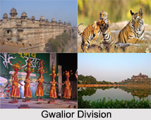
 Districts of Gwalior Division in Madhya Pradesh cover the districts like Gwalior district, Ashoknagar District, Shivpuri District, Datia District, Datia District and Guna district. Gwalior Division is an administrative subdivision of Madhya Pradesh state in central India. This division was formed from the Mughal era. This part in Madhya Pradesh had seen the royal development from the 10th century AD.
Gwalior District
Gwalior district is one of the 51 districts of Madhya Pradesh state in central India. Gwalior is its administrative headquarters. Gwalior is a royal medieval city in Central India. Gwalior Metropolitan Region is one of the major metropolitan areas in India. Other cities and towns in this district are Antari, Bhitarwar, Bilaua, Dabra, Morar, Lashkar, Morar Cantonment, Pichhore, and Tekanpur.
Ashoknagar District
Ashoknagar District is a district of Madhya Pradesh. The city of Ashoknagar is the administrative headquarters of the district.
Shivpuri District
Shivpuri District is a district of Madhya Pradesh state of India. The town of Shivpuri is the district headquarters.
Datia District
Datia District is in Gwalior Division in the Indian state of Madhya Pradesh. The town of Datia is the district headquarters. Datia District also has some famous temples. Peetambra Peeth is one such temple, which attracts many pilgrims. Purana Mahal also known as Datia Mahal is visible from the railway line between Gwalior to Jhansi and was built to welcome Mughal Emperor Jahangir after his coronation. The King never actually visited fearing he would have to reward the King of Datia for his help in getting the Mughal throne. Some of the other tourist spots are Ratangarh Mata, Sonagiri Temples, Shri Siddh Baba Mandir in Kurthara, Beer Singh Deo Mahal, Unao-Balaji Sun Temple, Badi mata mandir, Bihari Ji Mandir, Govind Ji Mandir Rajgarh Palace and Museum and Samrat Ashok Silalekh in Gujarra.
Guna District
Guna district is one of the 51 districts of Madhya Pradesh. Its administrative headquarters is Guna. The district has a population of 1,240,938. It has an area of 6390 square km, and is bounded on the northeast by Shivpuri District, on the east by Ashoknagar District, on the southeast by Vidisha District, on the southwest by Rajgarh District, on the west and northwest by Jhalawar District and Baran district of Rajasthan state. The Sindh River flows northward along the eastern edge of the district, forming part of the boundary with Ashoknagar District, and the Parbati River flows northwestward through the southern portion of the district, forming part of the boundary with Baran District before flowing into Rajasthan. On 15th August 2003, Guna District was split in two, with the eastern portion becoming Ashoknagar District. Awan is a town in the Guna district of Madhya Pradesh, India, located 37 kilometers south from Guna headquarters, 9 kilometers from Raghogarh-Vijaypur, and 152 kilometers from the capital of Madhya Pradesh, Bhopal.


