 South Indian states include Telangana, Andhra Pradesh, Tamil Nadu, Karnataka and Kerala. These South Indian states are covering the southern part of the peninsular Deccan Plateau. These states are bounded by the Bay of Bengal in the east, the Arabian Sea in the west and the Indian Ocean in the south. The geography of the region is diverse with two mountain ranges - the Western Ghats Mountain Range in India and Eastern Ghats Mountain Range in India, bordering the plateau heartland. Godavari River, Krishna River, Kaveri River, Tungabhadra River and Vaigai River are important sources of water. Bengaluru, Chennai, Hyderabad, Amaravati, Coimbatore and Kochi are the largest urban areas in the south Indian states with the scope to develop the economic sectors.
History of South Indian States
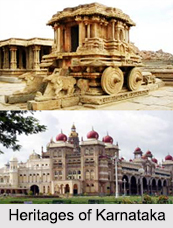
Excavations have shows Neolithic cultures and artifacts dating back to 8000 BCE have been found in southern part of India. The region has been a part of the trade route used by Romans, Greeks, Arabs, Jews, and Chinese during 3rd and 4th century. This was also a part of Silk route that developed trade relations with the East and West. Southern India has been ruled by several dynasties during the ancient and medieval era from 6th century BCE to 14th century CE. Dynasties like Cheras, Zamorins, Pandyas, Cholas, Satavahanas, Travancore royal family, Kingdom of Cochin, Mushikas, Pallavas, Kadambas, Western Gangas, Rashtrakutas, Chalukyas, Hoysalas, and Kakatiyas developed monumental sculptures and architectures in this region that are an integral part of the cultural and historical heritage of the country now. The architectural marvel at Hampi, built during 14th century CE by Vijayanagara Empire is an example here.
Vijayanagara Empire was the last dynasty to rule the region and post that southern Indian has been through multiple invasions. Delhi Sultanate led to the fall of Vijayanagara Empire and eventually captured the region and ruled as Deccan Sultanate. The region was later invaded by the Marathas, Palaiyakkarars, and Nayaks. Southern India was initially colonized by the Europeans in the 15th Century and by the mid 18th Century the French and British constantly fought over for control of that region. After several battles like the Anglo-Mysore war and the Vellore Mutiny, the British took control over that region in 1857 with exception of Pondicherry (now Puducherry) which remained under French rule. The British Empire divided the region into a few states and presidencies such as Madras Presidency, Hyderabad State, Mysore, Travancore, Cochin, and Jeypore.
After the Independence of Indian in 1947, Andhra State was formed for Telugu speaking people in 1953 and added to the existing Madras State, Mysore State, Hyderabad State, and Travancore–Cochin. Under the States Reorganisation Act of 1956, southern Indian was reorganized into multiple states based on linguistic lines. These states are what we have today with the recent addition of Telangana in 2 June 2014 by bifurcating Andhra Pradesh.
Geography of South Indian States
The peninsular India shaped like an inverted triangle is guarded by sea on all sides. It has Vindhyas and Satpura ranges running along the coastal regions while Eastern Ghats and Western Ghats meeting at the Nilgiri mountains. The low-lying coral islands of Lakshwadeep form the southwestern coast of India while the Andaman and Nicobar islands are located in the eastern coast. The Palk Strait and the chain of islands forming Rama`s Bridge separate southern India from Sri Lanka. The southernmost tip of India is at Kanyakumari which is also the meeting point of the Indian Ocean, Bay of Bengal, and the Arabian Sea. The Deccan plateau is also an elevated region bounded by mountains and watered by many rivers and their tributaries.
Climate of South Indian States
Southern India has tropical climate and mostly depends on monsoon for rainfall. Some of the regions are considered warmest in the country with average daily high temperature of 33 degrees C. It is warm to hot all year round, at average water temperatures of 28 degrees C. Precipitation is comparatively less here and winter, summer, and monsoons are the main seasons.
Flora and Fauna of South Indian States
Due to coastal location and mountainous regions, southern India has a vast range of Flora and Fauna. Deciduous forests are found along the Western Ghats while tropical dry forests and scrub lands are common in the Deccan plateau. Montane rain forests are found in South Western Ghats and Malabar Coast moist forests are found along the coastal plains. The biodiversity of the Western Ghats has been listed among the eight hottest biodiversity spots in the world and is a UNESCO World Heritage Site.
Enriched with vast ecological regions, south Indian states are blessed with several wildlife sanctuaries, biosphere reserves and national parks that are home to different species of animals and birds, including endangered ones. The fauna mainly includes Asian elephants, Royal Bengal tigers, giant squirrel, sloth bear, grey slender loris, Nilgiri tahr, Nilgiri langur, Indian leopard, blackbuck, chital deer, and lion tailed macaque. Due to its proximity to the sea, the coastal regions of southern India has rich marine life, coral reefs, and some endangered aquatic species like dugongs, dolphins, whales and sea cucumbers.
Andhra Pradesh
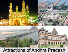
Andhra Pradesh is one of the south Indian states. The state is the eighth largest state in India covering an area of 160,205 sq km. Andhra Pradesh is promoted for the presence of beaches like Ramkrishna Beach, Rishikonda Beach, Bheemili, Suryalanka, Krishnapatnam, Vodarevu beach, Uppada beach; forts like Golconda Fort; caves like Borra Caves and Belum Caves; mountain ranges; valley like Araku Valley; and the wildlife sanctuaries like Coringa, Krishna Wildlife Sanctuary, Nagarjunsagar-Srisailam Tiger Reserve, Kambalakonda Wildlife Sanctuary, Sri Venkateswara Zoological Park, Indira Gandhi Zoological Park, Atapaka Bird Sanctuary, Nelapattu Bird Sanctuary and Pulicat Lake Bird Sanctuary. Amaravathi is the capital of Andhra Pradesh.
 Karnataka
Karnataka is a state in south western region with the capital and largest city -Bangalore. This south Indian state is bordered by the Arabian Sea and the Laccadive Sea to the west, Goa to the northwest, Maharashtra to the north, Telangana to the northeast, Andhra Pradesh to the east, Tamil Nadu to the southeast, and Kerala to the southwest.
Kerala
Kerala, one of the south Indian states, is spread over 38,863 km2 and it is bordered by Karnataka to the north and northeast, Tamil Nadu to the east and south, and the Lakshadweep Sea to the west. Kerala is the thirteenth-largest state by population and is divided into 14 districts with the capital being Thiruvananthapuram. Malayalam is the most widely spoken language and is also the official language of this south Indian state.
Tamil Nadu
Another south Indian state Tamil Nadu lies in the southernmost part of the Indian Peninsula and is bordered by the union territory of Puducherry and the South Indian states of Kerala, Karnataka, and Andhra Pradesh. It is bounded by the Eastern Ghats Mountain Range in India on the north, by the Nilgiri Mountain Range, the Annamalai Hills, and Kerala on the west, by the Bay of Bengal in the east, by the Gulf of Mannar and the Palk Strait on the southeast, and by the Indian Ocean on the south. The state shares a maritime border with the nation of Sri Lanka. Chennai is the state capital.
Telangana
Among all the south Indian states, Telangana is one of them. Telangana has an area of 112,077 square kilometers. The major cities include Hyderabad, Warangal, Nizamabad, Khammam, Karimnagar District and Ramagundam. Telangana is bordered by the states of Maharashtra to the north and North West, Chhattisgarh to the north, Karnataka to the west and Andhra Pradesh to the east and south. Hyderabad is the capital of this south Indian state.


