 North Indian States trace their origin from the history of the land. These states are politically mapped in 1767 by the British East India Company, but these cities were developed during the era of Indus Valley Civilization. The dominant geographical features of that demarcate North India from Tibetan Plateau are the Indo-Gangetic Plain and the Great Himalayas. The social, cultural, linguistic and religious unity helped the North Indian states to promote tourism and other industrial development in the modern India.
History of North Indian States
The Northern part of modern India has been the historical centre of the Mauryan Empire, Indo-Greek Empire, Northern Satraps, Gupta Empire, Harsha Empire, Pala Empire, Pratihara Empire, Delhi Sultanate, Mughal Empire, Sur, Sikh, Maratha Empire and British Empire.
Culture of North Indian States
North Indian States have diverse culture which is reflected in the different pilgrimages in this region. This includes Hindu, Islamic, Sikh, and Buddhist pilgrimages. Hindu pilgrimages include Haridwar, Char Dham, Mathura,Varanasi, Ayodhya, Pushkar, Allahabad, and Vaishno Devi. Sarnath and Kushinagar are famous Buddhist centers. The Taj Mahal, an Islamic monument, is one of the Seven Wonders of the World. Other Islamic pilgrimages in north India include Dargah Hazratbal, Dargah of Khwaja Moin-ud-din Chishti, Dargah Hazrat Nizamuddin, and Piran Kaliyar Sharif. The golden temple which is a Sikh pilgrimage is a world heritage site is located in Punjab.
Hindi, Urdu, Punjabi, Dogri, Kashmiri, and English are official languages in different states and Union Territories of north India. According to Ministry of Culture, a city in Punjab named Patiala became the North Culture Zone on 23 March 1985 and this excludes Delhi.
Demography of North Indian States
People of North India majorly comprises of groups from Indo-Aryan ethno linguistic branch. The demography includes various social groups called Rajputs, Brahmins, Banias, Rors, Jats, Gurjars, Yadavs, Kolis, Khatris, Dalits and Kambojs. There are also several minor ethno-linguistic communities like Dravidian, Austroasiatic, and Tibeto-Burman and these group exits throughout the Indian subcontinent.
 Climate of North India
Lying on the north of peninsular India, north Indian states form the coldest regions of the country. The average daily high temperature is at 32 degrees. For several months of the year, it is warm to hot at temperatures continuously above 25 degrees, sometimes up to 40 degrees. North India experiences winters in the months between October and March, as this time the weather remains pleasant and mildly cold to very cold and temperature ranges from a freezing -2 degree C to 14 degrees C.
Flora and Fauna of North India
North Indian states are rich in natural resources and have a large cover of forests. Due to this rich vegetation, several species of animals and birds are found in this region. The vegetation in north Indian states can be categories under Deciduous Forests, temperate forests, tropical thorny forests, and evergreen forest. Animal species found in northern zone include elephant, snow leopard, Bengal tiger, Indian leopard, Asiatic stag, spotted deer, red deer, hog deer, Indian gazelle, blackbuck, Nilgai, porcupine, wild boar, Tibetan sand fox, Indian fox, rhesus monkey, langur, and jungle cat. Both indigenous and migratory birds can be found here.
Tourism in North India
The northern states have a diverse culture, and include different places of tourism interest that comprises nature tourism, leisure tourism, adventure tourism, and also pilgrimage tourism. Pilgrimage destinations include Haridwar, Ayodhya, Mathura, Allahabad, and Pushkar for Hindus. Buddhist pilgrimage centers are Sarnath and Kushinagar. The Sikh Golden Temple as well as world heritage sites such as the Nanda Devi Biosphere Reserve, Forts in Rajasthan, Jantar Mantar (Jaipur), Qutb Minar, Red Fort, Agra Fort, Fatehpur Sikri and Taj Mahal comprise the main tourist attractions in north India.
States of North India
The northern part of India is a loosely defined region consisting of Indus-Gangetic Plain, Thar Desert and the Himalayan Mountain Range. Currently, North Indian comprises of six states and four union territories. The states are Punjab, Haryana, Himachal Pradesh, Uttar Pradesh, Uttarakhand, and some parts of Rajasthan. The Union Territories include, Jammu & Kashmir, Ladakh, Delhi, and Chandigarh. The state of Jammu & Kashmir was accorded as two union territories in August 2019. One part became the union territory of Jammu & Kashmir and the other part became the union territory of Ladakh.
Following are the states in north India discussed in details:
Punjab: Punjab is bordered by the Indian states of Jammu and Kashmir to the north, Himachal Pradesh to the east, Haryana to the south and southeast, Rajasthan to the southwest, and the Pakistani province of Punjab to the west. The state capital is located in Chandigarh. The culture of Punjab includes the "bhangra" dance, a vast range of cuisine which has become widely popular abroad, and a number of seasonal and harvest festivals such as Lohri, Vasant Panchami, Vaisakhi and Teeyan. There are 22 districts in the Indian state of Punjab.
Haryana: Haryana is spread about 44,212 square km. The city of Chandigarh is its capital while the NCR city of Faridabad is the most populous city of the state. Haryana is bordered by Punjab and Himachal Pradesh to the north and by Rajasthan to the west and south. The Yamuna River defines its eastern border with Uttar Pradesh. The Indian state of Haryana also has 22 districts.
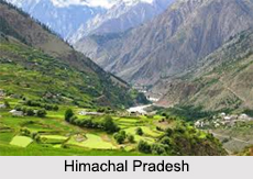
 Himachal Pradesh: Himachal Pradesh is bordered by Jammu and Kashmir on the north, Punjab and Chandigarh on the west, Haryana on the south-west, Uttarakhand on the south-east and by the Tibet Autonomous Region on the east. Himachal Pradesh consists of 12 districts.
Uttar Pradesh: Uttar Pradesh is the most populous state in India as well as the most populous country subdivision in the world. Lucknow is the capital city of Uttar Pradesh. Ghaziabad, Bulandshahr, Kanpur, Gorakhpur, Allahabad, Raebareli, Moradabad, Bareilly, Aligarh, Sonbhadra, and Varanasi are known for their industrial and tourism importance in this state. Currently, there are 75 districts in Uttar Pradesh.
Uttarakhand: Uttarakhand is often referred to as the "Devbhumi" due to many Hindu temples and Buddhist pilgrimage centers. It is noted for the Himalayan Mountain Range, the Bhabhar and the Terai. Uttarakhand is bounded by 13 districts, which are divided into two divisions- Garhwal and Kumaon regions.
Rajasthan: This state is partly located in the northern side of India, and some portion comes in the western part of India. Rajasthan has 33 districts in it.


