 Badulia is a village of the Burdwan district in the state of West Bengal in eastern India.
Location of Badulia
Badulia is a tiny village of the Burdwan district. It is a village in the Khandaghosh assembly area.
Geography of Badulia
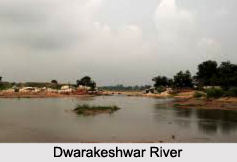
Badulia is at an average elevation of 35 meters. It lies to the north of the Damodar River, on the alluvial plains between the Damodar and the Dwarakeswar rivers. As a result, it has been a flood-prone area. Badulia is 18 km from Khandaghosh and 12 km from Burdwan sadar town. Most of the village falls on the west side of the Burdwan. Arambag Road. The Ghanaram Chacraborty Sarani, originating perpendicularly from the Burdwan- Arambag, road bisects the village.
Economy of Badulia
Badulia is also agriculture based village like other agro based village in Burdwan District. After land reform in West Bengal the agricultural lands were distributed here also from the big land lords. Though there are few family where large area of lands are still accumulated but there are many families who have small amount of agricultural lands. In the last two decades because of the open market economy all over India the cost of farming has largely increased. Now agriculture is no more profitable business for the small farmers. A large number of people in this village are engaged now in construction industry. Few middle-class or upper-middle-class family members are engaged in rice related business. There are people engaged in self owned business and in government service in different sectors.
Administration of Badulia
Badulia is in the Sagrai Gram Pachayat. The Panchayet office of Badulia is located in the central area of the village. The Block Development Office is 1 km from the Badulia bus stop.
