 Raigad District is a district in Maharashtra. The name of the district came into being after the name of the fort Raigad Fort. Raigad District had a population of 2,635,394, compared to 2,207,929 in 2001. In 2011, the urban dwellers had increased to 36.91 percent from 24.22 percent in 2001.
Location of Raigad District
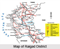
Raigad District is a district in the state of Maharashtra. This district is located in the Konkan region. Raigad District is located in dense forests on a west-facing spur of the Western Ghats of Sahyadri range. Raigad District is bounded by Mumbai Harbour to the northwest, Thane District to the north, Pune District to the east, Ratnagiri district to the south, and the Arabian Sea to the west. Raigad District includes the large natural harbour of Pen-Mandwa, which is immediately south of Mumbai Harbour and forming a single landform with it. The northern part of Raigad District is included in the planned metropolis of Navi Mumbai, and its port, the Jawaharlal Nehru Port.
History of Raigad District
Raigad District was split from Thane district in the year 1869. According to the 1872 census, Kulaba district had a population of just over 350,000 people, with 94 percent of the population being Hindus, and most of the remaining population being Muslims. In the year 1881 the population was about 382,000, with 95 percent of the population being Hindus. At this point the northernmost parts of modern Raigad district were retained in Thane district. After the annexation of Kobala from Marathas by the British East India Company, they developed this region from fort city to urbanised city.
Demography of Raigad District
According to the Population Census in the year 2011, Raigad district has a population of 2,634,200. Raigad District has a population density of 368 inhabitants per square kilometre. Its population growth rate over the decade 2001-2011 was 19.36 percent. Raigad District has a sex ratio of 955 females for every 1000 males, and a literacy rate of 83.89 percent. There are several scheduled tribes living in Raigad district. Among these are the Mahadev Tribe, Koli Tribe, Katkari Tribe and Thakur Tribe.
Tourism in Raigad District
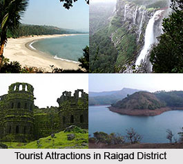
Tourism in Raigad District consists of serevral forts, beaches and hill stations. The various forts built by the Marathas and Muslim rulers are Avchitgad Fort, Karnala Fort, Kolaba Fort, Korlai Fort, Murud-Janjira , Padmadurg Fort and Sudhagad Fort. The climatic situation is the cynosure of this place. Apart from these, there are several hill stations and the beaches. Somes of the beaches are Mandawa Beach and Kihim Beach.
Visiting Information
Raigad District is well connected by Mumbai by Sion Panvel Expressway. The Mumbai-Pune expressway and National Highway 4 passes through Panvel. NH 17, which starts at Panvel, traverses the whole district. The Konkan Railway line starts at Roha and passes through Mangaon and Veer. The Central Railway Line of Mumbai to Pune passes through Karjat with Extension Line for Karjat to Khopoli.


