 Dams of Telangana have been constructed on several rivers and play an important role in the economy of the state. These dams are multipurpose. They are used to supply water for drinking, irrigation and generation of hydroelectric power. Some of the dams of Telangana are described below.
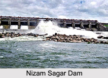
Nizam Sagar Dam
Nizam Sagar Dam is located in Nizamabad district. It is situated at a distance of about 144 kilometers, north-west of Hyderabad. The dam is a tank constructed across the Manjira River, a tributary of Godavari River (also known as the Ganga River of south India) between Achampet (Nizamabad) and Banjapalle villages of the Nizamabad district in Telangana. Nizamsagar Dam was constructed in the year 1923 by the ruler of the former Hyderabad State namely, Mir Osman Ali Khan. It was made by vacating over 40 villages.
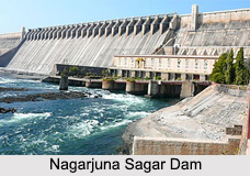
Nagarjuna Sagar Dam
 Nagarjuna Sagar Dam is the largest masonry dam in the world. It has been built on Krishna River at Nagarjuna Sagar, where the river acts as a boundary between Guntur district of Andhra Pradesh and Nalgonda District of Telangana. The construction of Nagarjuna Sagar Dam took place between the years, 1955 and 1967. Nagarjuna Sagar Dam is 490 feet (150 m) tall and 0.99 miles (1.6 km) long with 26 gates, which are 42 feet (13 m) wide and 45 feet (14 m) tall. The dam is associated with a water reservoir, which has a capacity of about 11,472,000,000 cubic meters (4.051x10¹¹ cu ft). This dam was the earliest in the series of large infrastructure projects initiated for the Green Revolution in India. It is one of the earliest multi-purpose irrigation and hydro-electric projects in India. The dam provides electric power to the national grid and water for irrigation to Nalgonda District and Khammam District of Telangana and Prakasam District, Krishna District and Guntur district of Andhra Pradesh.
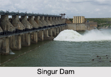
Singur Dam
Singur Dam, also known as Singoor Dam is located near Sangareddy town of Medak district in Telangana. It has been built on Manjira River. Its construction was completed in 1998. The dam is a project which aims at providing water for drinking, irrigation and generation of hydroelectricity. It helps in providing drinking water to Hyderabad, the capital city of Telangana and Andhra Pradesh. The dam is a pipeline scheme, providing an inter river basin transfer link. It feeds Krishna River basin with Godavari River water to provide drinking water to Hyderabad city and helps in the sewage flows for irrigation purpose. Singur Dam reservoir has a gross water storage capacity of about 30 TMC ft. Nearly 10 TMC ft of water is supplied to Hyderabad city from the reservoir. Singur Dam site is a popular tourist destination in Telangana.
Srisailam Dam
Srisailam Dam has been constructed across Krishna River at the border of Mahabubnagar district of Telangana and Kurnool district of Andhra Pradesh. It is a hydroelectric project of 3rd largest capacity in India. Srisailam Dam has been constructed in a deep gorge on Nallamala Hills, 300 m (980 ft) above sea level. It is 512 m (1,680 ft) long, 269.748 meters (885.00 ft) high and has 12 radial crest gates. The dam has a reservoir, which occupies an area of about 616 square kilometers (238 sq mi). The reservoir has a total capacity of about 216 TMC ft. The left bank power station associated with the dam houses 200,000 hp reversible Francis-pump turbines (for pumped-storage) and the right bank station contains 150,000 hp Francis-turbine generators.
 Upper Manair Dam
Upper Manair Dam has been constructed on Manair River at Narmal village, Gambhiraopet mandal in Rajanna Sircilla district of Telangana. Upper Manair Reservoir associated with Upper Manair Dam has a total capacity of about 62,387,000 cubic meters.
Lower Manair Dam
Lower Manair Dam, also known as LMD has been constructed across Manair River. It is located in Alugunur village, Thimmapur mandal in Karimnagar district of Telangana. The construction of the dam commenced in 1974. It was opened for operations in the year 1985. The catchment area of Lower Manair Dam is about 6648 square kilometers. The dam helps in providing drinking water to Karimnagar town and Warangal town. Lower Manair Reservoir is the reservoir associated with Lower Manair Dam.
Other Dams of Telangana
Some of the other dams of Telangana are Akkampalli Dam, Boggulavagu Dam, Dharamsagar Dam and Gandipally Dam.


