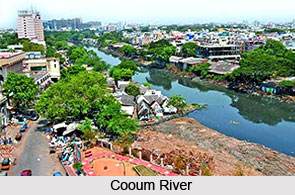
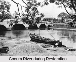
 Cooum River, which is also known as Triplicane River, is one of the most polluted rivers in South India. Due to the urbanisation, this rain fed river becomes polluted. The name Cooum River is derived from Tamil literature.
Location of Cooum River
Cooum River ends in the city of Chennai (which was formerly known as Madras) draining into the Bay of Bengal. Along with the Adyar River, Coonum River is running parallel to the south. Coonum River trifurcates the city and separates Northern Chennai from Central Chennai. The name of Coonum River may have been derived from the Tamil term Coopam meaning well or deep pit The word Coovalan or Coonum denotes a person who is well versed in the science of ground water, well water and stagnant water.
Etymology of Cooum River
Coonum River is considered to be the shortest classified river draining into the Bay of Bengal. It is only about 72 km long. Its source is in a place by the same name Cooum or Koovam in Tiruvallur district adjoining Chennai district of Tamil Nadu. Of the total length of 72 km, Coonum River flows in urban and semi-urban areas for 30 km and rural areas for 42 km. In Chennai district, Coonum River flows through three corporation zones like Kilpauk, Nungambakkam and Triplicane, with a total length of 16 kilometres.
 History of Coonum River
For centuries, Cooum River has been a vital part of the socio-economic and cultural life of the city of Chennai and other adjacent areas. Till the early twentieth century, Coonum River was a clean river, most suitable for navigation. In ancient times, it played a pivotal part in the far-flung maritime trade between the Roman Empire, South India and Sri Lanka. The ancient port of Manarpha or Mylapore is located near Coonum River. For this it added to the river`s strategic importance. Manarpha Port was frequented by Roman merchants who came here to buy Indian textiles, gemstones and spices. In return, India procured gold, silver, copper and high-quality wine from the Romans. The archaeologists have discovered ancient wine jars, Roman and Chinese coins from the banks of the river. In the late eighteenth century, Pachaiyappa Mudaliar, the renowned philanthropist, bathed in this river before offering prayers at the Komaleeswaranpet Temple in Chintadripet of Chennai. Cooum River and the nearby Elambore River which flows into the Cooum at its mouth were running very close to each other near the former Central Jail area opposite Chennai Central. During floods, both the watercourses inundated the whole area. In the 1700s, the two rivers were linked by a cut to equalise the floods in both the rivers and a bridge was constructed between these rivers in 1710 across the cut.
Coonum River became polluted owing to intensive use of surface water upstream for agriculture, indiscriminate pumping of groundwater leading to reduced base flow in the river, formation of sand bar at the mouth of the river, discharge of untreated sewage and industrial effluents and encroachment along the banks. According to the ancient scriptures to have its origin in Dharmapuri district, but now due to the changes in tectonic plates, Coonum River has shortened its course to Thiruvallur district. The ancient documents and scriptures from the nearby temples states about one reaching salvation on having a dip in the Cooum River. Cooum River was then clean and unpolluted.
Cooum River is presently a river spoiled by grime and pollution, and the water quality is considered to be highly toxic and completely non-potable. The 2004 tsunami cleaned the mouth of the river; however, the river returned to its usual polluted self within a short period.


