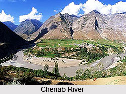
 The Chenab River is formed by the confluence of the Chandra and Bhaga rivers at Tandi in the upper Himalayas in the Lahaul and Spiti District of Himachal Pradesh, India. In its upper reaches it is also known as the Chandrabhaga. It is a tributary of the Indus River.
The Chenab River literally means "Moon" (Chan) and "River" (aab) is a major river of India and Pakistan. It flows through the Jammu region of Jammu and Kashmir into the plains of the Punjab, Pakistan. The waters of the Chenab are shared by India and Pakistan as per the terms of the Indus Water Treaty. It flows through the Jammu region of Jammu and Kashmir into the plains of the Punjab.
Geography of Chenab River
The waters of the Chenab start from snow melt from the Bara Lacha Pass, in Himachal Pradesh. The waters flowing south from the pass are known as the Chandra River and those that flow north are called the Bhaga River. Eventually the Bhaga flows around to the south joining the Chandra at the village of Tandi. The Chandra and Bhaga meet to form the Chandrabhaga River at Tandi. It becomes the Chenab when it joins the Marau River at Bhandera Kot, 12 km from Kishtwar Town in Jammu and Kashmir.
Chenab River, in Punjab constitutes the bounds between the Rechna and the Jech interfluves. The Ravi and the Jhelum River joins the Chenab at Trimmu. Near Uch Sharif it merges with the Sutlej River to form the famous Five Rivers of Punjab. The Beas River joins the Sutlej River near Ferozepur, India. The Sutlej joins the Indus at Mithankot. The Chenab River is approximately 960 km in length.
Course of Chenab River
After the confluence of Chandra and Bhaga, the Chandrabhaga or Chenab flows northwest for approximately 46 kilometers, before receiving the first important tributary, Miyar Nalla. The Chenab continues in north-west direction for approximately 90 kilometers through Pangi valley in Himachal Pradesh and gains entry in the Padder region of the Doda district within Jammu. Continuing in north-west direction for a distance of approximately 56 kilometers, the Chenab is joined by Marusudar in Bhandalkot. It turns south at Bengawar, and then moves through a gorge across the Pir-Panjal range.
 It then enters a valley between the Dhauladhar and Pir-Panjal ranges. Flowing through the southern base of the ranges, the river flows up to Akhnoor and here it gains entry into the Sialkot area of Pakistan. The total length of the river from the Chandra and Bhaga confluence up to Akhnoor is approximately 504 kilometers.
History of Chenab River
Indians knew the Chenab River in the Vedic period as Ashkini or Iskmati. It is the vital river around which Punjabi rituals revolves, and plays an important part in the story of Heer Ranjha, the Punjabi national epic and the legend of Sohni Mahiwal.
Chenab River present situation
This river has been in the news of late due to the steps taken by the Indian government to build a number of hydropower dams along its length in India and the most notable is the Baglihar Hydel Power Project. These planned projects on Chenab have been contested by Pakistan, though Pakistan`s objections have been dismissed by the Indian government.
Tributaries of Chenab River
The tributaries of the Chenab River include Miyar Nalla, Sohal, Thirot, Bhut Nalla, Marusudar and Lidrari. Marusudar is regarded as the biggest tributary of Chenab and joins Chenab in Bhandalkot. Kalnai, Neeru, Bichleri, Raghi and join the Chenab between Kishtwar and the Akhnoor region. Chenab is joined by Tawi as well as Manawar Tawi within Pakistan.
Bridges on Chenab River
There are several road and railway bridges on Chenab.
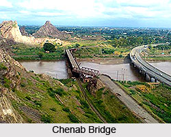
•The river is crossed in Jammu and Kashmir by the world`s highest railway bridge named Chenab Bridge.
•At Marala Headworks a bridge links Gujarat and Sialkot districts of Punjab, Pakistan.
•Two road bridges and a railway bridge cross the river near Gujarat and Wazirabad.
Chenab Bridge
The Chenab Bridge is an arch bridge under construction in India. It spans the Chenab River between Bakkal and Kauri, in Reasi district of Jammu and Kashmir. When completed, the bridge will be 1,315 m long, with a 480 m trussed arch span, 359 m above the river Chenab and a 650 m long viaduct on the Kauri side.


