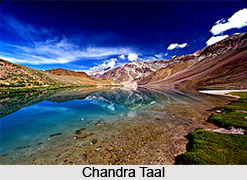
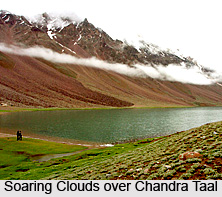
 Chandra Taal, literally meaning the `Lake of the Moon`, is an enchanting lake presenting a breathtaking beauty of nature at an altitude of about 4300 metres in the majestic Himalayas. The crescent shape of the lake makes it a spectacular spot, also rendering the name Chandra Taal to it. The lake is situated in the Spiti region of Lahaul and Spiti district in Himachal Pradesh with mountains of scree dotting on one side of the lake and a magnificent cirque (steep walled basin) on the other side. It is a popular destination for trekkers and campers. Vast meadows carpet the banks of the lake forming wondrous camping sites. During the spring season, these meadows get ornamented with vivid wild blooms. The pristine white Chandra Bhaga mountain range creates a mesmerising backdrop of Chandra Taal. The place is bestowed with unmatched scenic charm.
History and Mythology of Chandra Taal
Chandra Taal is believed to have discovered by traders who arrived from Tibet or Ladakh to this region. The traders used to take rest after a tiring journey at the lake side before resuming their journey to Spiti or Kullu. Indian mythology states that the King of Gods, Indra, descended on his chariot at Chandra Taal for transporting Yudhisthir, eldest of the five Pandavas, to heaven in his mortal form. According to the local beliefs the lake is visited by fairies at night.

Features of Chandra Taal
The most amazing feature of the lake is the lack of any visible source. However an outlet of the lake can be seen. This signifies that the lake possibly gets water from underground. The colour of the lake appears Prussian blue during the day and greenish during the evening. It often changes its hue with the changing colour of the sky. The lake is situated on a plateau named Samudra Tapu overlooking the Chandra River which originates from a glacier near Bara-lacha-la. The beautiful lake forms one of the two high-altitude wetlands of the country that has been enlisted amongst the Ramsar sites. Chandra Taal is a sweet water lake having a width of about 2.5 kilometres.
Visiting Information
Chandra Taal can only be visited during the summer as it remains frozen in the rest of the year. From May to August the lake is accessible on foot. There are three trekking routes to Chandra Taal. The easiest route without much gradient is from Batal which is a trek of about fourteen kilometres along River Chandra. From Kunjam La a thirteen kilometres trek can be opted to Chandra Taal. From Bara-lacha-la, a three day trek can be made to Chandra Taal and this route offers the most exotic view. Batal and Kunjam La are situated on the Manali Kazaa road. Bara-lacha-la is located on the Manali-Leh Highway. Chandra Taal has a number of bungalows and hotels for the travellers and the trekkers.


