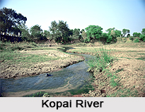
Home > Indian History > Geography of India > Kopai River
Kopai River
Kopai River is sickle-shaped and flows across Birbhum District of West Bengal and this rain fed river of West Bengal has inspired some literary geniuses of Bengal to write literature. Some of them are Tarashankar Bandhopadhaya and Rabindranath Tagore.

Share this Article:

Kopai River, Birbhum District, West BengalKopai River is also known as the `Sal River` and is Mayurakshi River`s tributary, which flows across towns like Kankalitala, Bolpur and Shantiniketan and Labhpur in the district of Birbhum. This is based in the eastern Indian state of West Bengal. Kopai River is generally dry during summer but overflows during the rains, in monsoon.

Soils of Kopai River
The region near Kopai River adjoining this river contains red soil where ravines are formed, and is popularly termed as the `khoai`. This beautiful river has been reputed for being the inspiration of several literary geniuses, which includes the noble laureate Rabindranath Tagore. One can recall the poem composed by Tagore which goes like this: `amader chhoto nodi chale anke bankey boisakh masey taar hantu jal thake, which when translated in English means, `Our small stream moves forward in bends and curves. In the month of Baisakh it only has knee deep waters`

Shape of Kopai River
Kopai River is shaped like a sickle, particularly its curves. It is this very charming appearance of this sickle-shaped Indian river which motivated Tarashanka Bandopadhyay to write a novel entitled `Hansuli Banker Upokatha` or `Story of the Sickle-Shaped Curve`. This novel was later made into a movie, by the famous film director Tapan Sinha.

History behind Kopai River
There are microliths of wood and crystalline stone belonging to the period of 1250 to 1000 BC have been discovered in the areas of Ajay -Kunar-Kopai river system. Kunur River is one of main tributaries of the Ajay River. It is about 112 kilometres in length. It has its origin near Bansgara in the Faridpur police station area. With water from several small streams swelling it during the monsoons, it often floods large areas of the Ausgram community blocks and Mangalkot police stations of Bardhaman district.


Share this Article:

Related Articles

More Articles in Geography of India


Geography of Uttar Pradesh
The fourth largest State in India UP is located in the Northern part of India whose area is 2,36,286 sq Kms.
Geography of Maharashtra
Covering an area of 308,000 sq. km, Maharashtra, the third largest state in India.
Geography of Kerala
Geography of Kerala includes plains, hills, valleys and coasts. With the Arabian Sea in the west, the Western Ghats in the east and networked by several rivers, Kerala enjoys diverse geographical features.
Geography of West Bengal
The geography of West Bengal is unique with high peaks of the Himalayan range in the north, the Bay of Bengal in the south and the remaining region is covered with both plains and plateaus.
Geography of Jharkhand
Geography of Jharkhand is comprised of the rich mineral resources and the highly agricultural prospect in this state.
Geography of Sikkim
Geography of Sikkim is characterised by a vast array of magnificent hillock that extends from one corner of the state to the other.
Geography of Meghalaya
The suitable climate, highland plateaus, rivers and the flora and fauna together forms the geography of Meghalaya.
Geography of Mizoram
Mizoram is surrounded by hills, valleys, rivers, waterfalls and lakes. The hills range from 1000 meters to 2000 meters. Rivers, lakes and waterfalls also play major role in forming the land of Mizoram.
Geography of Jammu & Kashmir
Jammu and Kashmir is encompassed by valleys. Some of the dominant valleys of the state are Kashmir Valley, Tawi Valley, Chenab Valley, Poonch Valley, Sind Valley and Lidder Valley etc. Jhelum River is the only major Himalayan River which flows through the Kashmir valley. Indus, Tawi, Ravi and Chenab Rivers are the major ones flowing through the region.
Geography of Daman and Diu
Daman and Diu is situated on the west coast of India and are the smallest union territories of India.
Geography of Goa
Geography of Goa occupies a prime location along the Konkan coastal belt on the western coast of India. The state is bordered by Maharashtra in the north and Karnataka in the south. The Western Ghats in the east contribute to the flora and fauna of Goa.
Geography of Arunachal Pradesh
Geography of Arunachal Pradesh reveals that it is a hilly tract nestled in the foot of Himalayas.
Geography of Kutch
Geography of Kutch District is covering an area of 45,612 km. Kutch District is the largest district in the state of Gujarat.
Geography of Ladakh
Geography of Ladakh mainly comprises the huge Karakoram Range with long stretch of cold desert which mark the region separately from the rest of the states of Indian subcontinent. Surrounded with the mountain ranges from all corners this small region separates Indian subcontinent from rest of the Asian continent.
Geography of Rajasthan
Geography of Rajasthan defines the dry topography with arid climate of the western mountain region.
Geography of Tamil Nadu
The Indian state of Tamil Nadu is located in the Northern hemisphere in the hot zone.