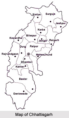
Introduction
Bijapur district is one of the Twenty Seven districts of Chhattisgarh State and Bijapuris markedly the administrative head quarters of the place. It was earlier part of Dantewada District.

Geography of Bijapur District
Bijapur district distinctly occupies the southernmost part of Chhattisgarh state. The district is confined on all sides on north and northeast of its parent district, i.e. Dantewada district. On east by Dantewada district of Chhattisgarh district, on south and lower half portion of the western state by Andhra Pradesh state and the remaining western portion by Maharashtra state. The total area of the district is approximately 6562.48 Sq. Kms. The four block divisions are Bijapur, Bairamgarh, Bhopalpatnam and Usoor. Most part of the district consists of hills. The loftiest peak of the district is Bailadila or the "Bullock`s Hump". It is situated to the south of the Indravati River and tilts towards north-south.
The district is rich in forest. The forest found in the district falls under the dry region comprising mixed forest range. The dry region consists of mixed forest is extensive and is interspersed between the moist and intermediate belt but more generally confined to the western half and southern parts of the district. Here are found trees of the mixed variety viz. Dhawra (Anogeissus latifolia), Bhirra (Chloroxylon swietenia), Rhoni (Soymida febrifuga) and others like Char, Tendu, Aonia, Aonla, Harra, Haria and so on.

In the rocky regions, the trees are generally stunted and deformed. The common trees in the rocky region are salai, Hangu, Khair, Harra, Palas, Seesame and others. In the northern portions of the district the forest trees are Teak (Tectona grandis), Sal (Shoraaro-busta), Sirsa (Dalbergia latifolia), Bijasal (Ptetocarpus marsupium), Kusum (Schleichera trijuga), Palas (Butea frondosa), Mahua (Bassia latifolia) Tendu (Diospyos melanoxylon), Harra (Terminalia chebula) Aonla (Phyllanthus emblica) Saja (Terminalla tomentosa), Kauha (T. arjuna), Salai (Boswellia serrata), Char (Buchanania latifolia) and others.
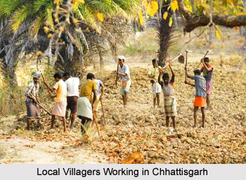
Economy of Bijapur District
In the region around village settlement are found the common trees which need no mention here. Palms fill an important place in the domestic economy of the people. The Palmyra palm (Borassua flabellifer), locally known as tar, grows gregariously in the south-west. From this people extract tari. The next most important is Sulphy (Caryota urens). Unlike the Palmyra palm, Sulphi is not a gregarious species and grows in the shady valleys of hills of depressions of undulating plains. It thrives best in the central regions of the district. The sulphi yields a sap, known by the same name and provides a delicious juice. Other palm trees are the wild date palms (Phoenix Sylvestris) and P. acaulis, which are locally named as chhind and the buta chhind (P. farinifera). From the stem of this buta chhind is obtained a grub which is a delicacy for the tribes.
Wildlife of Bijapur District
The district is famous for its rich wildlife as it has very thick cover of forest. Tigers and Panthers are found throughout the district in the forest. Tigers and Panthers have notoriety for turning man-eaters, evidently because of the scarcity of the trees, natural food in the forest and absence of cattle. Nearest airport is at Raipur and railway station is at Dantewada. By road, Bijapur is linked with Dantewada, Raipur and Vishakhapatnam. It`s headquarter is situated at Bijapur which is approximately 90 kilometres south from the Dantewada District. River Indravati the main geographical feature of the district flows across the southern limit of it with a tortuous course.