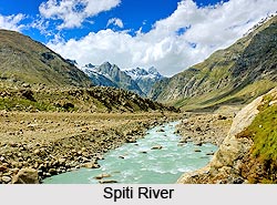
 Spiti River originates from Kunzum Mountain Range, which is located at a height of 16,000 ft above sea level. The Tegpo and Kabzian streams are its tributaries. Water of these two tributaries is draining the famous Pin valley area are also a part of the Spiti river system. Spiti River attains peak discharge in late summers due to glacier melting. After flowing through Spiti valley, the Spiti River meets Sutlej River at Namgia in Kinnaur district traversing a length of about 150 km. from the North-West beyond that it flows in South-West direction in the Himachal Pradesh. Spiti River, is one of the most important river of Lahaul and Spiti District in Himachal Pradesh, added the beauty of this hilly village.
Its position across the main Himalayan range deprives it from the benefit of the South-West monsoons that causes widespread rain in most parts of India from June to September.
The huge mountain ranges rise to very high elevations on either sides of the Spiti River and its numerous tributaries. The mountains are barren and largely devoid of a vegetative cover. Spiti River also attracts thousands of tourists from the various parts of world. The main villages along the Spiti River and its tributaries are Hansi and Dhankar Gompa.
Tourist Spots near Spiti River
The Spiti river system is a great center for cultural arts and Buddhists and their major attractions include Tabo and Ki monasteries. These monasteries are a beloved place of Dalai Lama. They represent intense beauty and holiness simultaneously. The silence of this river deeply describes Buddhist culture and monasteries.
The deep color of this river"s water is sure to mesmerize viewers with its intense beauty. This has made Spiti River a popular tourist destination for national and international travelers. The Buddhist connection has enhanced its popularity.
An expedition of the river in Pin valley and Spiti offers a great opportunity to discover the beauty of Kullu Valley, Tibet and Ladakh. River rafters crossing these rivers relish the beauty of Zanskar valleys, Leh and Nubra. One can also see villages, monasteries and sub-tropical forest areas around this river. Camping overnight in the foothills is also a great idea to enjoy the beauty of this river. Shadows and light also play interesting notes to create striking natural imagery. Sarachu is the last village of Himachal Pradesh. One can directly reach Jammu and Kashmir from here.
Tourists can relish different kinds of adventures including rock climbing, trekking, paragliding and angling around Spiti River.
Best Time to Visit
Summers last from May to mid-October. This is a warm and comfortable time to visit this place. Spiti is also open during other seasons. However, it can get really cold in winters and temperatures dip below sub zero temperatures. Therefore, it is a good idea to visit Spiti during summers.
How to Reach Spiti River
Bhuntar Airport at Kullu is 250 km away and Shimla Airport is 445 km away, are the closest airports from Kaza, which is the headquarters of Spiti. While from Shimla and Kullu one has to drive down to Kaza. Joginder Nagar next to Manali is the closest railway station. From Manali one can drive to Kaza via Kuzam Pass. Manali and Kaza are 200 km apart.


