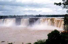
 Bastar District is located in Chhattisgarh in the central parts of India. Bastar District, before splitting into three districts, was one of the largest districts in India, with an area of 39114 sq km. The district headquarters are in located at Jagdalpur. The district covers an area of around 8755.79 sq km. Bastar District is located in the southern part of Chhattisgarh and is situated at a height of 2000 ft plateau from sea level. Bastar District is bounded by Kanker District in the north, by Maharashtra in the west, by Dantewada District in the south and by Orissa in the east. The district has an average population of 1,302,253 as per the 2001 census. Of the total population more than 70 per cent are tribal people like Gond Tribe, Abhuj Maria, Darda Maria, Bison Horn Maria, Munia Doria, Dhruva, Bhatra, Halba Tribe, etc. Bastar District is divided into four tehsils, namely Jagdalpur, Kondagaon, Keshkal, and Narainpur. There are two municipalities, Jagdalpur and Kondagaon.
History of Bastar District
According to the history, Bastar District and Dantewada District were part of the princely state of Bastar. After the independence of the country in 1947, the princely states of Bastar and Kanker were handed over to the Government of India. Then they were merged to form Bastar District of Madhya Pradesh. In the year 1999, the district was divided into the existing districts of Bastar, Dantewada, and Kanker, which cumulatively form the Bastar Division with the divisional head quarter at Jagdalpur. In the year 2000, Bastar District became one of the 16 districts of the newly formed state Chhattisgarh, which was earlier in Madhya Pradesh.
Geography of Bastar District
Geography of Bastar District is characterized by its vast natural forest area and prominent rivers. The total forest area of the district is roughly 7112 sq km which is more than 75 per cent of the total area of the district. The largest and the most important river in Bastar district is Indravati River which has numerous tributaries, the largest being the Pamer Chinta. The Indravati River rises from Rampur Thuamul in Orissa and flowing through the Bastar division for around 240 miles finally merges into Godavari River in Dantewada District. Owing to its rocky bed the river is not navigable. Interestingly, neither the river nor its tributaries dry up in the hot summer season. Bastar District is abundantly and richly endowed with forest resources. The forests in this district can be divided in to four belts, namely, Northern Mixed forests, Central Moist Region comprising of Sal belts, Teak belt zone and the dry region comprising mixed forests.
Tourism in Bastar District
Bastar District is home to the Chitrakot and Tiratgarh waterfalls and several other tourist attractions. Danteshwari Temple, Bastar Palace, Kutumsar Caves and Kailash Gufa and Kanger Valley National Park are some of the other major attractions of this district. This district is also popular for its art and crafts.
Bastar District is well known for the traditional Dussehra festival. It is a religious festival that attracts many tourists from all across the world.


