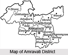
 Amravati district is situated in the state of Maharashtra, in the Deccan plateau. It has followed a long history of dynastic rule as well as conquest and annexation by different rulers at different points in time. It finally became a part of the state of Maharashtra in the year 1960. Chikhaldhara, located in the district, is the only coffee-growing area in the state of Maharashtra. It is also a much-visited tourist spot well-known for being the place where Bhima killed the villain Keechaka. According to the census of 2001 the population of the Amravati district 2,607,160. Mentioned below are further details regarding the district of Amravati.
Location of Amravati District
The district is located between 21 degrees 46 minutes North to 20 degrees 32 minutes North and 78 degrees 27 minutes East to 76 degrees 37 minutes East, which essentially indicates that Amravati District is located in the Deccan plateau. Amravati district covers a total area of 12626 sq.kms.The districts adjacent to Amravati are Nagpur, Akola, Wardha, Yavatmal, and the state of Madhya Pradesh. The district is divided into 14 Talukas and six sub-divisions
History of Amravati District
Amravati District, with the rest of the Berar, was assigned to the British East India Company by the Nizam following the treaty of 1853. After the province was assigned to the Company, it was divided into two districts, South Berar with its headquarters at Hingoli with neighbouring region restored to the Nizam and North Berar was reconstituted into East Berar with headquarters at Akola. In 1864, the district of Yavatmal was separated from Amravati. In 1903, the Treaties of Assignment were superseded by an agreement under which the Nizam leased Berar to the Government of India in perpetuity. Berar was merged with the central provinces in 1903 to form the enlarged province of Central Provinces and Berar. With the recognition of States in1956, Amravati district, along with other districts of Vidarbha region was included in the then Bilingual Mumbai State. Since the bifurcation of Mumbai state into Maharashtra and Gujarat in 1960, Amravati, along with other districts of Vidharbha formed one of the districts of Maharashtra.
 Geography of Amravati District
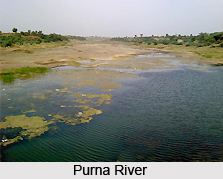
Amravati faces extreme variations in temperature with very hot summers and very cold winters. Amravati district receives rainfall from south westerly monsoons mainly in the months of June, July, August and September. July and August are the months during which the maximum rainfall as well as maximum continuous rainfall is received by the region. Among the major crops grown in the district are wheat, gram, moong, toor, soyabean, sunflower, groundnut, sesamum, jowar, orange, chilli and banana. The main rivers in this district are Tapi River, Purna River, River Pedhi, Chandrabhaga River Wardha River, Shahanoor River, Burshi River, and Tigria River. The dams in Amravati district include Upper Wardha Project, Lower Wardha Project, Bembala Project, Chandrabhaga Project, Purna Project, and Sapan Project.
Education in Amravati district
Amravati district is well known for its educational facilities. The district gets inspiration from its two great leaders Shri GadageBaba, Saint Tukadoji Maharaj, and Dr. Panjabrao Deshmukh who brought about a revolution in the field of education. Established on the 1st of May 1983, Amravati University has the lion`s share in its contribution to the educational development of Vidarbha. Amravati University covers five major districts in Vidarbha viz. Amravati, Akola, Yavatmal, Buldhana, and Washim. There are affiliated 180 colleges, 22 postgraduate departments and one College of Education run by the University. The district is also reputed for technical education. There are three Engineering colleges viz.
1) Government College of Engineering, Amravati
2) V.Y.W.S. College of Engineering, Badnera (Rly), Amravati
3) Sipana College of Engineering, Amravati and four polytechnic colleges
 In Amravati, there are four medical colleges of which two run Ayurvedic courses, one each for Allopathy, Homeopathy, and one Dental College.
1)Panjabrao Deshmukh Memorial Medical College, Amravati
2)Vidarbha Ayurved Mahavidyalaya, Amravati
3)V.Y.W.S. Dental College, Amravati
4)Shri Vallabh Takhatmal College of Homeopathy, Amravati
5)Pandit Jawaharlal Nehru Memorial Institute of Homeopathic Medical Science, Amravati
The only law college in Amravati is Panjabrao Deshmukh Law College. Amravati has gained a place of honour in the field of physical education because of Shri Hanuman Vyayam Prasarak Mandal. Situated in the heart of the city, it is enriched with modern facilities, H.V.P.M. also runs the Degree College of Physical Education.
Tourism in Amravati District
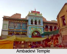
Amravati district has several tourist attractions, which draws a large number of tourists to this place every year. The religious significance of the district of Amravati is also immense. The Ambadevi Temple situated in the heart of this district has immense religious significance attached to it. The locals of this place believe that Lord Krishna abducted Rukmini from this temple and married her. The Satidham Temple located in the Amravati district is also known all over for the beautiful idols of Lord Rama and his consort Sita, Lord Krishna and Radha, his principal paramour, Lord Shiva, Lord Ganesha and Rani Satiji. Another attraction is Chatri Talao, a small reservoir that supplies drinking water to the whole of Amravati district. In recent times however, Amravati district gets water from the Upper Wardha Dam. The places to see around the Amravati district are Wan Sanctuary, which is situated at Melghat area of the Amravati district and Melghat Tiger Reserve, which is located in Chikhaldara and Dharni tehsils along the Satpura mountain range.


