 aramulla District is situated in Jammu and Kashmir and is the largest district of the state. The District is spread over an area of 4588 Sq. Kms and its population according to 2001 census is 11.51 lakhs.
History of Baramulla District
History of Baramulla district states that the city of Baramulla, founded by Raja Bhimasena held the position of a gate-way to the valley as it was located on the route to the Valley from Muzaffarabad, and Rawalpindi, now in Pakistan. Being the gate way of the valley it was a halting station for the visitors during their visits to the Valley. In 1508 A.D. Emperor Akbar who entered the Valley spent a few days at Baramulla and Jahangir is also said to have stayed at Baramulla during his visit to Kashmir in 1620 A.D. From the very beginning, Baramulla has enjoyed religious importance. Baramulla became an abode of Hindus, Muslims, Buddhists and Sikhs living in accord and contributing to a rich amalgamated culture.
Geography of Baramulla District
Baramulla District is bounded by Kupwara in the North, Budgam and Poonch in the South, parts of Srinagar and Ladakh in the East and has the line of control in west. The Baramulla District is the largest District in entire valley both with reference to the population and area. The District is spread over an area of 4588 Sq. Kms. Baramulla district has severe cold climate in the winter and a pleasurable weather during summer. Each part of the district experiences snowfall during winter. Snowfall in Gulmarg is known for winter sports. Average annual rainfall in District Baramulla has been recorded as 1270 mm. The district is worth visiting in the winters for taking pleasure in the Snowfall and for winter sports, and also in the summers for enjoying the amusing climate.
Culture of Baramulla District
Culture of Baramulla district is no diverse from other parts of Kashmir Valley. The dress pattern, food habits, customs and traditions are the same as followed in other parts of the valley. Kashmiri is the most important language of the people in the District. Pahari and Gojari are also spoken in Uri and areas near foothills of Gulmarg and Bandipora, Sheena (Dard) is the local language in Gurez and Tilail areas. The people also speak Urdu.
Administration of Baramulla District
 Baramulla District is administratively divided into 8 Tehsils, and 16 CD Blocks. The eight tehsils of Baramulla are Uri, Sopore, Gurez, Tangmarg, Baramulla, Sumbal, Pattan and Bandipora. The Sixteen blocks of the district are Uri, Baramulla, Wagoora, Bandipora, Hajin, Boniyar, Pattan, Tangmarg, Sopore, Rafiabad, Rohama, Gurez, Kunzer Zaingeer, Sumbal, and Singhpora. Chief Planning officer of the District is concerned with the timely formulation and implementation of developmental plan of the District as per aspirations of the people ensuring balanced development of all quarters. Assistant Commissioner has been entrusted with the implementation of various state or centrally sponsored schemes such with the main purpose to create avenues of employment in the rural areas and also to create community assets for the people.
Tourism in Baramulla District
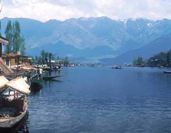
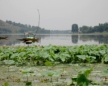
Tourism in Baramulla district offers wilderness of lakes, placid valleys, gigantic sun-tinted, torrential mountain streams and snow capped mountain ranges. Gulmarg is a tranquil summer resort in the clouds, and the hot spot of winter frolics in the snow. Gulmarg is a spectacular valley at the dizzy height of 2730 meters. Wular Lake which is 60 Kms from Srinagar is Asia`s largest fresh-water lake. Manasbal Lake is a bird watching paradise. The Archaeological Monument at Parihaspora Pattan and the Archaeological Monument in Pattan Bazar are the historical places in the district.
How to reach Baramulla District
By Road:
District Headquarter Baramulla is located about 60 Kms. from Srinagar. There is a National Highway (NH-1A) connecting the district to the rest of the country. The general approach to the whole of the District is through road transport i.e. Taxi and Buses. Taxi and busses are accessible from Srinagar and Jammu.
By Rail:
The nearest Railway Station to Baramulla district is Jammu Tawi, about 360 Kms from District Headquarters. A new railway line is under construction which will join Baramulla to Jammu Tawi through Budgam, Srinagar, Pulwama, Anantnag, Doda and Udhampur.
By Air:
The nearby Airport is that of Srinagar about 65 Kms from District Headquarters.


