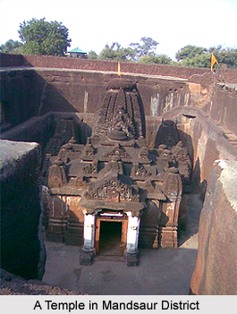
 Mandsaur district in Madhya Pradesh is rich in archaeological and historical heritage. However, the district is famous for the temple of Lord Pashupatinath located on the bank of Shivna River. Its idol has parallel only in Nepal. The most common language is Malwi (a blend of Rajasthani and Hindi languages).
This district is also famous for large production of opium around the world. The slate pencil industry is the main industry of the district. Mandsaur is famous in poppy`s production. Huge mines of rocky stone and limestone are available within the district. There is a high production of slate pencils, which are created by rocky stone. There are 110 slate pencil industries. The district of Mandsaur is noted for the manufacture of Kambals or coarse woollen blankets. Mandsaur is an average-sized district of Madhya Pradesh state.
History of Mandsaur District
Mandsaur District forms the northern projection of the state of Madhya Pradesh from its western division, i.e. Ujjain Commissioner`s division. The district of Mandsaur takes its name from the headquarters town, Mandsaur. It is considered to have been evolved from Marhsaur, originating from Marh and Saur or Dasaur, two of the villages which merged in the town.
Geography of Mandsaur District
Mandsaur district is located between 23 degrees 45.50 minutes and 25 degrees 2.55 minutes to the North Latitudes and 74 degrees 42.30 minutes and 75 degrees 50.20 minutes to the East Longitudes. It is bounded by four districts of Rajasthan namely Chittorgarh district to the West and North, Bhilwara district to the North, Kota district to the North-East and Jhalawar district to the East while Ratlam district of Madhya Pradesh to the South. The district extends for about 142 kilometers from north to south and 124 kilometers from east to west. The total area covered by Mandsaur district is 5521 square kilometers.
 People of Mandsaur District
In 2011, Mandsaur district had population of 1,339,832. Ot of which the male and female were 681,439 and 658,393 respectively. Mandsaur District population constituted 1.85 percent. The initial provisional data released by census India 2011, shows that density of Mandsaur district for 2011 is 242 people per sq. km. The average literacy rate of Mandsaur in 2011 was 72.75
Tourism of Mandsaur District
The district of Mandsaur is famous for its temples and the temple of Lord Pashupatinath is one of the most famous temples of this district. Pashpupatinath is synonymous name of Lord Shiva. This artistic effigy is built-up smooth, glowingly dark coppery fiery rock-block. The temple is located at the bank of Shivana River. This temple possesses four doors in the four directions but entrance door is situated in the west. This effigy`s head which is situated in the west presents a fearful image of Lord Shiva. Its make-up indicates three ras (relish) which is in bun-shaped hair with poisonous snakes, emerging third eye and opened under lip. This temple forms the major attraction in the district of Mandsaur.
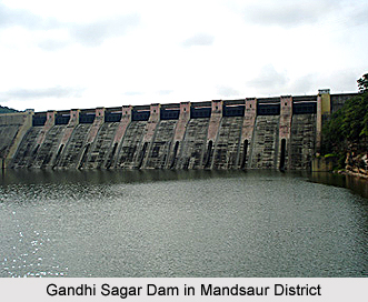
Another important tourist attraction of this district is the Gandhi Sagar Dam. This Dam is situated at a distance of 168 kilometers from the district headquarters. The Dam is constructed on the Chambal River. The foundation stone for the construction of Gandhi Sagar Dam/Power Station in the District was laid by the first Prime Minister of India, Pandit Jawaharlal Nehru on the 7th of March 1954. The Gandhi Sagar Power Station is 65 meters long and 56 feet wide. The Power Station possesses five turbines of 23 mega watt capacity, thus having a total installed capacity of 115 mega watt. Apart from these some of the other attractions of the Mandsaur district include Chandwasa, Hinglajgarh, Bahi Parashnath Jain temple, etc.


