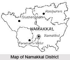
 Namakkal district is located at an altitude of three hundred meters above the mean sea level in the south Indian state of Tamil Nadu. The famous Kaveri River flows along the Western and Southern boundaries of the district at an elevation of one hundred and fifty meters. This river benefits most of the cultivated lands in the Paramathy and Mohanur Blocks in the Tamil Nadu state. The tributaries of this river are Sarabanga and Tirumanimuthar. The Namakkal district experiences semi-arid tropical climate and the average annual rainfall received by this district is seven hundred and seventy six millimeter. The roads transport system of this district is also well-developed.
History of Namakkal district
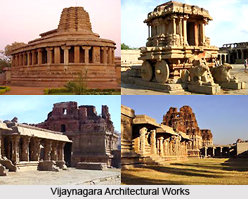
Since the district of Namakkal forms a part of the Salem District, the historical background of Salem and Namakkal are same. After the struggle between the Cholas, Cheras and Pandiyas, the Hoysalas rose to power and had control over this district till the fourteenth Century followed by the kings of the Vijayanagar Empire till A.D. 1565. Then the Madurai Nayakas came to power in A.D. 1623. Two of the Polygons of Thirumalai Nayak called Ramachandra Nayaka and Gatti Mudaliars, ruled the Salem area. It is reported that the Namakkal Fort was constructed by Ramachandra Nayakas. After about A.D.1625, the area came successively under the rule of Muslim Sultans of Bijapur and Golconda Mysore kings and then the Marathas, when about the year A.D. 1750, Hyder Ali came to power. This period records the power struggle between Hyder Ali and later Tipu Sultan, with the British. Namakkal remained under the Atikula King called Gunasila. Later the taluk was over run by the Cholas in the Kongu Mangalam which was over run by the Cholas in the 9th Century and passed on to Vijayanagar under the Viuroyultry of Madra. Namakkal was held by Killdhar (Caption) on Hyder Ali until it went into the hands of the British in the year 1768.
 Geography of Namakkal district
Namakkal district is located at eleven degree and twelve degree of the North latitude and seventy seven degree and forty minutes and seventy eight degree and five minutes of the East longitude. The altitude of the district is three hundred meters above the mean sea level. This district comes under the North-Western Agro-climatic zone (excluding Tiruchengode taluk) of Tamil Nadu state. It is located in the dividing portion of two watersheds between the Kaveri River and the Vellar System with the taluks of Attur, Rasipuram and Namakkal on the East and Salem, Omalur and Mettur on the West. Tiruchengode taluk alone is placed under Western Agro-climatic zone.
This district experiences a semi-arid tropical climate wherein four distinct seasons like, South-west monsoon (from June to September), North-East monsoon (from October to December), winter season (from January to February) and summer season (from April to May) are experienced. The maximum temperature ranges from twenty eight degree Celsius to forty degree Celsius and the minimum temperature ranges from fourteen degree Celsius to twenty six degree Celsius. During January and February lowest temperatures are recorded while maximum temperature is experienced during April-May. The average annual rainfall received by this district is seven hundred and seventy six millimeter. About eighty percent of the total rainfall is received during the South-west monsoon and the North-east monsoon season.
Tourism in Namakkal district
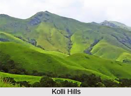
Tourism in the district of Namakkal is filled with some of the best natural beauties including hills, water falls, boat house, botanical garden, beautiful cottages, temples, etc. The Kolli Hills is one of the most prominent mountain ranges and is an outliner of the Eastern Ghats. It is eighteen miles or twenty eight kilometers long (from north to south), twelve miles or nineteen kilometers wide (from east to west) and the Koll block is spread over an area of 441.4 square kilometers. When viewed from the plains of the Namakkal district, the mountain looks like a flat-topped mass. The mountain has been inhabited from pre-historic times. It is much celebrated in the Tamil Literature of the Sangam Age and at least eleven poets describe about it in their poems. The famous Shiva Temple known as the Arappalleeswarar Temple dating back to twelfth century is located at Periakoviloor near the famous water falls called Akasa Gangai. An ancient and powerful deity called Kolli Paavai of Ettukkai Amman is also at the Kolli Hills. It attracts large pilgrims and it is originally a Jain retreat.
 The Akasa Gangai is a bewitching three hundred feet waterfall of River Aiyaru, situated close to the Arappaleeshwarar Temple. This is an ideal location for trekking and the breeze is pleasant, the cascade of silvery water touching and brushing the innumerable herbs which are abound in Kolli hills keeps all the visitors spell bound and fresh with its herbal qualities. Another major attraction of this district of the Tamil Nadu state is the Boat House at Vasulurpatty. It is located on the Solakkadu-Thinnanurpatty road and is one of the most beautiful spots with small Natural Island in the lake covered with huge rocks and greenery on all sides. Perennial water source is available in the lake throughout the year.
There is a Botanical Garden which is formed at the old Tampcol site. It is situated about three kilometers from Semmedu in the Namakkal district. In this Garden area an Herbal park, Rose Garden, Park, Eco friendly cottages and a view point is located. Thus, the district of Namakkal is filled with a number of beautiful attractions which draw people from various parts of Tamil Nadu and other parts of India throughout the year. The district is also suitable connected by road ways with the National Highway number seven and forty seven passing through all the taluk headquarters.


