 Jashpur District is situated in the north-east region of Chhattisgarh. Having an average altitude from 2500 to 3500 meters above sea-level, the district is situated between 22 degrees 17 minutes north to 23 degree 15 minutes north latitude and to 83 degree 30 minutes east to 84 degree 24 minutes east longitude. It is surrounded by Gumla District of Jharkhand in the east, Sarguja in the west, some parts of Jharkhand and Sarguja in the north and the districts of Raigarh and Sundargarh (Orissa) in the south. Jashpur District covers a total area of 5339.78 sq km. According to Census 2001, Jashpur District has a population of around 7,39,780, males ratio is 3,70,287 and 3,69,493 is females ratio. The density of population of this district of Chhattisgarh is 127 persons per sq km. This is basically a rural district as 96 per cent of the total population is accounted for by the same.
History of Jashpur District
History of Jashpur District is quite vague. However, some archaeological sites are significant in providing evidences of its history. In the 18th century, Jashpur was among the 14 princely states of Chhattisgarh, placed under Sarguja group. Further, as per the historical accounts, till 1905 it was under the administration of Chota Nagpur commissioner. It must be noted that no archaeological or historical study and exploration was ever undertaken in this region neither during the royal regime. Jashpur District became a part of Madhya Pradesh in the year 1956 when this state was formed under union of India. After the formation of Chhattisgarh as a new state, this district became a part of this state.
Geography of Jashpur District
Jashpur, located on the western extension of Chota Nagpur Plateau, forms the north-east region of Chhattisgarh province. Deep, dense and extensive forests, a number of streams and rivers constitute the geography of Jashpur District. The topography and the soil of Jashpur District contain rich bio-diversity, enough mineral deposits, well distributed drainage system and pleasant climate. This district has the generous blessings of nature. Jashpur District is rich with dense and green flora. Northern region of the district has a long series of hills and mountains, sometimes running parallel to each other or criss-crossing some where. Lush green terrain and valleys present elegant natural beauty.
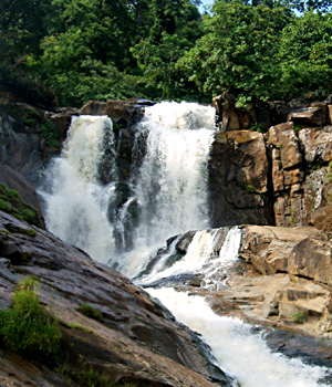
Culture of Jashpur District is basically of tribal character. The beliefs and customs of the local tribe are quite unique. People of this district are mainly engaged in agriculture and several crops are grown here. This tribal district also offers several tourism options to the people. Like for instance, Kotebira Eb river, Rajpuri Water fall, Kailash gupha (Cave), Danpuri, Waterfall, Rani Dah Waterfall, Bhringraj Waterfall, Gullu Waterfall, etc. are some of the main attractions offered by this district. Jashpur District has a high literacy rate.


