 Hazaribagh District, an administrative district of Jharkhand, is situated in the north east part of North Chota Nagpur Plateau Division. Hazaribagh is its administrative headquarters. The average altitude of Hazaribagh District is 611 metres above the sea level. This district occupies a total area of 11165 sq km. Hazaribagh District is surrounded by districts of Gaya and Koderma District in the north, Giridih District and Bokaro District in the east, Ranchi in the south and Palamu and Chatra in the west.
History of Hazaribagh District
In according to the history of Hazaribagh District in early times it was covered with inaccessible forests. Throughout the Turko-Afghan period the area remained virtually free from external influence. Subsequent to the uprising of Kol caste in 1831 the administrative structure of the territory was subsequent. The Paraganas Ramgarh, Kharagdiha, Kendi and Kunda became parts of the South-West Frontier Agency and were formed into a division named Hazaribagh as the administrative headquarters. In 1854, the designation of South-West Frontier Agency was changed to Chota Nagpur and it began to be administered as a non-regulation province under the Lieutenant Governor of Bihar. In 1855-1856 there was the great uprising of the Santhals against the British but was brutally suppressed. After 1991 Census, Hazaribagh division has been divided into three separate districts namely Hazaribagh, Chatra and Koderma.
Geography of Hazaribagh District
This district forms a part of the Chota Nagpur Plateau. It is a region of plateaus, residual hills and valleys, which occupy the southern half of the state. The district may be divided into three divisions and these are the central plateau, lower plateaus and Damodar River Valley. The central plateau, average 2000 feet high, is situated in the centre of the district. Around the central plateau are the lower plateaus on all sides except the west where a high ridge connects the central plateau to the Palamu district. The lower plateaus are of average 1300 feet in height, their surface being undulating. In the north and northwest, the lower plateaus form fairly level tablelands.

The chief hills in central Hazaribagh are Chandwara and Jillinga which rise above the central plateau to 2816 and 3057 feet respectively above the mean sea level. Hazaribagh is predominantly a forest district and nearly half of the total area is covered by forests which are distributed uniformly throughout the district. It has an excellent climate and beautiful scenery all around it in the midst of dense forest. Average annual rainfall of the district is 1234.5 mm. The district comes within the Tropical Monsoon Regions of the world. Three broad seasons of the district are cool season (November to February), hot weather season (March to May) and rainy season (June to October). It is rich in flora and fauna. About 45 per cent of the total area of this district is covered with forests. The forest area of this district is full of medicinal plants and trees. The cultivable land can be divided into two parts namely - Upper land and Lower land. The lands situated on the banks of rivers are fertile. Rabi and Kharif crops are generally sown here. Irrigation facility is not adequate in this district due to hilly area. There are small natural rivulets, which are generally used for irrigation.
Demography of Hazaribagh District
According to the Population Census in the year 2011, Hazaribagh District had a population of 1,734,005 of which male and female were 891,179 and 842,826 respectively. The population of Hazaribagh District constituted 5.26 percent of total population of Jharkhand. The population density of Hazaribagh district for 2011 is 403 people per sq. km. Hazaribagh district administer 4,302 square kilometers of areas. The average literacy rate of Hazaribagh in 2011 was 70.48 percent compared to 57.75 of 2001. If things are looked out at gender wise, male and female literacy were 81.15 and 59.25 respectively. The total literates in Hazaribagh District were 1,029,415 of which male and female were 607,854 and 421,580 respectively. In 2001, Hazaribagh District had 675,463 in its district.
Tourism in Hazaribagh District
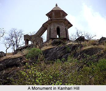
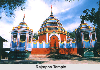
Tourism in Hazaribagh District includes visits to the popular places of interest offered by the district. Rajrappa Temple, Narshigha Temple, Harihar Dham, National Park, Silwar Temple, Kanhari Hill, Salparni, Barso Pani and Barkattha Suraj Kund are some of the attractions of Hazaribagh District. These sightseeing options are worth visiting. The natural beauty of enhances the charm of travelling. Tourism in Hazaribagh District means deep forests rich of wilds, the holy Rajrappa Mandir, beautiful Tilaiya Dam, Suraj Kund and various other attractive hills. Hazaribagh District of Jharkhand is one of the districts executing rapid developments in every sphere of the society.


