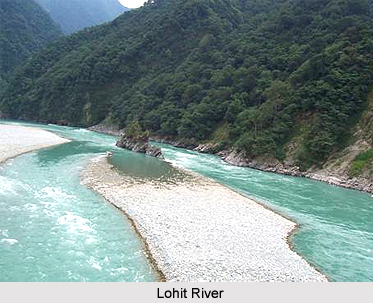
 Lohit District is the administrative district of the state of Arunachal Pradesh. It is a part of Tezu and is located at an elevation of 21 degrees. It is actually situated on the North Eastern extremity of Arunachal Pradesh. At this district the Holy place of Brahma Kunda also known as Parasuram Kund is situated. The present name of Lohit district is derived from one of its principal rivers, the Lohit River that rises from the eastern Tibet and enters India in Kibithoo area of this district. In ancient Indian literature the Lohit River is known as `Lauhitya`, a name, which is associated with the legends of Parasuram which referred in Srimad Bhagavat Purana, Kalika Purana and in the Mahabharata. The main occupation of the people of Lohit district is agriculture.
History of Lohit District
Lohit district was a part of Lakhimpur district in Assam prior to the year 1914. After that, the North East Frontier Tract was constituted with three political charges and the areas covered by this district become a part of the central and Eastern Section. In the year 1951, the plains portion of the Mishmi Hills District was shifted to organizational authority of the Government of Assam. In 1952, the headquarters of the Mishmi Hills District was shifted fro Sadiya to Tezu. According to the North East Frontier, areas (Administration) Regulation 1954, the North-East Frontier Tract came to be known as North-East Frontier Agency and the Mishmi Hills District was renamed as the Lohit Frontier Division. the Lohit Frontier Division came was renamed as the Lohit District under the North-East Frontier Agency (Administration) Regulation, 1956 and the in charge Political Officer and Additional Political Officer were designated as the Deputy Commissioner and Additional Deputy Commissioner respectively. In June of the year 1980 under the Arunachal Pradesh (Re-organisation of district), Act 1980 the Lohit District was bifurcated into two independent district namely Lohit District and Dibang Valley District. District headquarters of the Lohit district is at Tezu.
Geography of Lohit District
Lohit district is located approximately between the latitudes 27 degree 33 minutes and 29 degree 22 minutes North and the Longitudes 95 degree 15 minutes East and 97 degree 24 minutes East. The total area of Lohit district is near about 11402 Square km. This district in its north has China and portions of Dibang Valley District of Assam, Changlang District of Arunachal Pradesh at its south, in the east it has Burma and in the west it has the state of Assam.
Demography of Lohit District
According to the Population Census in the year 2011, the Lohit District had a population of 145,538 of which male and female were 76,544 and 68,994 respectively. The population of Lohit District constituted 10.53 percent of total population of Arunachal Pradesh. The initial provisional data released in the Population Cenus in India, in the year 2011, shows that the population density of Lohit district is 28 people per sq. km. The average literacy rate of Lohit District was 69.88 percent. If things are looked out at gender wise, the male and female literacy rate of Lohit District were 77.25 percent and 61.62 percent respectively. The total literates in Lohit District were 85,206 o
Culture of Lohit District
In Lohit district, there are different tribes. Their traditional dances, games and sports can be enjoyed in celebration. Tamladu Festival and Sangken are the main festivals celebrated in this district. They also honour the festivals of each other. Elephant raiding, angling, rafting, hitchhiking, mountaineering etc. are the entertainment scopes available in the district.
Tourism of Lohit District
Lohit district is aptly described by snowy mountains along with the international borders, the lower hills deck with intense evergreen forests and numerous rivers. Here the climate is hot and extremely humid especially in the lower elevations and in the Valleys, however, it is mildly cold in the higher elevations. Some of the tourist attraction spots of Lohit district are Parasuram Kund, Tamreswari temple and Sivalinga site. Along with these opportunities, an ancient city of King Bhismak in the pre historic times situated in this region is clearly mentioned in the Puranic Indian Literature and Tantra literature.


