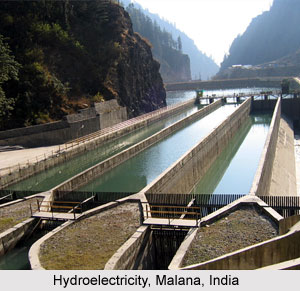
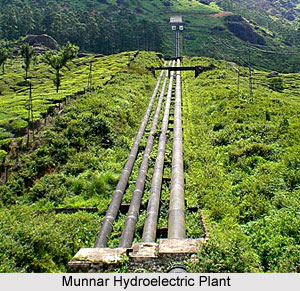
 India has a huge potential of hydroelectricity. Further, India is also considered as a big potential source of power. And water power potential is also evenly distributed. Of the total hydro-electric potential of India, rivers of Arunachal Pradesh, Assam, Tripura, Nagaland and Manipur account for the major portion. Further, eastward rivers of the peninsular India, westward flowing rivers of the Western Ghats, rivers of Central India, Ganga Basin, and Indus basin also account for a huge portion. With the significant advancement in the technology, the hydroelectric potential of the country has also increased tremendously.
Generation of Hydroelectricity in India
It is a common fact that a region with high hydro-electric potential may not necessarily lead other regions in the production of hydro-electric power. There are several factors that influence the selection of sites for the generation of power. The major factors include volume of water, character of the river valley and waterfall, non availability of other sources of power, etc. Waterfalls mainly exist in the Shillong Plateau and in the sea facing margins of the Western and Eastern Ghats. Some of them have been successfully harvested for the generation of power.
 One major factor that affects the power generation is the volume of water in rivers that fluctuates hugely because of seasonal character of the rainfall and its pronounced variability. Storage dams have been built across the rivers especially in the Indian plateau as the rivers become dry in several regions for few months. Further, large sized power projects have been constructed in the country as suitable sites for the generation of small amount of electricity were not available. As the hydro power projects are situated several kms away from the main consuming markets and that is why, power sells at comparatively higher rates in the country.
In India, hydro-electricity is mainly produced in the Western Ghats and in parts of several states like Uttar Pradesh, Kerala and Punjab because they are situated far away from the coal mines. Moreover, Western Ghats and Nilgiri Hills in Tamil Nadu have the advantage of heavy rainfall. The disadvantage of seasonal rainfall has been offset by storage dams. With these advantages, the Western Ghats and Nilgiri Hills have a substantial share in the installed hydroelectric capacity of the country. Elsewhere in the India plateau, rivers flow in broad valleys. Thus, some of the rivers have been harnessed for generating electricity as well as for irrigation.
The hydroelectric power supply in the country may fall considerably in those years when the monsoon season arrives late. In such cases, power generation gets affected badly and it becomes necessary to discard power supply to industries for some weeks. Moreover, large quantity of power supply is required in the plains of northern India. At some places, power plants have been set up in the northern plains of the country and electricity generated from these hydro-electric plants is used in several states like Punjab, Uttar Pradesh and Jammu and Kashmir. Only a small quantity of power is developed in the Himalayan mountain ranges.


