About Kinnaur District
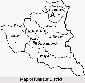 Kinnaur district is situated on the Indo Tibetan border. This beautiful district of Himachal Pradesh is surrounded by Garhwal Himalayan to the south and Tibet to its east. Kinnaur is located around 200 km from Shimla. Kinnaur conjures up a picture of inaccessible valleys, of the Hindustan-Tibet road, of the mighty gorge of Satluj and different customs. Sutlej River rises on the southern slopes of Kailash Mountain in Tibet and flows through the Kinnaur valley. Kinnaur is defined as the land of legends and mythology.
Today, several possibilities for trekkers and mountaineers have opened up at Kinnaur. The earliest explorers to Kinnaur were the Gerard brothers in the year 1818. It was Marco Pallis in the year 1933 the Kinnaur valley to the notice of mountaineers through an article and a book when he climbed Leo Pargial (6791 m), travelled on the Hindustan-Tibet road into the Baspa valley and crossed the Lamkhaga pass to Gangotri. The Hindustan - Tibet road passes through the Kinnaur valley and this route was considered as the main trade road from Tibet, There were many pilgrims who went around the (Kinnaur) Kailash massif, clockwise, from the Tirung valley, over Charang Ghati to Baspa and back and the tradition continues even today. The Army and the I.T.B.P have made many climbs.
Kalpa, situated in the centre of Kinnaur, is the district head-quarters, with one of the finest views one can have while enclosed in a comfortable bungalow. Incidentally, the old name `Chini` was changed to Kalpa, just in case the Chinese had some other ideas! About 760 m below Kalpa there is Rekong Peo, which is developing as the central bazar and administrative town, served by many buses that pass on the Hindustan-Tibet road - from Shimla to Wangtu (where the Inner Line begins), Karchham (bifurcate southeast for Sangla, 17 km), Powari (for Rekong Peo, 6 km and Kalpa, 13 km), Akpa (for Morang and the Tirung valley), Kanam (for the Gyamthang valley), Shi Asu Khad (for the Ropa valley), Puh (old Poo), Leo and Chango (for Leo Pargial in the east). The road continues to Kaurik and Sumdo to enter Spiti and reach Kaja. Over the years, there have been several developments in Kinnaur that have opened up many possibilities for the local people and the valleys are now far more accessible to mountaineers. Like for instance, an afternoon bus from Kalpa will reach Shimla on the same day. These developments have not yet taken a heavy toll of the forest cover, culture and peace.
A lot has been written on the cultural aspect of Kinnaur. A fusion of Hinduism and Buddhism exists almost in totality. Every village has a temple and a gompa and all worship at both. Various primitive traditions, beliefs and superstitions survive. Legends are held in awe. Though a large proportion of the population is educated, and many serve in the Army. Kinnauri architecture is a thing of beauty to behold. Perched on a hillock, the Kamru Fort or some exquisite gompas and temples can take one`s breath away. The area also has plenty of fruit orchards and the valleys are rich and hospitable.
For such a large district like Kinnaur of Himachal Pradesh, where people have traveled for years, it is not possible to record its mountain and mountaineering history exhaustively. The Satluj literally cuts through the Himalayan chain near Shipki La and then runs through the centre of Kinnaur. There are four major valleys to its southeast and east. These are Baspa valley, Tirung valley (Tidong), Gyamthang valley (Nisang) and Leo Pargial (Hangrang valley). To the northwest of the Satluj lies the other half of Kinnaur. The gentler valleys lead to a divide with Pin valley (Spiti). It has numerous passes which afford many a pleasurable trekking route but offer no climbing higher than about 5900 m.
The important passes of this beautiful district are as follows -
* Tari Khango pass: Bhabha valley to Pin-Parbati pass
* Larsa Way pass: Larsa Garang (Taiti Garang) to Pin valley
* Ghunsarang pass: Ropa valley to Pin valley
* Manirang pass: Ropa valley (to the north) to Pin valley
It was over the Tari Khango that the Indo-New Zealand Himalayan Traverse Expedition passed in the year 1981. It is regarded as a good pass for the trekkers. Historically, Dr J. de V. Graaff reached Manirang pass in the year 1952 and climbed Manirang peak (6593 m) to its northeast. Again its second ascent was in the year 1988 by the Indian Para Regiment (Col B. S. Sandhu). The other peaks climbed in the area are Manirang South in 1982. There are numerous peaks around 5500 metres to 6000 metres in the area which have not been touched. It is evident that in Kinnaur many trekking and climbing opportunities await the mountaineer. There are many side valleys, peaks and passes which are inviting, unexplored and certainly unrecorded. Hence, it can be said that with the tremendous development of roads, the valleys of the beautiful Kinnaur district are one night away from Shimla.
History of Kinnaur District
History of Kinnaur District states that the district was formerly a part of Mahasu District. It came into being as an independent district on 1st of May, 1960. Prior to the merger of the state on the eve of independence of the country, Kinnaur valley was a part of erstwhile Bushahr state which had its headquarters at Rampur.
Early History of Kinnaur District
In the absence of authentic historical record the early history of Kinnaur region is obscure and the reference of the Kinnaura or Kannaura and there land is by the large confined to legends and mythological accounts. Early history of Kinnaur District dates back to 6th century BC. India was divided in to sixteen mahajanapadas and several smaller ones. Among them, Gandhara, Kamboja, Kuru, Kosala, Malla, Vajji, Panchala, Sakya were either in the southern Himalayas ranges or had territories extended up to Himalayan ranges. Among the states that were flourishing in the six century BC. The kingdom of Magadh was the first to make a successful bid for supremacy under Bimbisara.
 Its emperor belonging to Sunga, Nanda Dynasty and Maurya Empire carried their banners up to the inhabited parts of inner Himalayan region. Chandragupta Maurya brought about its political amalgamation under one scepter, negotiated an alliance with Parvataka (Himalayan King) before empire building. With the help of several frontier tribes such as Kiratas, Kambojas, Panasikas and Valhika, he built up the great Mauryan Empire. The empire of Ashoka extended up to natural boundaries of India and beyond that in the west. After the collapse of the Mauryan Empire the Kushana Empire established its reign within and beyond India in the northwest. Emperor Kanishka supremacy spread over Kashmir and the Central Asian regions of Kashgar, Yarkand and Khotan. His hold extended up to the territory of the Inner Himalayas and Kinnaur had been the part of this empire.
In the meantime northern India was divided into a number of small kingdoms and autonomous tribal states. Under such a divided country Gupta Empire grew. Samudragupta`s empire included the territories of Rohilkhand, Kumaon, Garhwal, Nepal and Assam. Its northern boundary was along the high Himalayas. Kinnaur was included in it too. Early in the 7th century AD, Harsha came to power at Thaneshwar in A.D. 606. During the course of four decades he had established a most powerful empire in India. All the existing kingdoms of Kapisa, Kashmir, Kuluta, Satadru, Ladakh and Suwarnagotra (in the high Himalayas) were incorporated in his empire. After the death of Harsha in A.D. 647 the country was once again divided into old principalities of the sixth century B.C.
Further, from the historical accounts it appears that the princes being adventurous owing to territorial greed first went to these high hills and established themselves on varying territories in accordance with their powers. Particularly the area between Sutlej River, its tributaries and Baspa up to Manasarovar was under the rule of Thakkers from very early times. They were known by the place they had occupied like that of Chini Thakur and Kamru Thakur, under the overall sovereignty of Mauryan and Gupta kings later on. It was the Thakur of Kamru who proved strongest of all the other chiefs of the area and annexed their territories by force sometime after the fall of the Kannauj Empire and laid the foundation of the state of Bushahr, to which the region of Kinnaur belonged till the dissolution of the state very recently.
 Medieval History of Kinnaur District
Medieval history of Kinnaur District says that by the beginning of the fourteenth century the entire area of Kinnaur was divided in seven parts, locally called sat khund. There was further splitting up of and the area came to be covered with several small hegemonies, which were constantly warring against, or allying with, each other as conditions required. The neighbouring Bhots also found time to jump into the fray and did not desist from creating trouble. There are various forts like Labrang, Morang, and Kamru forts telling the story of that age. Further, in the medieval period, though some of the hill states such as Kangra, Chamba and Sirmaur were attacked and made tributary to the Mughal emperor at Delhi, Bushahr state could not be reached by any adventurer of that time.
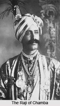
The consolidation and addition of territories of the Bushahr state continued during the period also. Raja Chatar Singh, who brought the whole area of the erstwhile Bushahr state under his control, was considered as most virtuous ruler during his reign. However, nothing particular is known about his successor Kalyan Singh. The successor of Kalyan Singh according to genealogy was Raja Kehri Singh. He was the highest skilled warrior of the time. Kehri Singh`s successors were not of the same mettle. Besides mention in genealogy of Bushahr state, nothing is known about Vijay Singh and Udai Singh. It is said that one Raja Ram Singh made Rampur his capital in place of Sarahan and Kamru. During his reign a series of contests began with the Raja of Kullu and Bushahr had lost the territory of Seraj. It seems that the territories which were annexed by Raja Kehri Singh became free during the weak rule of Raja Rudra Singh. But his successor Ugar Singh took them over by force.
Modern History of Kinnaur District
According to modern history of Kinnaur District the erstwhile states of Bushahr faced the menace of Gurkha invasions. Immediate after the death of Raja Kehri Singh, The Gurkhas made massive attack on Bushahr. The minor ruler fled away to Namru leaving behind a rich treasury at Sarahan. The Gurkhas looted the treasury and completely destroyed the records of the state. Keeping Gurkhas of Nepal had extended their dominions greatly during the end of the eighteen century. Amar Singh Thapa, the Gurkha leader went up to Kangra valley. The tract between the Sutlej and Yamuna River came under British protection by the treaty of 1809 between Ranjit Singh and the British Government. Thus the British Government took positive step to expel the Gurkhas and after a long and desperate struggle and defeated Amar Singh Thapa in the year 1815.
From the historical accounts, it appears that during the princely days Kinnaur valley acted as a fortification to the Bushahr state. However with the lapse of paramount, the Kinnaur then known as Chini tehsil was merged to form a part of then Mahasu district. In fact, then Chini tehsil covered the entire Kinnaur valley beyond Wangtu which was created in 1891 by the then ruler Tika Raghunath Singh. Thus 1891 onwards Chinni tehsil continued to be in existence with its vast area beyond Wangtu till 1960. Since 1947 it was a tehsil of the then Mahasu district. By 1960 the importance of re-organising border area was realised and consequently in view of ethnic and cultural considerations the areas which were partly in Rampur tehsil were reorganised into a separate district forming the present Kinnaur District.
Culture of Kinnaur District
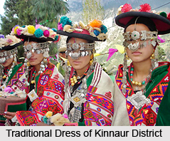 Culture of Kinnaur District exhibits a great heterogeneity in the state of Himachal Pradesh. Different communities dwelling in the district follow different lifestyles. The society is divided into various groups and people belonging to these groups have adopted different occupations. Peculiar food habits prevail in the district which suits the geography and climate of the region. A number of local dialects are also prevalent in the district. Numerous rituals, beliefs and practices of Kinnaur District echo the ancient heritage of the country. These diverse practices make the culture of the district highly vibrant and colourful.
People of Kinnaur District
Kinnaur District has a heterogeneous population. Prominent diversity can be witnessed and people belonging to various ethnicities dwell in the district. Three territorial units have been assigned to categorize the people of the district. People belonging to lower Kinnaur are of Mediterranean physical type. The majority of people are Hindus however; influence of Buddhism is also evident. People of middle Kinnaur are of mixed races having Mediterranean as well as Mongoloid features. Both Buddhism and Hinduism are prevalent among the people. People of upper Kinnaur have mostly Mongoloid features with a few exceptions. People of the district are mostly artisans or peasants. The cultivating community are known as Kanets who are further categorized into various sub castes. The scheduled castes of the district are referred as Domangs and Chamangs who are professionally blacksmiths and weavers respectively. Ores is another caste which is mainly involved in carpentry. People of different localities of the district worship different local deities.
 Dresses of Kinnaur District
Woollen clothes are prevalent in Kinnaur District which suits to the climate of the district. Head dress is very common among both men and women which comprise of a round woollen cap, locally known as thepang. Chamn Kurti is the male woollen shirts and Chhuba is woollen coat. Sometimes sleeveless woollen jacket is also worn in over Chhuba. Among women, dohru is common, which is a woollen shawl. These shawls generally have dark hues. Choli refers to full sleeves blouse for women having decorative linings. Traditional foot ware is made up of goat hair or wool with a goat hide sole.
Food of Kinnaur District
People of Kinnaur district consume phafra, wheat, ogla and barley are staple food. Rice is also a common diet. Cha is referred to the salted tea which is taken in the mornings. It is taken along with sattu prepared of parched barley flour. Both vegetarians as well as non vegetarians constitute the population of Kinnaur District. During festivals, consumption of alcohols is also common.
 Language of Kinnaur District
A number of dialects are followed in Kinnaur District, which are collectively known as `Kanauri`. The people belonging to the villages situated in Tibetan Border speak Tibetian dialects. In Lippa, Asrang and Jangi regions Jangram dialect is spoken whereas Shumceho dialect is spoken in Labrang, Kanam, Shyaso, Spilo, Rushkalang villages. Schedule castes speak languages prevalent in the adjoining districts. Besides these, English and Hindi languages are also commonly spoken in the district.
Houses of Kinnaur District
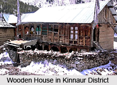
The pattern of housing varies from region to region starting from lower to upper Kinnaur. The houses of lower Kinnaur are generally two storied with wooden or stone structure. The roofs are either slated or flat. Upper Kinnaur region has mostly stone houses with flat roofs and are often two storied. The scarcity of wood in this region had led to the poor construction of houses. Separate wooden structures for the storage of grains, also known as `Kathar`, are present in most of the houses. For the purpose of sitting, Khayarchais used in the houses which are mats made of goat hair. Utensils used in the district are made of bronze, aluminium or brass. However with changing time, stainless steel utensils and china crockery are also being used.
Festivals of Kinnaur District
Festivals of Kinnaur District represent the rich cultural heritage as well as the cultural diversity of the country. These are celebrated in the honour of different deities and a number of myths surround these celebrations. The grandeur and splendour of these festivals are remarkable. The rituals performed in the ceremonies are unique and are immensely cherished by the local folks. Peculiar food delicacies form a distinct aspect of these festivals.
 Sazo
Sazo
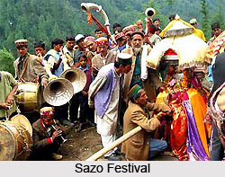
Sazo festival is celebrated in the month of January. On this occasion people take holy bath in natural springs or Sutlej River. The main food delicacies prepared during this festival are rice, vegetables, pulses, poltus, chilta, halwa and pug. Family God is worshipped in the mornings and the hearth is worshipped in the noon. Fold dance is also performed. After the occasion it is believed that the deity leaves for Kinnaur Kailash.
Phagul or Suskar
This festival is celebrated during February or March. The festival is celebrated in a grand way throughout the district for about a fortnight where sprit of Kanda (peak), also known as Kali, is worshipped. Different names have been assigned to the different days of the festival in which peculiar functions are organized. A feast is held on the last day of the festival and according to the local faiths; the deity blesses the villagers for prosperity.
 Baisakhi or Beesh
The celebration of Baisakhi takes place during the month of April. Delicacies like Keyshid, Halwa and Poltu are prepared during this festival. A fair is also organized during the festival when the idol of the goddess is brought out of the temple. Get together and feasts are the prominent features of the festival which also marks the end of winters. New woollen clothes are prepared and are worn by the people.
Dakhraini
Dakhraini is celebrated during July and is accompanied by a grand feast. The villages perform dances before the idol of the deity which is brought out of the temple. Special garlands made of loskar and zongor flowers, found in kand peak, are offered to the Goddess. This is followed by the distribution of the flowers among the villagers. In case of a death in the family, the members of the family visit the peak of the hill to offer fruits and food to shepherd in the honour of the departed soul. Another ritual is performed which involves fixing of a white flag with Buddhist mantras on the peak through which the peace of the departed soul is wished.
Flaich Ukhayang
In the month of September, Flaich Ukhayang is celebrated which is a festival of flowers. It is also celebrated all over the district on different dates. The festival is celebrated over the peak of nearby hills where the idol of deity is taken through a procession accompanied by a band. Sacrifice of a goat is also carried out. Garlands are prepared with shuloo flowers brought from the peaks and a grand fair is organized. These garlands are dedicated to the deity. The idol of the goddess, decorated with flowers, is then brought back to the village and during the return journey people sing and dance with great vigour.
 Losar
Losar
Losar is the celebration of New Year in the month of December. A special delicacy of parched barley mixed with butter milk is consumed by the family members. Garlands made of chilgoza flowers are put on and wishes and greetings are exchanged between the family and friends. Khepa is observed before two to three days of this celebration. Small branches of a thorny bush are generally placed at the doorstep as a ritual to keep the evil spirits away.
Tribal Festival
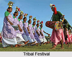
Tribal Festival is observed every year from 30 October to 2nd November at District Headquarter Reckong Peo. This celebration has commenced from the year 1990s. It has been also declared as state level festival. Previously, this festival was also celebrated under different names viz. Phulaich Utsav, Janjatiya Utsav and also Tribal Festival. It is a grand showcase of the cultural heritage of the district and provides a great opportunity to the local folk for displaying or selling their handicrafts, agricultural or horticultural products. Various cultural programs are also organized during the festival, which are symbolic of national integration and brotherhood.
Festivals of Kinnaur District play a key role in promoting brotherhood and togetherness among different communities of the district. The spirit of these celebrations not only attracts the local people, but also numerous tourists from far off places. The gaiety and frolic of these colourful festivals amidst the mesmerizing landscapes creates a delightful experience.
Valleys of Kinnaur District
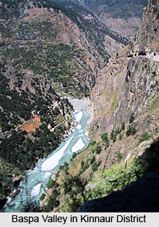 Valleys of Kinnaur District in Himachal Pradesh create a centre of attention to the global tourists. In Kinnaur district, Sutlej River passes through the Himalayan chain and runs through the centre of Kinnaur. The four major valleys of Kinnaur district of Himachal Pradesh to the southeast and east are listed below -
Baspa Valley
The Baspa valley is considered as the loveliest and most beautiful of all the Himalayan valleys. Many travellers have visited this valley, for it is connected to Garhwal in the south by some famous passes which have been crossed from time immemorial.
The main passes are as follows -
* Buran Ghati: Sanga to Pabar gad
* Rupin Ghati: Sangla to Rupin gad
* Nargah Ghati: Sangla to Nargani khad
* Singha Ghati: Mastarang to Supin gad
* Khimloga Pass: Chhitkul to Supin gad
* Borasu Ghati: Nagasti to Har-ki-Doon
* Lamkhaga Pass: Upper Baspa valley to Harsil
All these passes offer possibilities for trekking, climbing small peaks and of grand views.
There are also two major passes which lead to Tibet. The famous one is the Yamrang La (5570 m) and a little to its south is the Gugairang La. For mountaineers the upper Baspa valley offers a lot by way of shapely peaks. Generally they are all around 5600-5900 m with about five peaks rising above 6000 m and the highest up to 6227 metres. Many have passed through this valley but the climbing history is brief. Col Balwant Sandhu led an expedition here in the year 1976 which climbed a peak north of Sui Thatang. Another visitor was Jack Gibson on two trekking visits the Yamrang La was visited in 1978 and Soli Mehta crossed the Lamkhaga pass with Maj JungalwalLa, in 1966.
The I.T.B-P have been in the area for many years, and some officers have written warmly and authentically about it.12 But the two reported climbs in the Baspa valley which include the three high peaks north of Dunthi have, unfortunately, no accurate written record. A good road branches off at Karchham to Sangla. It is extended further to Rakchham, and Sushung khad, four km short of Chhitkul. Buses ply regularly up to Sangla and sometimes further up to Shushung khad. In a year or two the road should reach Chhitkul.
Tirung Valley (Tidong)
This valley north of Baspa has close connections with the Baspa valley across the Charang Ghati (5242 m). It runs in the east to the Khimokul La (Gunrang La) and Tibet. A jeepabte road leads from Morang to Thangi. Ahead, the road is being constructed to Charang. Thangi has been used as a starting point to attempt the peaks in the Kinnaur Kailash range. It also gives access to Phawararang (6349 m) which has been climbed a few times. Northeast of Thangi lie two shapely peaks, both on the Tirung-Gyamthang divide.
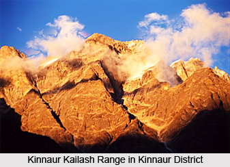 Kinnaur Kailash Range
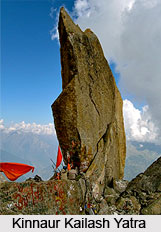
There are three peaks to consider. First is Kailash (6050 m), seen from Kalpa near the Shivling-shaped pillar which is the real Kinnaur Kailash, and worshipped as the holy summit. Finally there is Jorkanden (6473 m), the highest peak of the massif, often mistaken for Kinnaur Kailash. Jorkanden has received various attempts and ascents. After the recce by P. R. Oliver in the year 1931, it was attempted by the Indian Army in 1964, 1967, 1972, and finally in the year 1973 by Major D. K. Khullar. The first ascent was made in the year 1974 by the I.T.B.F, which was followed a month later by the Army. Since then, it has been climbed by the Indian Army again in the year 1978.
Gyamthang Valley (Nisang)
A relatively unknown valley to the north of Tirung Gad is approached from Kanam. It leads to the Raniso pass (into Tibet) and has one major peak the 6063 metres high Gang-chha. Further to the east lies Gang Chua (6288 m). It was climbed in the year 1974 by an Army team from the Hojis Lungba valley to the north. To the north of this there are no mountains of great height till the Shipki La and the gorge of the Satluj and its meeting with the Spiti River north of Puh.
Leo Pargial (Hangrang valley)
This peak at 6791 m is a high landmark north of the Shipki La on the Tibetan border, and has attracted mountaineers for many years. It was first climbed by Marco Pallis and C. B. M. Warren in the year 1933. It was attempted several times by the Army, and climbed by them in 1967, 1975 and 1980. The I.T.B.P. made the third ascent in the year 1971. The peak has been frequently attempted by civilian parties and was climbed twice in the year 1982. Its principal approach is from Nako and another route has been receding from Chango.
Temples and Monasteries of Kinnaur District
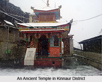
 Temples and monasteries of Kinnaur District are representatives of the rich cultural heritage of the district. The religious beliefs of people in this district vary from region to region. Hinduism and Buddhism are the prevalent religions and numerous temples and monasteries stand in the district to shelter the devotees of respective religions. Apart from this, many of the temples are dedicated to local deities.
Temples of Kinnaur District
Kinnaur district houses a number of temples which attracts numerous pilgrims and devotees from distant places. They also form famous tourist centres, owing to their antiquity and exquisite embellishments.
Chandika Temple, Kothi
Chandika Temple, situated in Kothi village, is a magnificent temple dedicated to Goddess Chandika. In the village, she is considered as the most powerful goddess. The temple houses a gold image of the Goddess, seated over an ark. The rituals followed during the worship are unique in their own way.
Mathi Temple, Chhitkul
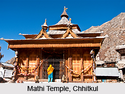
Mathi Temple is located at Chhitkul village and is dedicated to the local deity Mathi. It is a group of three temples and the main one among them was is 500 years old, built by a Garhwal resident in ancient past. The ark over which the idol is seated is made up of walnut wood, covered with clothes.
 Maheshwar Temple, Sungra
Maheshwar Temple is a significant historical structure exhibiting intricate and beautiful wooden panels. The temple is dedicated to prominent Hindu deities and the idols are exquisite with deeply cut structures. On the eastern wall of the temple a beautifully carved panel depicts the Avatars of Lord Vishnu and Hindu zodiac symbols. Near the temple, an ancient stone shrine belonging to eighth century stands.
Chango Temples, Chango
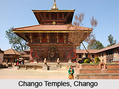
In the village Chango, three temples are situated. Rinchen Zangpo temple stands in lower Chango. Near this temple, another village temple stands which is more frequently used by the devotees. This temple has clay idols, a prayer wheel and contemporary paintings on its wall. Between these two temples, a huge stone idol of Avalokitesvara is located.
Durga Temple, Ropa
At Ropa, a Durga temple is located which is often also called as Chandika temple. It is believed that this semi arid region was assigned by the Goddess to herself while she was dividing the district among her brothers and sisters. The temple is made of a reinforced cement concrete frame and exhibits splendid architecture.
 Charang Temple
An ancient temple stands beyond Charang, known as Rangrik Tungma complex. The temple belongs to 11th century. The name of the temple is derived from its presiding deity Goddess Rangrik Tungma. The temple houses an old metal image of Goddess astride a horse. It is believed that Rangrik Tungma was a pre-Buddhist deity. Apart from this, two bronze statues are also housed in the temple. The main hall of the temple has clay idols of certain protective deities and ancient wall paintings.
Monasteries of Kinnaur District
Buddhism is quite prevalent in Kinnaur district which is quite evident in the monasteries situated in the district
Rarang Monastery, Rarang
Rarang Monastery is a newly built monastery of Tashi Choeling. The monastery came into being owing to post-1960 Tibetan influences and was constructed by Drugpa sect. Near the monastery, remains of old temples and settlements can be witnessed. The remains are believed to be associated to Nyingmapa adherents.
Brelengi Gompa, Brelengi
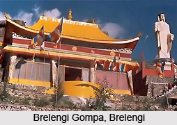
A Buddhist monastery, known as Brelengi gompa, is situated in Brelengi, near Reckong Peo. The attractive monastery was built by Mahabodhi society for the Dalai Lama for performing the Kalachakra ceremony in the year 1992. Just beside the monastery stands a 10 metre tall statue of Lord Budha which is visible even from a far off distance.
Temples and monasteries of Kinnaur District were built in ancient times and have still retained their beauty and significance. The architecture and craftsmanship of the temples and monasteries are also admirable. Myths and legends are associated with the construction of some of these temples. A number of unique rituals and worshipping styles are also associated with the temples and monasteries of Kinnaur District.
Temples in Kinnaur
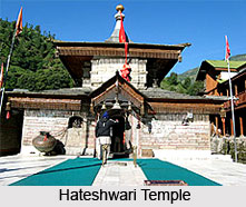 One of the 12 districts in Himachal Pradesh, Kinnaur is divided into three administrative areas of Pooh, Kalpa and Nichar. The administrative districts are located in Reckong Peo. According to prehistoric texts, Kinners are half humans and half gods. Reckong Peo, Kalpa and Kinnaur Kailash, regarded the abode of Lord Shiva, surrounded with breathtaking beauty, can be witnessed from Sangla Valley. The place is extremely revered by the Hindus. A number of temples lace Kinnaur whilst echoing the sheer religiosity of the place. Besides Hindus, Tibetan Buddhism is also practiced in this district and the presence of various monasteries and the Buddhist gompas further proves this. The Kinnaur Kailash is considered the most sacred mountain by most Kinners. Every year a yatra is organised, with huge participation from the believers` front.
Badri Narayan Temple, Batseri, Kinnaur, Himachal Pradesh- Showcasing intermixture of structural design, Badri Narayan Temple is home to Lord Badri Narayan.
Hateshwari Temple, Kinnaur, Himachal Pradesh- Demonstrating Buddhist style of architecture, Hateshwari Temple houses two divinities within the sanctum.
Maheshwar Temple, Sungra, Kinnaur, Himachal Pradesh- Explicit in architectural work, Maheshwar Temple redefines gothic work in ancient India.
Bering Nag Temple, Kinnaur, Himachal Pradesh-Bering Nag Temple is situated in Kinnaur district, Himachal Pradesh. The temple is consecrated to God Jagas. The renowned Fulaich Fair, a flower festival, is celebrated between August and September every year in the temple premises.
Kamakhya Devi Temple, Kamru Village, Kinnaur, Himachal Pradesh- Encased within strict rules, Kamakhya Devi Temple resembles a patronising citadel.
Narayan Nagini Temple, Chini Village, Kinnaur, Himachal Pradesh-Narayan Nagini Temple is located atop a hill in Chini Village in Kinnaur district in Himachal Pradesh. This brilliant shrine, built in the Tibetan Pagoda style of architecture, is a perfect example of Kinnauri masonry.
Kinnaur Kailash Yatra, Kinnaur, Himachal Pradesh- Legendary for being the dwelling of Lord Shiva, pilgrims undertake the Kinnaur Kailash Yatra, spellbinding from every angle.
Mahabodhi Kinnaur Buddhist Temple, Kinnaur, Himachal Pradesh- Blessed by his holiness, the Dalai Lama, Mahabodhi Kinnaur Buddhist Temple is situated amidst luxurious environs.
Namgaya Buddhist Temple, Namgaya Village, Kinnaur, Himachal Pradesh- Dedicated to local goddesses, Namgaya Buddhist Temple is situated close to the Chinese border.
Lippa Monastery, Jangi Village, Kinnaur, Himachal Pradesh- A prehistoric construction, Lippa Monastery is a key centre of Buddhist religious works.
Kanam Monastery, Kanam Village, Kinnaur, Himachal Pradesh- Housing the holy texts of Buddhism, Kanam Monastery houses several other monasteries in its complex.
Jampa Monastery, Chuling Village, Kinnaur, Himachal Pradesh-Jampa Monastery is situated in Chuling Village in Kinnaur district, Himachal Pradesh. Daily bus service is obtainable to Reckong Peo from Shimla. The trip to Chuling takes a whole day by bus, in addition to a two-hour walk. No inner line-permit is needed to travel to Chuling.
Tourism in Kinnaur District
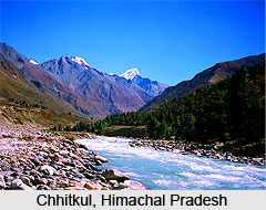 Tourism in Kinnaur District of Himachal Pradesh offers a wondrous experience of exploring the enticing beauty of nature. The stunning landscape of the district adorned with lush greenery and sky kissing majestic mountains, is a visual treat. Kinnaur District forms an excellent destination for adventure as well as nature lovers. The sparkling rivers, resplendent valleys, green fields and beautiful orchards are some of the most delightful features of the district.
Kalpa
Kalpa is located at a height of 2759 metres above sea level. Previously it was the district headquarters of Kinnaur. Kalpa has typical features of a heritage village. Narayan-Nagani temple of Kalpa is a famous pilgrimage site, known for its excellent craftsmanship. The place also houses two Buddhist monasteries and one of them, known as Hu-Bu-Ian-Car Gompa, was established by Rinchensang-Po. Legends say that Kalpa is the winter home of Lord Shiva. Kalpa offers a splendid view of sunrise when the golden rays touch the pinnacles of snow capped mountains.
Reckong Peo
Reckong Peo is another beautiful tourist site situated at an altitude of 2670 metres. The place serve as the district headquarters and offers a magnificent sight of Kinner Kailash which is a mythical home of Lord Shiva. The mountain houses a large rock resembling Sivalinga which changes colour with changing time. Reckong Peo also hosts a Buddhist monastery.
Sangla
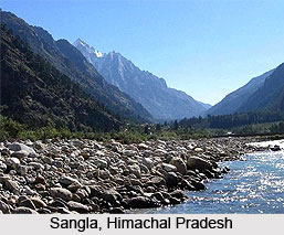
Sangla is a village located along the bank of the Baspa River. The village is known for its highly fertile soil. The populous village is situated on a slope with houses built at rising levels. Lush green forests spans all over the village and the snow covered peaks forms a magnificent view. The Baspa valley where the village is situated is beautiful owing to its greenery and flat terrain.
Chango
Chango is an assemblage of 4 hamlets situated in sub-tehsil Hangrang along the left bank of Spiti River. It is encircled by high mountains and housed a lake in the past. Buddhism is prevalent in this region; however some Hindu deities like Dablaand Yulsa and Gyalbo are also worshipped.
Chhitkul
Chhitkul is also situated in the Baspa valley and is the highest village of this region. The village houses three temples dedicated to the local deity, Goddess Mathi. The main temple among the three is believed to be constructed by the Garhwal residents, about 500 years ago. Walnut wood forms the structure of the square ark of the deity. The goddess also has a mouthpiece.
Kothi
Kothi, also known as Koshtampi, is an ancient village situated at a little lower altitude than Kalpa. The village is covered with numerous fruit trees, beautiful fields and vineyards. Kinner Kailash peak forms the mesmerizing backdrop of the village. The landscape of the village is adorned with magnificent temples, gracious willows and tanks. The most famous temple of the village is dedicated to Goddess Shuwang Chandika. She is believed to be the most powerful goddess in the locality and her idol is made of gold and is installed over an ark. Another temple dedicated to Lord Bhairon is also situated here.
Lippa
Lippa is another village located on the bank of Taiti stream. It is believed that the grass of the village is quite nourishing to the cattle. Nearby forest is the home to Ibex. The village also houses three Buddhist temples dedicated to Kangyur, Dunguir and Galdang Chhoikar. Apart from these, the village has another beautiful temple where the local deity Tangtashu is worshipped.
Moorang
Moorang is located along the left bank of Sutlej River at a little distance where the river meets Tirang River. The village has a pretty landscape which is entered through a beautiful apricot orchard. The village is embraced by huge magnificent mountains on all the sides except the western part where it opens to Sutlej River. On the bank, an old fort stands which is said to be built by the Pandavas. Thwaring is the local deity of the village.
Nichar
Nichar is also located on the left bank of Sutlej River, between Wangtu and Taranda. The place has a picturesque beauty with a mild climate. Dense forest and rocky land spans the place where thar antelopes and goral can be witnessed wandering. Colder regions of Nichar nestles red and black bear. Ukha is the village goddess.
Nako
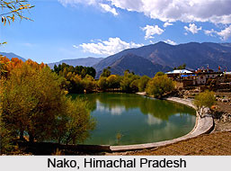
Nako is the highest village of Hangrang valley. It hosts an enchanting lake which formed by the melted snow and ice. Willows form the village boundary and kine, yak, asses, horses are found in abundance in the village. Lagang temple is a famous pilgrimage site of the village which is dedicated to several deities. Deodum is the local deity of the village. Budhhist temples are scattered in the village. It also houses a famed rock which is believed to have the imprints of Saint Padmasambhava.
Namgya
Namgya is another tourist destination situated amidst pretty landscape near the confluence of Sutlej and Spiti rivers. The place is quite barren and the habitation can be witnessed on the opposite bank. The place also houses a Buddhist temple and the local deities are Bushahru, Kuldeo Narain, Dabla and Chola.
Pooh
Pooh is located besides the national highway 22. The village is adorned with enticing beauty of lush green fields, vineyards, grape, almond and apricot orchards. Dabla is the local deity of the village; however no temple has been dedicated to the God. The manifestation of the God is a pole having a small dot which is embellished with coloured clothes and yak tail hair.
Rakchham
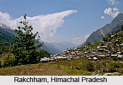
Rakchham is another beautiful village on the right bank of Baspa River. `Rak` refers to stone and `Cham` refers to bridge and the name of the village has been derived from the stone bridge which was previously existent over the Baspa River. The village possesses a striking natural beauty and is located at the extreme western part of a glen.
Ribba
Ribba, also known as Rirang is another village situated near Moorang. It is located at the northern part of Kinner Kailash group of mountains. Edible pine and other trees span the village. The village is also famous for grapes orchards.
Tourism in Kinnaur District also gives a chance to explore the social and cultural heritage of the district. Buddhism is widely spread in the district and religious beliefs vary from region to region. Different villages worship different local deities. Apart from inviting natural beauty, the district also houses a number of temples which are admirable for their intricate and alluring architecture.


