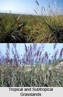
 The tropical and subtropical grasslands, savannas and shrub-lands in India are mainly found in the semi-arid to semi-humid climate regions of the subtropical and tropical latitudes. These forests are actually a grassland biome that is dominated by grass and other herbaceous plants. The savannas are grasslands having scattered trees and the shrub-lands are mainly dominated by the woody or herbaceous shrubs. Annual rainfall in the tropical and subtropical grasslands, savannas and shrub-lands in India ranges between 300 and 1500 millimeters (20 to 60 inches). The forests can also be highly seasonal, as sometimes the entire year`s rainfall occurs within a couple of weeks. The forests have cool and dry, warm and dry, and also hot and rainy seasons.
The tropical and subtropical grasslands, savannas, and shrub-lands can be found in the Terai-Duar savanna and grasslands, in India. The Terai or "moist land" is actually a belt of marshy grasslands, savannas, and forests, located at the base of the Himalaya range in India. The area is stretched from the Yamuna River in the west to the Brahmaputra River in the east. Bhabhar soil has eroded from the Himalayas, where the water table lies from 5 to 37 meters deep. The Terai zone is composed of alternate layers of clay and sand, with a high water table that creates many springs and wetlands. The monsoon-swollen rivers of the Himalaya inundate the Terai zone every year. The great alluvial plain of the Yamuna, Ganges, Brahmaputra, and their tributaries and also located below the Terai zone.
The Terai-Duar savanna and grasslands is an eco region that stretches across the middle of the Terai belt, from the state of Uttarakhand through southern Nepal to the northern part of West Bengal. The Terai-Duar savanna and wetlands are a wonderful mixture of tall grasslands, savannas and evergreen and deciduous forests and the grasslands are counted among the tallest in the world. They are well maintained by silt that is deposited by the yearly monsoon floods. Some of the most important grasses in these forests include the Kans grass and the Baruwa grass. Several mammals, birds and insects can also be found in these forests. The eco region is also home to a number of endangered species like the Indian Rhinoceros and the other animals like Elephants, Tigers, Bears, Leopards, etc. The soil of the forests is fertile and the plants include grass, and infrequent clumps of deciduous trees. Some of the notable flora species include the trees like Acacia, Baobab, and other slow shrubs.


