 The Northeast India-Myanmar Pine forests are located in the northeastern part of India and in the adjacent portions of Burma (Myanmar). The forests form an ecoregion that covers a huge area of 9700 square kilometres in the Naga Hills and part of the belt of folded mountains that make up the India-Burma border region. These Pine forests can be found between 1500 and 2500 meters elevation and they mainly occur in three enclaves. The largest enclave straddles the boundary between India`s Nagaland state and Myanmar, and the other two smaller enclaves are located in the southern portion of India`s Mizoram state, near the Myanmar border. The forests are surrounded by the predominantly broadleaf Mizoram-Manipur-Kachin rain forests, at lower elevations.
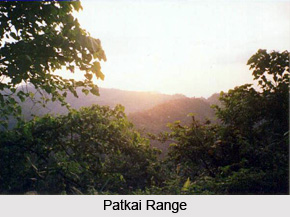
The Northeast India-Myanmar Pine forests ecoregion is counted amongst the only four tropical or subtropical conifer forest ecoregions in the Indo-Pacific region. Though, all the four ecoregions contain less biodiversity than the forests that surround them, they contain processes and species unique to these ecosystems. The Pine forests ecoregion also contains moderate levels of biodiversity. As the forests remain largely intact, they provide opportunities to conserve and protect this eco-region`s biodiversity into the future. The forests are mainly found in the north-south Burmese-Java Arc that is formed by the parallel folded mountain ranges that culminate in the Himalayas in the north. The mountain ranges of Patkoi, Lushai Hills, Naga Hills, Manipur, and the Chin Hills are located to the south of these forests. Geologically the ecoregion has gley and black slates and dark-coloured serpentine and gabbro are also found interstratified within the shales, in these forests.

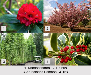
As the name suggests, the vegetation in the Northeast India-Myanmar Pine forests is mainly dominated by the Pine trees. Several pine species occur in these forests. The species like P. merkusii is dominating in the lower elevations of these forests and it is occasionally associated with dipterocarps. The higher altitude of the forests is dominated by the species like Pinus insularis and Pinus excelsa. Numerous broadleaf species like Tsuga, Picea, Acer, and Quercus often associate the Pine species. Apart from that, the species like Rhododendron, Ilex, Prunus, and Arundinaria Bamboo can also be found in the understory of these forests. The forests are home to a rich variety of mammal species like the Sambar, Barking Deer, Wild Boar, and Asiatic Black Bear. The species like Serow was plentiful in the forests, in the past. Apart from that, the species like Large Squirrel, Brown Squirrel, Small Chipmunk, and Civet are also found in these forests.
The Northeast India-Myanmar Pine forests also provide habitat for a rich variety of bird fauna species, however, they are less diverse than the surrounding ecoregions. Several distinctive bird species were found in the forests during the 1950s. The species include the Silver-Breasted Broadbill, White-Naped Yuhina, Rufous-Vented Tit, Stripe-Throated Yuhina, Babblers, Grey-Sided Laughingthrush, Rufous-Chinned Laughingthrush, Striated Laughingthrush, Cochoa, Beautiful Nuthatch, Sultan Tit, Leaf Bird, and White-Browed Fulvetta, etc. Apart from that, the species like Shelduck and Bare-Headed Geese were also found in these forests along the Chindwin River. Two additional laughingthrush species named the Striped Laughingthrush and Brown-Capped Laughingthrush are also found in these forests and are considered as near endemics.


