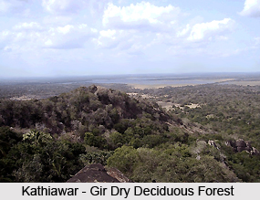
 Located in the western India, the Kathiawar-Gir dry deciduous forests in India are a tropical dry broadleaf forest ecoregion. The main part of the ecoregion comprises the Aravalli Range and the eastern half of Rajasthan state and the ecoregion extends into eastern Gujarat and the Malwa region of Madhya Pradesh. The forests have a disjunctive or isolated distribution. The peak of Girnar on the Kathiawar peninsula of western Gujarat is located in a small territory of the ecoregion.
The drier Northwestern thorn scrub forests ecoregion lies to the west of the Kathiawar-Gir dry deciduous forests in India and cover the remainder of the Kathiawar Peninsula. The forests also cover the strip of western Rajasthan between the Aravalli Range and the Thar Desert. To the northwest the Kathiawar-Gir dry deciduous forests transition to the Upper Gangetic Plains moist deciduous forests. The Narmada Valley dry deciduous forests ecoregion lies to the southeast of the forests and they cover the Vindhya Range and Narmada River valley. The ecoregion also borders on the North Western Ghats moist deciduous forests in southeastern Gujarat.
The climate of the Kathiawar-Gir dry deciduous forests in India is tropical monsoon type and they receive most of the rainfall during the southwest monsoon, during the months of June-September. The forests remain arid for the remaining months of the year. The annual rainfall in the forests averages 550 to 700 mm and the temperatures often exceed 40 °C. The higher elevations of the Aravallis stay cooler, and the windward slopes receive higher rainfall.
 The composition of the Kathiawar-Gir dry deciduous forests in India varies with moisture and soils. The wetter areas contain three-storied forests that are dominated by Teak in association with Agele marmelos, Boswellia serrata, Ougeinia oojeinensis, Diospyros spp., Bombax ceiba, Sterculia urens, Emblica officinalis, Dalbergia paniculata, and Terminalia tomentosa, etc. These forests have a three-storied structure. The top story of the forests reaches from 15 to 25 meters. The plant species like Anogeissus pendula grow in almost pure stands or in association with Acacia catechu is predominant in drier areas, especially on the quartzite ridges and gneiss hillocks of the Aravalli Range.
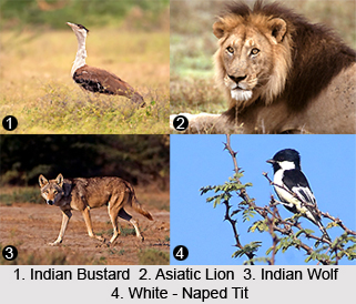
The Kathiawar-Gir dry deciduous forests in India have a rich variety of fauna species. The most notable fauna species found in the forests include the Asiatic Lion, Bengal Tiger, Leopard, and Indian Wolf. Apart from these, there are also several other mammal fauna species that can be found in these forests. These species include the Hyena, Chousingha, Blackbuck, and Chinkara, etc. The forests are also home to a rich variety of bird species that include the endangered Indian Bustard, and Lesser Florican. The near-endemic species like White-Naped Tit is also found in the Kathiawar-Gir dry deciduous forests in India.


