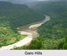
 Garo Hills are a part of the range that is called the Garo-Khasi range in Meghalaya. The range is part of the Meghalaya subtropical forests eco-region. It is one of the wettest places in the world. Situated close to the Indo-Bangladesh Border, the Garo hills are part of the Patkai hill range, which extends across the Indo-Myanmar border. The greater part of Garo Hills ranges in height from 450m to 600m and drops steeply to the Brahmaputra Valley on the north and to the plains of Bangladesh on the south.
Through the Garo Hills, two mountain ranges pass, called the Arabella Range and the Tura Range, which forms the great Balpakram Valley in between. Balpakram area is considered to be sacred for the Garo community due to their belief that the spirits of the dead sojourn here. The Nokrek Peak is the highest point in the Garo Hills, which is covered by a thick film of lush forest. The hills are also decked with splendid waterfalls, enriching the environmental coherence of the place.
Flora and Fauna of Garo Hills
Garo Hills are known for its abundance of wildlife with a unique range of flora and fauna. The Nokrek National Park comprises herds of wild elephants, many rare varieties of birds and pheasants along with rare orchids. Garo Hills is densely forested and hence one of the richest spots in bio-diversity.
 Divisions of Garo Hills
The Garo Hills have an area of approximately 8,000 sq. Kms which forms the western part of Meghalaya. Garo Hills comprises 5 districts; North Garo Hills, East Garo Hills, West Garo Hills, South Garo Hills and South-West Garo Hills. West Garo Hills is one of the largest districts of Meghalaya located in the western part of the state. Tura is the largest town having a population of 70,000.
Tribes of Garo Hills
The Garo Hills are mostly dominated by the tribes known as Garos. The Garos call themselves Achik-mande. In the Garo language Achik means "Hills" and mande means "Man". So, Achik-mande means the Hills people.
Festivals in Garo Hills
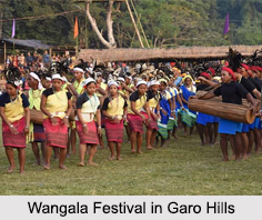
Festivals in Garo Hills include Wangala Festival, which takes place every November at the hills. This is a harvest festival held in honour of Saljong, the Sun God of fertility. The others are Rongchu gala, DenBilsia, Mangona, Mi Amua, Jamang Sia, Sa Sat Ra, Grengdik BaA, Chaka, Ja Megapa, Chambil Mesara, AjeaorAhaoea, Dore Rata Dance Do"KruSua, Saram Cha"A, A se Mania or Tata.
 Tourism in Garo Hills
These are locations in and around Garo Hills which are tourist spots. These include:
•Nokrek Peak: The highest point of the Garo Hills region of the State, Nokrek Peak stands 1412 m above sea level. This discovery of Citrus-Indica led to the establishment of the National Citrus Gene Sanctuary-cum-Biosphere Reserve at Nokrek covering an area of 47 sqkm.
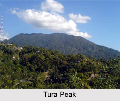
•Tura Peak: A majestic hill stands on the eastern flank of Tura, the largest town in the Garo Hills region of the State. It peaks 872metres above sea level. A tourist-bungalow, an observatory and a Cinchona-plantation are located at Tura Peak and its environs.
•Imilchang Dare: This waterfall is located close to the Tura-Chokpot Road in West Garo Hills district. The deep, wide pool at the bottom of the fall with its wide and expansive surroundings makes it an exciting swimming pool, full of fish of varied sizes and colours.
•Balpakram National Park: A National Wildlife Park, located in South Garo Hills and 167 km from Tura. It is home to the rare Lesser Panda, the Indian bison and the Stag like Serow. A variety of medicinal herbs locally called "dikges" grow abundantly in Balpakram.
•Naphak Lake: Located at a distance of 112 km from Tura, ideal for fishing and bird watching with the river Simsang flowing nearby.
•Siju Caves: The famous limestone caves of Siju are located near Naphak Lake.


