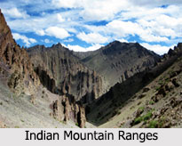
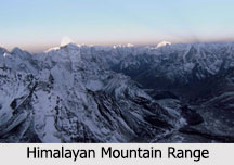
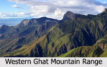
 Indian Mountain Ranges form an important part of the topography of India affecting climate, lives, settlement and economy of the country. They are pristine, serene, unruffled and majestic. The swaying snow peaks, lofty crests and emerald meadows blessed with the lush fruit laden valleys, invite tourists, bewitching and mesmerizing them. They also have the capacity to evoke spirituality and sanctity. India begins with the dynamic area of the northern mountain terrain varying from arid mountains in the far north to the lake country, and then to the evergreen forests near Srinagar and Jammu.
Major Indian Mountain Ranges
The major Indian Mountain Ranges are:
1. Himalayan Mountain Range
2. Karakoram Mountain Range
3. Eastern Mountain Range
4. Satpura Mountain Range
5. Vindhya Mountain Range
6. Aravalli Mountain Range
7. Western Ghats
8. Eastern Ghats
 Himalayan Mountain Range: The Himalayas have the distinction of being the world"s highest mountain range and world"s youngest mountains. This range of mountains separates the plains of the Indian Subcontinent from the Tibetan Plateau. The Himalayas stretch about 2,400 km (1,500 mi) in length. Several highest peaks of the world are part of this mountain range, including Mount Everest, which is the highest mountain in the world. Kanchenjunga is the highest point in India and the second highest mountain of the Himalayas.
Karakoram Mountain Range: Karakoram Mountain Range is situated in the regions of Gilgit-Baltistan (Pakistan), Ladakh (India) and southern Xinjiang (China) and reaches the Wakhan Corridor (Afghanistan). This mountain range has more than 60 peaks above 22,966 ft. Mount Godwin-Austen or Chhogori, the second highest mountain in the world is a part of the Karakoram Mountain Range. The Pir Panjal Range is located in southern direction of Himalayas starting from Himachal Pradesh and running north-west towards Jammu and Kashmir.
Eastern Mountain Range: Also known as "Purvanchal Range", it is considered as an extension of Himalayas in the north-eastern part of India. This range comprises of three parts The Patkai-Bum Hill, The Garo - Khasi - Jaintia Hills and Lushai Hill (Mizo Hills). This range covers all the north-eastern states of India which are commonly referred as Seven Sisters. Nokrek Peak is the highest peak of this region with a height of about 1,412 m (4,632 ft).
 Aravalli Mountain Range: Aravalli Mountain Range is located in the Indian states of Rajasthan, Haryana, Delhi and Gujarat. This range has the distinction of being the oldest fold mountains in India. Guru Shikhar is the highest point of this range with a height of about 1,722 m (5,650 ft).
Vindhya Mountain Range: Vindhya Mountain Range is located in the Indian states of Madhya Pradesh, Gujarat, Uttar Pradesh and Bihar. It comprises of complex and discontinuous chain of mountain ridges, hill ranges, highlands and plateau escarpments. Sadbhawna Shikhar or Kalumar Peak is the highest point of this range with a height of about 752 m (2,467 ft).
Satpura Mountain Range: Satpura Mountain Range is located in the Indian states of Madhya Pradesh, Maharashtra, Chhattisgarh and Gujarat. More specifically, the range rises in eastern Gujarat and runs east through the border of Maharashtra and Madhya Pradesh to the east till Chhattisgarh. Dhupgarh is the highest point of this range with a height of about 1,350 m (4,430 ft).
Western Ghats: Western Ghats is a mountain range that runs parallel to the western coast of the Indian states of Kerala, Tamil Nadu, Karnataka, Goa, Maharashtra and Gujarat. It has the distinction of being a UNESCO World Heritage Site. Anamudi is the highest point of this range with a height of about 2695 m (8,842 ft).
Eastern Ghats: Eastern Ghats is a discontinuous range of mountains located in the Indian states of Odisha, Andhra Pradesh, Karnataka and Tamil Nadu. Eastern Ghats comprises of thrusts and strike-slip faults all along its range. Arma Konda is the highest point of this range with a height of about 1,680 m (5,512 ft).
Other Indian Mountain Ranges
Some of the other Indian Mountain Ranges are Garhjat Hills, Zanskar Range, Bailadila Range, Sivalik Hills and Palni Hills.


