 The Indian dry deciduous forests are actually a type of the Indian deciduous or monsoon forests and they are mainly found in both Northern India and in south Deccan plateau in India. The dry deciduous forests are mainly situated in the areas, where annual rainfall ranges from 500 - 1,500 mm and every species in these forests has its own time of leaf casting. Sal is the most significant tree found in the dry deciduous forests. Several studies have revealed that the dry deciduous forests are step by step replacing the moist deciduous forests in India.
The Indian dry deciduous forests are mainly located at tropical and subtropical latitudes. They occur in climates that are warm, year-round, and may receive several hundred centimeters or rain per year. The seasonal droughts in these forests have a great impact on all the living beings, as the trees lose moisture through their leaves, during this time. In spite of being less biologically diverse than rainforests, the Indian dry deciduous forests are home to a wide variety of wildlife. Some of the most notable animals include monkeys, large cats, parrots, various rodents, and ground dwelling birds. The Mammalian biomass also tends to live in higher numbers in dry forests than in rain forests.
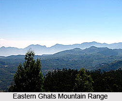
 The Northern Dry Deciduous Forests Ecoregions in India do not have large number of species or they are not high in numbers of endemic species, as well. However, they harbour several large vertebrates, which include the largest and most charismatic carnivore of Asia, the tiger (Panthera tigris). The northern Indian dry deciduous forests are mainly located across the Indian states of Bihar, Orissa, and Madhya Pradesh. They can also be found in the rain shadow of the Eastern Ghats Mountain Range. The vegetation in the Indian dry deciduous forests is made up of associations of Anogeissus latifolia, Dalbergia latifolia, Pterocarpus marsupium, Stereospermum suaveolens, Spondias pinnata, Cleistanthus collinus, Acacia lenticularis, Flacourtia indica, Boswellia serrata, Butea monosperma, etc. The dry forests do not harbor large numbers of endemic species, or they are not exceptionally rich in biodiversity, as well. The known mammal fauna in these forests consists of sixty-eight species and there are no eco-regional endemic species. However, the threatened species include the tiger, wild dog, sloth bear, and chousingha.
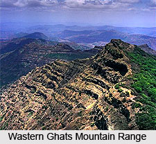
Among the Indian dry deciduous forests, the South Deccan Plateau dry deciduous forests are not exceptionally outstanding for biological richness or endemism. The South Deccan Plateau dry deciduous forests are located on the lee side of the Western Ghats Mountain Range. The forests in this region extend across the southern Indian states of Karnataka and Tamil Nadu and their vegetation is highly influenced by climate. As the tall Western Ghats Mountain Range intercepts the moisture from the southwest monsoon, the eastern slopes and the Deccan Plateau receive very little rainfall. The annual rainfall in these forests ranges from 900 to 1,500 millimeters (mm).
The Indian dry deciduous forests in this region have a three-storied structure, with an upper canopy at 15-25 meters, an understory at 10-15 meters, and undergrowth at 3-5 meters. The vegetation in these forests is characterised by Boswellia serrata, Anogeissus latifolia, Acacia catechu, Terminalia tomentosa, Terminalia paniculata, Terminalia belirica, Chloroxylon swietenia, Albizzia amara, Cassia fistula, Hardwickia binata, Dalbergia latifolia, etc. The forests are also home to several important populations of India`s large threatened vertebrates. One of the most important among them is the elephant population that ranges from the Nilgiri Hills to the Eastern Ghats. Some of the other important species include the Asian elephant, wild dog, sloth bear, chousingha, gaur, and grizzled giant squirrel.


