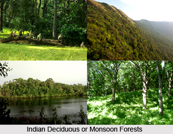
The Indian Deciduous forests are the most abundantly found among all the different types of forests in India. Deciduous forests are so called because the trees of these forests seasonally shed all their leaves. The Indian deciduous are found in a range of landscapes from the plains to the hills. They occur as Sal-dominated forests in the Bhabhar tract of the Himalayan foothills and Central India, and continue as teak-dominated forests across the Deccan Plateau. Apart from the extensive space that they cover in the country`s land area, the deciduous forests are further made important by the fact they are home to some of the most endangered wildlife in the country. The largest remaining populations of species such as the tiger, Asian elephant and Gaur in the country occur in these forests. As with all other ecosystems in India, deciduous forests also are under extensive pressures from human resource-use.
Features of Deciduous Forests
The trees in these forests have quite large and broad leaves and they shed all their leaves for about six to eight weeks in summer. They are counted among the most widely-represented forest types in India. Found in a range of landscapes from the plains to the hills, these forests grow over a wide range of rainfall regimes, occurring as dry deciduous forests where rainfall ranges from 500 - 1,500 mm and moist deciduous forests in wetter regions.
 Types of Deciduous Forests
The Deciduous forests usually cover a wide range of rainfall regimes and they can be classified into two divisions, namely the moist deciduous forests and the dry deciduous forests.
Moist Deciduous Forests
The moist deciduous forests are situated in wet regions which receive rainfall ranging between 100-200 cms. The moist deciduous forests, among the Indian deciduous or monsoon forests, are most commonly found on the eastern slopes of the Western Ghats. They can also be found in the north-eastern part of the peninsula i.e. in the region of Chota Nagpur Plateau, covering east Madhya Pradesh, south Bihar and west Orissa. They are widespread along the Shiwaliks in the northern India.
A number of valuable and popular trees can be found in these forests. Some of the important trees found in these forests include Teak, Sandalwood, Mahua, Sal, Khair, Mango Tree, Wattle And Bamboo, Jackfruit, Semal, Myrobalan, Arjun and the Banyan Tree. Teak is considered as one of the most vital species of this region. The trees found in these regions usually shed their leaves for about six to eight weeks during the dry season, generally during the months March to May, in order to prevent the loss of water in the form of moisture through the process of transpiration.
Most of the tropical deciduous forests are found in the state of Kerala in India. Apart from Kerala, they can also be found in the eastern slopes of Western Ghats; in the north-eastern parts of the peninsular plateau and in the valleys of the Himalayas. The Indian deciduous or monsoon forests are pretty substantial, cost-effective and they demand a lot of maintenance, as they are less resistant to fire.
Dry Deciduous Forests
The dry deciduous forests are found in those areas where annual rainfall ranges from 500 - 1,500 mm. Sal is the most significant tree found in the dry deciduous forests. It has been found in studies that the dry deciduous forests are step by step replacing the moist deciduous forests in India. Every species in these forests has its own time of leaf casting.
The eco-region extends across the Indian states of Bihar, Orissa, and Madhya Pradesh. It represents a north-south-directed island of dry deciduous forests in the rain shadow of the Eastern Ghats Mountain Range in India and is completely surrounded by the Eastern Highlands Moist Deciduous Forests. The region is not too rich in biodiversity. Among the threatened species found here are the tiger, wild dog, sloth bear and Chousingha.
The Indian deciduous or monsoon forests are pretty substantial and cost-effective, but they demand a lot of maintenance, as they are less resistant to fire. The Nature Conservation Foundation (NCF) has taken a lot of initiatives to preserve the Indian deciduous forests. Its programme in the deciduous forests has mainly focused on understanding the interface between people and wildlife. The NCF is also conducting research programmes into the ecology of threatened large mammal species and assemblages.


