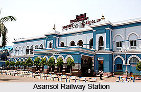
 Eastern Railway is an integral part of the Indian Railways. The Eastern Railway of India is headquartered at Kolkata and it stretches for 2414 km and includes the stations of Howrah, Sealdah, Malda and Asansol.
The formation of Eastern Railway dates back to 14th April, 1952; it was formed including Howrah, Sealdah, Danapur and Asansol Divisions along with the whole of West Bengal and Nagpur Railway. Later, some portions of this railway were separated and South Eastern Railway was formed on 1st August 1955. After reconstruction, Eastern Railway was stretched to 4245.61 km on 30th September 2002. Danapur, Dhanbad and Mughalsarai were separated from Eastern Railway on 1st October 2002, and these stations were included into East Central Railway area.
The Eastern Railway is an essential part of Indian economy as it not only serves the densely populated areas of eastern India but also covers the mineral rich regions and regions prospering in industries and agriculture. Eastern Railway stretches to the border of Bangaladesh upto Lalgola, Kiul and Malda in the North, Gede and Benapole in the East, Namkhana in the South and Jhajha and Asansol in the West. The major workshops of Eastern Railways are at Jamalpur, Liluah and Kanchrapara. 1308 km route of Eastern Railway has the capability of 25 KV AC traction electrification. From Howrah, the Eastern Railway main line runs for 221 km to Sitarampur from it bifurcates for Delhi, with one via Dhanbad - Gaya and the other via Patna. The lines meet at Mughalsarai Station.
Eastern Railway offers a number of express trains or fast long distance trains in Eastern Railways; one of the most popular one is the Rajdhani Express. The Eastern Railway - Howrah and Sealdah suburban divisions cater to a huge population of Greater Kolkata passengers, except the South Eastern Railway system. Eastern Railway introduced Diesel Multiple Units. The electrified "Routes Mainline Electrical Multiple Units" served passengers in the Non-suburban areas.
Besides passengers, Eastern Railway also carries stones, cements and merchandise and serves a number of oil installations, fertilizer plants and several industrial regions. Eastern Railway loads and carries Stone from Pakur and Jamalpur, Cement from Durgapur and host of other merchandise including Jute, Tea, Textile, Automobiles and others at various stations. The oil installations at Rajbandh and Budge-Budge, fertiliser plants at Durgapur and the enormous industrial complexes at Asansol, Durgapur, Chittaranjan, Burnpur and industrial suburbs of Kolkata and Howrah are solely served by Eastern Railway.
The Eastern Railways has authorised the Rail Travel Service Agents (RTSA) that help the passengers to purchase tickets and make reservations for the passengers. For classes other than Sleeper or second class, the service charge is Rs. 25/- per passenger and for Second Class or Sleeper class the service charge is Rs. 15/- per passenger. The Catering facilities are present in most of the stations and available on long distance as well as inter-city trains of the Eastern Railway.


