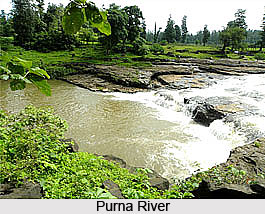
 The Purna River is a river of Western India. It is the principal tributary of Tapti River in Western India. The river rises in the Betul district in Gawilgarh hills of the eastern Satpura Range at an elevation of 900m in the southern Madhya Pradesh state, and flows westward, draining Maharashtra`s Vidarbha region before flowing into the Arabian Sea. The watershed lies mostly in eastern Vidarbha region of Maharashtra state and is nearly 18,929 kmŒ. The length of the river is about 334 Km. The catchment area of the Purna basin is 2431 sqkm.
The Purna River starts in Amravati district of Maharashtra and flows across Akola, Buldhana and Jalgaon district. The river finally flows into the Gulf of Khambhat near the city of Navsari in Southern Gujarat. On the banks of the river Purna villages like Assegaon, Thugaon, Kholapur etc. are situated.
Etymology
The word Purna means "Complete" and also simultaneously known as `Sampurna` in Sanskrit. Purna River was also called as "Payoshni" or "Paisani". It is Sanskrit word meaning ambrosia.
Tributaries of Purna River
Purna River has several tributaries, namely the Gotma River, Aarna River, Uma River, Pendhi River, Katepurna River, Shahanur River, Bhavkhuri River, Bhuleswari River, Chandrabhaga River, Morna River, Mas River, Mann River, Gandhari River, Vishwamitri River, Utawali River, Nirguna River, Aas River and Vaan River.

Purna Wildlife Sanctuary
Purna Sanctuary is a dense moist deciduous forest in Western Ghat of Gujarat and supports gamut of flora and fauna of very high evolutionary value. It is situated on the banks of the Purna River. The Sanctuary, along with Vansda National Park, is the only Protected Area in South Gujarat for conserving diverse biological resources. Wild bulls, elephants, Sloth bear and rhinoceros also roamed in this forest-tract. Forests of this region satisfy material and cultural needs of local tribes and maintain ecological stability of the area. About 700 identified plant species with dominance of grasses and broad-leaved plants in high density and diversity are found in the Sanctuary.
Problems in the Purna River Water
The Purna River Basin has several problems, for example one quarter of its area is affected by salinity. This affects 300 villages within the basin. Due to poor quality water for irrigating crops, agricultural development has also been hampered.
Purna Dam
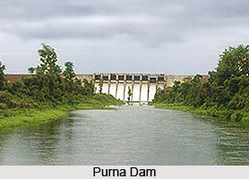
Purna Dam is an earth fill dam on Purna River near Amaravati in the state of Maharashtra in India. The height of the dam above lowest foundation is 38 m while the length is 3,120 m. The volume content is 1,277 km3 and gross storage capacity is 41,759.00 km3.
The main objective of creating this dam is to supply sufficient water for irrigation, Hydroelectricity and water supply to its nearby villages.
The Purna Area Water Partnership was established in 1995 and has since carried out extensive work in water resources development and management in the Purna River Basin. The Purna Area Water Partnership has opened up new livelihood opportunities by installing bore wells to improve the quality of water, introduced the concept of roof top harvesting of rain water and encouraged a shift in cropping patterns.


