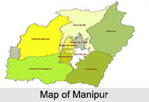
 Manipur is a North East Indian state and it is the home of many North East Indian tribes like Kuki Tribe, Naga Tribe, and Pangal Tribe. Manipur was once the Princely State and here the culture is depicted in their dance formations, sports and religion. Earlier different people called Manipur by different names. Some called the state as Monglei, others called it as Mekhlee and still others called it by the name Cassay. The name "Mekhele" as used for Manipur is mentioned in the Mahabharata and Skanda Purana. This is found in the treaty of king Gourayam and the British East India Company.
History of Manipur
The history of Manipur can be traced back to the founding of the capital city, Imphal in the first century AD. The tribal people who inhabited the hilly areas are known as the Nagas. The people who inhabited the valleys are called Meiteis. The recorded history of Manipur dates back to 900 AD. Manipur witnessed invasions from Myanmar (Burma). Later in 1826, the Treaty of Yandavo by Raja Jai Singh brought Manipur into India. At the end of the First Indo-Burmese War there was a difference of opinion regarding the succession to the throne. The dispute was settled with the intervention of the British. During the World War II, Imphal was occupied by Indian National Army and the Japanese forces. On 21st January 1972 (after the Indian Independence) Manipur became an Indian state.
Geography of Manipur
Manipur stretches across the border of Myanmar and is centered on a vast lowland area. Manipur is watered by the lake system, south of its capital Imphal. Almost 70 percent of the land is under forest area. The land surface of Manipur is 22,347 sq km. About 90 percent of the land is hilly. Nagaland in the North, Mizoram in the South, Assam in the West and Burma in the East surround Manipur.
Geography of Manipur
Manipur has also an enjoyable climate almost throughout the year and free from the severity of both summer and winter. The major river of the land is known as Imphal after which, the capital city is named. The other rivers are the Iril River, Thoubal River, Irnag River, Nambul River etc. The important and the biggest fresh water lake is the Loktak Lake. Keibul Lamijao is the only floated national park located in Manipur.
Demography of Manipur
The total population of Manipur is 2,721,756 as per the 2011 census. The male population is 1,369,764 and the female populace is 1,351,992. The male literacy rate is 86.49 percent and the female literacy rate is 73.17 according to 2100 census. The three major ethnic tribal groups of Manipur are the Meiteis Tribe, Meitei Pangals Tribe, the Nagas Tribe and the Kuki-Chins Tribe. The Meiteis inhabit in the valleys. The Meitei Pangals form a minority community. The Nagas and the Kuki Chins inhabit in the hills. People speak Tibeto- Burman.
Culture of Manipur
 Manipur is a land of festivals. The different festivals celebrated by the people are Lai Haroba, Ratha Yatra, Ramzan, Eid-ul- Fitar, Kut, Gang-Ngai, Chumpha, Christmas, Cheiraoba, Heikru Hidongba, Ningol Chakoub and Lui Ngai Ni. Here the culture also includes handloom industry, weaving industry and cane and bamboo crafts. Basketry is a popular occupation of the people as cane and bamboo are available in plenty. Pottery culture is very ancient in Manipur.
Education in Manipur
The education of Manipur has four different entities namely: Department of Education that includes university and higher education, State Council of Educational Research and Training and the department of Adult Education. The University of Manipur came into existence on June 5, 1980. It is set up under the Manipur University Act, 1980 i.e. (Manipur Act No VIII of 1980). Manipur has two universities, which imparts quality education to students.
Administration in Manipur
Manipur is administratively divided into sixteen districts. Manipur is governed by the Chief Minister and the Governor. Tengnoura Autonomous District Council, Sadar Hills Autonomous District Council, Manipur South Autonomous District Council, Manipur North Autonomous District Council, Manipur East Autonomous District Council and Manipur West Autonomous District Council are the administrative councils here.
Economy of Manipur
Manipur has several small-scale industrial units. A joint sector plant has been established for the manufacture of drugs and pharmaceuticals. Steel fabrication articles, electronic goods and plastic goods are being produced in the state. A cement plant has also been established in Manipur. Among other industries are spinning mill, ghee manufacturing unit and factories of similar kind. Training facilities has been provided to enable men and woman to acquire technological capability and provide industries with trained manpower. The centers for electronic design, technology, plastic, engineering industry have been set up at Imphal.
Tourism in Manipur
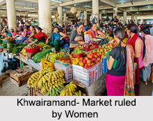
Manipur has many tourism destinations which mainly covers the hill stations, eco tourism areas and the bio-sphere reserves. Some of the popular destinations in Manipur are Shree Govindajee Temple, Kaina, Khwairamand Bazaar, Manipur Zoological Garden, Loktak Lake and Sendra Island. Other tourist attractions in Manipur are Langthabal Moirang, Moreh, Phubala, Singda, Khongjom, Sahid Mandir, Khonghampat Orchidarium, Keibul Lamjao National Park, Sekta Archeological Living Museum, and the Manipur State Museum.


