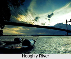
 Hooghly River or the Bhagirathi-Hooghly is an approximately 260 kilometers long distributary of the Ganges River in West Bengal. The river divides from the Ganges as a canal in Murshidabad district at the Farakka Barrage. The town of Hugli-Chinsura was formerly known as Hooghly. This town is located on the banks of the river, in the Hooghly District. The origins of the name of Hooghly River or Hugli River are not known, whether the city or the river derived the name first.
History of the Hooghly River
In the upper course of the river, it is generally known as the Bhagirathi, until it reaches Hooghly. The literal meaning of the word Bhagirathi is `caused by Bhagiratha`, a legendary Sagar dynasty prince who was involved in bringing the river Ganga from the heavens on to the earth, in order to release his 60,000 grand-uncles from a curse of the saint Kapila.
The river was a vital transportation channel in the early Bengal history and later with the colonial trading ports. The river`s flow is one of the reasons chosen by the British to inhabit there at Calcutta. The Dutch/French colony at Chandannagar on the Hooghly was once the competitor of British Calcutta, but was diminished by Calcutta in the colonial wars of the 18th century. The river banks have experienced several battles and combats in the beginning of the colonial era, including the Battle of Plassey, as well as previous wars against Maratha invaders. On eastern bank, there lie many historic and wealthy towns like Jangipur, Murshidabad and Ziaganj. In 1974 the Farakka Barrage began diverting water into the Hooghly during the dry season so as to check the silting difficulties at Kolkata`s port. Like the rest of the Ganges, the Bhagirathi-Hooghly is known to be sacred to Hindus, and its water is believed to be holy.
 Course of Hooghly River
The Farakka Barrage is a dam that transfers water from the Ganges into a canal near the town of Tildanga in Murshidabad district. The canal supplies the Hooghly with water even in the dry season. It runs parallel to the Ganges, past Dhulian, until just above Jahangirpur where the canal ends and the river takes another course. Just south of Jahangirpur, Hoogly River leaves the Ganges area and flows south past Jiaganj Azimganj, Murshidabad, and Baharampur.
South of Baharampur and north of Palashi had the river as its border between Bardhaman district and Nadia district. The river then flows southwards along the places like Katwa, Nabadwip and Kalna. At Kalna it initially formed the boundary between Nadia district and Hooghly district, and then further south between Hooghly district and North 24 Parganas district. It flows past Halisahar, Rishra, Chunchura and Kamarhati. The river turns to the southwest and enters the twin cities of Kolkata (Calcutta) and Howrah. At Nurpur it enters an old channel of the Ganges, turns south, and empties into the Bay of Bengal. Two of its well-known tributaries are Damodar and Rupnarayan.
Religious Significance of Hooghly River
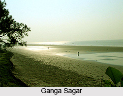
The nexus, formed by the Hooghly River (Ganga) and the Bay of Bengal, is called Ganga Sagar. This is a holy place for Hindus. A dip in the ocean, where the river empties into the sea is thought to be of great devout significance particularly on the Makara Sankranti day when the sun makes an evolution to Capricorn from Sagittarius and this place becomes home to vast fairs, attracting visitors and hermits from all over the state.
 Importance of Hooghly River
Bhagirathi-Hooghly river system is an essential lifeline for the people of West Bengal. Through this river, East India Company sailed in to Bengal and established their trade settlement in Calcutta, which later grew up to be one of the greatest cities of the world and capital of the one-time British India. People from other countries like French, Portuguese, Dutch and others had their trade settlement by the banks of this river.
The river provides perpetual supply of water to the plains of West Bengal for irrigation, human and industry consumption. The river is navigable and the major transport system in the region with a huge traffic flow. Port of Kolkata on this river is the third biggest port of India. The fish from the river are essential to the local economy. The modern container port of Haldia, on the meeting point of lower Hooghly and Haldi River, now carries much of the region`s naval trade.
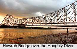
Hooghly river valley was the most important industrial locality of former state of Bengal. Due to the declining jute industry, the main industry of this region, it lost its glory. But still it is one of the biggest industrial areas of India. Except Kolkata and Howrah, it has several small cities that form the Greater Kolkata Agglomeration. Several bridges run over the Hooghly River namely Howrah Bridge (Rabindra Setu), Vidyasagar Setu, Jubilee Bridge, Vivekananda Setu, Nivedita Setu (second Vivekananda Bridge) and Iswar Gupta Setu.


