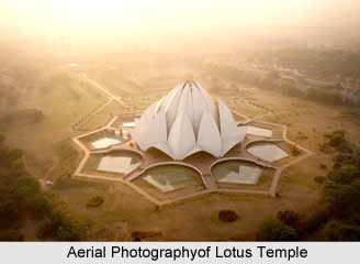
 The first recorded aerial photography in India was flown in 1927 on a scale of 4" mile. Since then, over the years, almost the entire country has been aerially photographed on various scales. Of late, expansions in the disciplines of Photogrammetry and Remote Sensing and especially of Photo-interpretation in the country, have given impetus to the requirements for aerial photography, and this has consequently led to the requirement for quality control, necessitating the use of special material and processes. Sadly though, still today, Indian aerial photography is restricted to few government authorised agencies, due to security concerns. A minimum flying altitude of approximately 9 km (27,000 ft) is generally maintained. Such kind is used for numerous substantial purposes, like monitoring analogue data, forestry and agriculture, environmental monitoring and pollution investigations, physical planning and administration, geological and hydrological surveys. Aerial photography is also necessary during the times of accident surviving victims, damage assessment appraisals, construction progress reports, property boundary records and clarification of zoning issues. Like a silver lining in the dark cloud, however, the Indian government has plans to lift the ban from aerial photography, and let in more interest in the field.
This partial lifting of the ban had perhaps attracted several private video-filming companies to make the most use of it. That might be the reason that one gets to see breathtaking aerial shots in Indian films of various genres. Besides these, the main purposes of governmental and private agencies is basically served by the National Remote Sensing Agency of India, an authorised agency to carry out aerial photography for commercial users. However, the use of photogrammetric techniques was confined to a smaller circle, due to the highly restricted nature of aerial photography. The original practice was set by Survey of India, and other state Remote Sensing Agencies. Today, aerial photography of India can be had by any government or private companies after receiving the clearance from the ministry of defence. Some of the other notable agencies are - Remote Sensing and Geographic Information System (GIS), Hyderabad (main campus), Indian Institute of remote Sensing (IIRS), Dehradun.