Home > Travel > Hill Stations in India > Panhala
Panhala
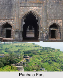
Panhala is a hill station in Kolhapur District of Maharashtra. This hilly destination allures the tourists for the presence of Panhala Fort.

Share this Article:

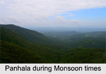
Panhala, Kolhapur District, MaharashtraPanhala is a popular hill station in the West Indian state of Maharashtra. It is now a weekend destination from Mumbai and Pune. Panhala is located in Kolhapur District of Maharashtra.

History of Panhala
History of Panhala is closely associated with the rise of Marathas and Shivaji. Panhala Fort is an only fort where Shivaji spend more than 500 days. Panhala Fort was the centre of military activities during Shivaji rule. This fort played a most important role to resist the British East India Company. In 1827 it became a part of the British Empire.

Panhala Fort was built between 1178 and 1209 with best architectural designs. It first served as the headquarters of the Parmaras and consequently passed into the power of the Yadavas. By the beginning of the 16th century, Panhala was assimilated within the Adil Shahi Dynasty. Adil Shahi Dynasty was responsible for fortifying and reconstructing the battlements and entryways.

Panhala Fort was raided by Shivaji in 1659 AD, but it was not until 1673 that he was successful in invading it everlastingly. After Sambhaji`s death in 1689, it was seized by Mughal Emperor Aurangzeb. However, Panhala Fort was re-captured 1692 by Kashi Ranganath Sarpotdar under the supervision of Parshuram Pant Pratinidhi.

In 1701 AD, Panhala was ultimately surrendered to Aurangzeb and it was in this spot that the Aurangzeb welcomed the British ambassador, Sir William Norris. With a subsequent series of capturing and re-capturing, Panhala fort was finally taken over by the British East India Company in 1844. It was in Panhala that one of the supreme sacrifices in history of Maratha Empire was accomplished by Bajiprabhu Deshpande, who at Ghodkind held back the army of Sidi Jauhar, Adil Shah`s general, so that Shivaji could flee to Vishalgad Fort. It is known as the capture of Panhala.

Geography of Panhala
Panhala is located with a latitudinal and longitudinal limits 16 degree 49 minutes 12 seconds north to 74 degree 7 minutes 12 seconds east. The average elevation of this hill station is about 754 meters.
Panhala, Kolhapur District, MaharashtraDemography of Panhala
According to the Population Census in the year 2011, Panhala had a population of 3450. The males constitute 57 percent and the females constitute 43 percent.

Tourism in Panhala
Panhala is famous only for Panhala Fort. Panhala also has some monuments which were built during the time of Mughal regime. There are many places to see around Panhala.

Visiting Information
Panhala is connected by Kolhapur through roadways, airways and railways. The nearest railhead is located in Kolhapur, at a distance of 18 km, on the South Central Railway. The Mumbai-Panhala National Highway stretch is measures 428 km in total. It can be accessed via Kolhapur and the Kolhapur-Panhala stretch is just 18 km. A straight drive from Mumbai can take one to Panhala in 8 hours.
Share this Article:

Related Articles

More Articles in Hill Stations in India


Shillong
Shillong, the meeting point of tradition and cosmopolitanism, is known as the Scotland of the East.
Tourism in East Khasi Hills District
Tourism in East Khasi Hills District offers a pleasurable experience to the travellers. Magnificent lakes, waterfalls, parks and caves are some of the tourist attractions offered by East Khasi Hills District.
Jaintia Hills District
Jaintia Hills District is an administrative district of Meghalaya and its headquarters are located at Jowai. Economy of Jaintia Hills District is mainly agrarian in character as most of the people are engaged in agriculture.
Ananthagiri Hills
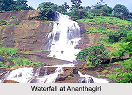
Ananthagiri Hills is an important tourist destination in Telangana. It serves as the pilgrimage tourism site and the leisure tourism site in this state.
Mahendragiri Hill
Mahendragiri is a place of great scenic beauty. The place is surrounded on three sides by hills and thick growth of wild trees.
Tourism in West Garo Hills District
Tourism in West Garo Hills District comprises exploring several beautiful peaks as well as sites of historical importance. Wangala Dance festival of the Garo tribe is another major attraction for the travellers.
Agumbe Hill Station
Agumbe Hill Station in Karnataka is a well-known tourist spot for its sunsets, waterfalls research unit on king cobras.
Hilly and Forest areas
There are four hilly and forest areas in the Indian subcontinent, which are, still the safe haven of the Indian tribes.
Structure on a Hill
Vastu Shastra offers invaluable tips on the construction of a Structure on a Hill.
Yercaud Hill station
Yercaud is a fascinating hill station of Tamil Nadu, situated about 8 kms from Salem.
Wilson Hills
Wilson Hills offers a mesmerizing view of the vast Arabian Sea from a high altitude. The place is immensely enjoyed by the mountaineers and nature lovers.
East Garo Hills District
East Garo Hills District is one of the seven administrative districts of Meghalaya. Williamnagar is the district headquarters. East Garo Hills District is well known in north-east India for its handicrafts and textiles.
Garo Hills
Garo are part of the Garo-Khasi range in Meghalaya. People who reside in the Garo Hills are known as the Garos. The range is part of the Meghalaya subtropical forests eco-region.
Tourism in East Garo Hills District
Tourism in East Garo Hills District includes visits to several historical sites as well as those places that have some association with the culture of the local people. The natural beauty of the region adds charm to the tourism experience.
Khasi Hills
Khasi Hills belong to the Garo-Khasi range located in Himalayas. Khasi Hills are known for housing Sohra, popularly known as Cherrapunjee.
East Khasi Hills District
East Khasi Hills District, an administrative district of Meghalaya, was formed after the bifurcation of Khasi Hills District. Shillong is the district headquarters of East Khasi Hills District.
West Khasi Hills District
West Khasi Hills District is the largest district of Meghalaya with its administrative headquarters located at Nongstoin. West Khasi Hills District was formerly a part of Khasi Hills District and it came into existence in the year 1976.
South Garo Hills District
South Garo Hills District is an administrative district of Meghalaya with its headquarters located at Baghmara. South Garo Hills District is mainly inhabited by Garo Tribes.
Langudi Hill
Langudi Hill, Odisha is a significant Buddhist archaeological site containing ruins of Pushpagiri University, rock-cut caves, Buddhist stupas and numerous other Buddhist relics.
Tendong Hill
Tendong Hill in South Sikkim is located at an altitude of 8530 ft. The hill is deeply revered by the local villagers.
Maenam Hill
Maenam Hill located near to Ravangla town in Sikkim is a famous tourist spot. One can enjoy the breathtaking view of the Kanchenjunga Peak and waterfalls.
Kolli Hills
Kolli Hills is a small mountain range located in Tamil Nadu. It is a part of the Eastern Ghats and serves as a great tourist spot.