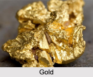
 Gold is a precious metal but in India at present the reserves of gold ore are low. Gold mining in India has a long history and official records have confirmed that old gold mine sites are found which are of two hundred years old. Gold occurs in nature as native gold. It may be found as a constituent of solid rock (a lode deposit), as flakes, grains or nuggets of native gold in sands and gravels (a placer deposit) eroded from the original merit-rock. Gold is one of the least reactive chemical elements, solid under standard conditions.
Tracing of Gold Mines
India"s domestic gold production was at 3.05 tonnes during the financial year 2006. The low production of gold have adversely affected the economy of the country and the government has asked domestic gold miners to actively survey joint venture with foreign companies to speed up exploration of the yellow metal within the country. In India, identification of gold bearing zones is done by gathering rock chip specimens from favourable places for gold mineralisation while planning the geological chart of the region. In case the rocks are not exposed stream sediment sampling method is implemented to spot the gold anomalous areas.
Gold Mines in India
India is the largest importer and consumer of Gold but Gold mining remains at a low level. Following are the names and locations of the Gold Mines in India:
•Karnataka: Kolar Gold field has been functioning since from1871 when mining first started in Ooregum mines, Hutti, Topuldedi and wondalli. The Hutti gold mines, which is owned by the government of Karnataka expects its gold production to touch 3.5 tonnes in 3 to 5 years from now, from the current 2.8 tones. It is the only company in India which produces gold by mining and processing the gold ore.
•Andhra Pradesh: The Ramagiri Gold field mine is situated in Anantpur district of Andhra Pradesh.
Present gold-producing centres of India have observed very old and modern mining activities. Largest resources of gold ore (primary) are located in Bihar followed by Karanataka, Rajasthan, West Bangal, Andhra Pradesh, Madhya Pradesh, etc. Karnataka remained on the top followed by Rajasthan, West Bengal, Bihar and Andhra Pradesh.


