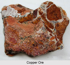
 Copper in India is chiefly used for the production of electrical machinery. As an industrial metal, copper stands second only to steel. It is measured as the best conductor of electricity. Copper is also used in producing brass and bronze, castings and pipes. Further, for the refining of copper, cheap and abundant electricity is required. India manufactures only a little amount of copper and it imports a huge quantity of this mineral resource annually to meet domestic needs. At present, most of the copper ore is mined in the districts of Singhbhum (Jharkhand), Baiaghat (Madhya Pradesh) and Jhunjhunu District and Alwar in Rajasthan. The small producers of copper include Khammam District of Andhra Pradesh, Dhitradurga and Hassan District of Karnataka and also in some parts of Sikkim.
The smelter at Ghatsila in Singhbhum district is very old. It receives copper ore concentrates from Mosabani. Interestingly, up to the year 1971, the smelter at Ghatsila was the only producer of copper in the country. It also produced huge tonnes of copper annually. On the other hand, the smelter situated at Khetri in Jhunjhunu district of Andhra Pradesh also has a huge capacity. In the year 1970, this smelter started producing copper on an experimental basis. The smelter was commissioned for the production of electrolytic copper on a real large scale in the year 1974. This smelter gets copper ore from the copper ore mines at Khetri, Chandmari, Dariba and Kolihan. All these places are located within close proximity from Khetri.
With the increase in the copper smelting capacity of India, production of this mineral resource started an upward trend long time back after 1971. Further, production rose further since then. India is quite able to meet nearly more than half of the annual domestic requirements of copper. In India, several copper projects are being developed in order to augment the production of copper.
This article is a stub. You can enrich by adding more information to it. Send your Write Up to content@indianetzone.com


