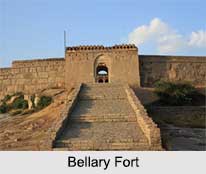
 Bellary Fort is one of those historical sites that spin a history of over 3000 years. Hanumappa Nayaka constructed it during Vijayanagar Empire. It was built on top of a hill called the "Ballari Gudda" or the Fort Hill. One of the main reasons for its attraction is the fort being built on a monolithic rock.
Location of Bellary Fort
Bellary Fort is situated at the hilltop of the Ballari Gudda. It is situated in the historic city of Bellary, in the Bellary district, in Karnataka state, India.
History of Bellary Fort
In 1769, Hyder Ali captured the fort and revamped it with the help of a French engineer. He renovated the higher fort also. After the fort was finished, Haider Ali found that the fort was built at a lower height, concerning an opposite hill called the `Kumbara Gudda`. As a consequence, Haider Ali was annoyed with this drift and it is believed that he ordered the hanging of the French engineer at the east gate of the fort. The French engineer`s grave, dated 1769, is situated at the east gate of the fort and has been conserved due to the efforts of local Muslims who also argue that the tomb was belonged to a Muslim saint. After Hyder Ali it was Tipu Sultan who ruled Bellary Fort.
A legendary myth states that the Bellary city is named after Lord Indra who destroyed the demon "Balla" who lived in the region. It is believed that Lord Rama, while searching for Sita met Sugreeva and Hanuman at a place near Hampi, 30 kilometres, from Bellary. Bellary town and the district have an ancient history dating from 300 BC till 1365 AD, the establishment of the Vijayanagar Empire. It was ruled by Mauryas, Satavahanas, Kadambas, Chalukyas of Kalyana, Kalachuryas, Sevunas and Hoysalas. The region consequently came under the control of the Bijapur Sultans. During one of his campaigns Shivaji was passing through the fort in 1678. He later restored the fort on condition of a tribute payment. The fort came under the rule of Basalat Jung of Adoni in 1761.
Architecture of Bellary Fort
Bellary Fort can be divided into two parts-the "Upper fort" and the "Lower fort". The Upper fort was originally constructed during the Vijayanagara times. The polygonal Bellary Fort is with a single entrance. This part of the fort consists of a citadel (1976 ft.), cisterns, temple, several pools and cells. A seven-colour water body has currently evaporated. The tunnel here is also said to link the cities of Mysore and Sriragapatna. A single rock-strewn way will lead the travellers to the top of Bellary Fort.
Hyder Ali constructed the lower part of the fort. This part lies in the eastern base of the rock. Measuring half a mile it once had armoury and garrisons. There are two entrances to access the Lower fort facing the eastern and the western directions. Outside the eastern gate the tourists will come across a temple of Lord Hanuman. Bellary Fort is a major tourist attraction in the Bellary district. Recently the fort has been beautified with light and it is spectacular to witness the huge structure in the evening. The green expanse and the hill top sceneries are the other attractions of the Bellary fort. The extraordinary fort is enlightened in Sundays and holidays of state and national significance.
Visiting Information of Bellary Fort
The fort is well connected by road, rail and air transport facilities connecting all parts of the country. Guntakal is an important junction near Bellary from where trains to Delhi, Chennai, Mumbai and to most of the places in India are available. Bellary Airport is situated at the far end of the Cantonment area with normal flights operating from Bengaluru and Goa. National Highways and State Highway road networks provide an excellent net work of road communications.


