 Himalayan Mountain Range has received its name from a Sanskrit word, Himalaya. Hima stands for "snow", whereas alaya stands for "abode". Thus, Himalaya means "the abode of snow". Kalidasa has described the Himalayas as the "King of Mountains". The Himalayan Mountain Range stretches across the countries of Bhutan, China, India, Nepal, Pakistan and Afghanistan. From the Pamirs in Pakistan to the easternmost bend of the Brahmaputra in Assam, the Himalayas cover a length of about 2,400km. The Himalayan Range has about 100 mountain peaks exceeding 7,200 meters, including the world"s highest mountain peak namely, Mount Everest. The mountain range encompasses many glaciers like the famous Siachen Glacier. It is the longest glacier in the Karakoram Mountain Range. The higher regions of the Himalayan Mountain Range are snowbound throughout the year in spite of their proximity to the tropics. An estimated 750 million people live in the watershed area of the Himalayan Rivers, which also includes Bangladesh.
Geology of Himalayan Mountains Range
The Himalayan Mountain Range is known to be one of the youngest mountain ranges in the world. In the Miocene Period, there was a sea known as the Tethys Sea, where the Himalayan range is located now. The process of formation of these mountain ranges began in the Oligocene period and continued up to the Post-Pliocene period.
Divisions of Himalayan Mountain Range
There are five divisions of Himalayan Mountain Range. They are the Greater or Central Himalayas with the highest and oldest peaks in the world (many of which are in Nepal), the Shiwaliks or Outer Himalayas located in between the Great Plains and Lesser Himalayas, the Lesser or Middle Himalayas (including ranges like the Pir Panjal Mountain Range and the Dhauladhar Mountain Range), the Trans-Himalayas and the Purvanchal Hills or Eastern Hills. These divisions are described below.
•Greater Himalayas
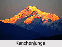
Greater Himalayas comprise a zone of high snow-capped peaks, which are 128 to 144 km above the plains. Two important peaks of Greater Himalayas located in India are Nanda Devi (7816 meters) and Kanchenjunga (8586 meters). Other significant peaks are Mount Everest (8848 meters), Dhaulagiri (8167 meters) and Mount Godwin Austin (8611 meters).
•Outer Himalayas
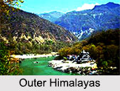
Outer Himalayas extend continuously along the foot of the Himalayas for about 2,400 km, from the Potwar Plateau in the west to the Brahmaputra Valley in the east.

•Lesser Himalayas
Lesser Himalayas is 64 to 80 km wide and has an average altitude of about 3000 meters. Between 1500 and 1600 meters of height, this zone is covered with evergreen and oak forests. Between 1600 and 2124 meters, the zone is covered with coniferous forests of chir, deodar, pine, oaks and magnolias. Above 2436 meters, the zone is covered with birch, spruce, silver fir, etc.
•Trans-Himalayas
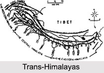
Trans-Himalayan zone extends for a distance of about 1,000 km in east-west direction. It has an average width of about 40 km at the extremities and about 225 km in the central portion. This zone has valleys of the rivers rising behind the Great Himalayas.
•Purvanchal Hills
Purvanchal Hills extend along the India-Myanmar border from Arunachal Pradesh in the north to Mizoram in the south. These hills are convex to the west.
Geographical Extensions of Himalayan Mountain Range
Himalayan Mountain Range can be divided into three major regions namely, the Western Himalayan region, the Central Himalayan region and the Eastern Himalayan region, from west to east. In the western region, the valleys are under irrigation and cultivated wherever possible. Along these valleys and over the passes such as the Gomal, the Bolan and the Khyber run the routes to Central Asia and China on one hand and to Persia and the West on the other hand. The central region extends from Bhutan to Chitral. The eastern region consists of mountains, which lie to the east of the Brahmaputra. Along the summit of these mountains run the frontiers of India and Burma. They are divided by a series of river valleys and are covered for most of the part with thick forests. The routes through these mountains are difficult.
Significance of Himalayan Mountain Range
Himalayan Mountain Range acts as a natural barrier in the northern part of the Indian peninsula, due to its large size and expanse. Himalayan Mountains have hindered trade routes and prevented military expeditions across its expanse. These mountains have not only protected the country from invasion from the north, but have also sheltered the vast plains of northern India from the ice cold winds from Tibet. They play a vital role in determining the climate of northern India. Himalayan Mountain Range is the source for several large perennial rivers, most of which combine into large river systems. For example, it is the source of three of the world`s major river systems namely, the Indus River system, the Ganga- Brahmaputra river system and the Yangtze River system. Himalayan Mountains are studded with a variety of vegetations ranging from dense tropical forests in the lower foothills to alpine and sub-alpine vegetation in the higher reaches and from the rain forests of the east to the desert vegetation in the barren Trans-Himalayas.
Himalayan Mountains have been restricting movement of people for thousands of years. This range of mountains has prevented intermingling of Indians with Chinese and Mongolians. This can be comprehended from differences in languages and customs of India, China and Mongolia.
Tourism in Himalayan Mountain Range
Himalayan Mountain Range is famous for adventure tourism among climbers and trekkers throughout the world. It offers some of the finest trekking and mountaineering challenges. Since most of India`s northern boundary lies in the Himalayan Mountains, many areas close to the international borders have been declared off-limits for tourists, especially for foreigners. Territorial disputes and trouble caused by militants are other reasons why access to some parts of Himalayan Mountain Range is restricted. However, many high mountain ranges and deep valleys are still accessible to the tourists. Himalayan Mountain Range is also associated with pilgrimage tourism. From ancient times, Himalayan Mountains have attracted pilgrims from all over India.


