 Indian Mountains form an important part of the topography of India affecting climate, lives, settlement and economy. They have played an important role in building the ecosystem of the country. They have long added to the pristine beauty of the country, epitomizing majesty with their tall and regal presence and invite tourists, bewitching and mesmerizing them. They also have the capacity to evoke spirituality and sanctity. For centuries, these mountains have protected the nation`s borders from invading armies. Discussed below are some of these Mountains of India.
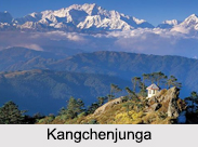
Kanchenjunga
Kanchenjunga is a mountain located in Sikkim in India and also in Nepal. It has the distinction of being the third highest mountain in the world. Its parent mountain range is the Himalayas. At its highest point, Kanchenjunga reaches a height of about 8,586 m (28,169 ft).
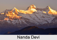
Nanda Devi
Nanda Devi is located in Chamoli District in the Indian state of Uttarakhand. It has the distinction of being the second highest mountain in India, the highest mountain located entirely within the country and the 23rd highest peak in the world. Its parent range is Garhwal Himalayas. At its highest point, Nanda Devi reaches a height of about 7,816 m (25,643 ft). 
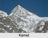
Kamet
Kamet is situated in Chamoli District in Uttarakhand. It has the distinction of being the second highest mountain in the Garhwal region of Uttarakhand and the third highest mountain in India. The mountain seems to be a giant pyramid topped by a flat summit area with two peaks. At its highest point, Kamet reaches a height of about 7,756 m (25,446 ft).
Saltoro Kangri
Saltoro Kangri is located on the Actual Ground Position Line between the Indian controlled territory in the Siachen region and the Pakistani controlled territory west of the Saltoro Range. The parent range of Saltoro Kangri is Saltoro Mountains, which is a sub-range of the Karakoram Range. At its highest point, Saltoro Kangri reaches a height of about 7,742 m (25,400 ft).
Saser Kangri
Saser Kangri is located within the Indian state of Jammu and Kashmir. Its peak has the distinction of being the highest peak in Saser Muztagh, which is the easternmost sub-range of the Karakoram Range. Saser Muztagh is called the parent range of Saser Kangri. At its highest point, Saser Kangri reaches a height of about 7,672 m (25,171 ft). Saser Kangri II East reaches a height of about 7,518 m (24,665 ft), whereas Saser Kangri II West has a height of about 7,500 m (24,600 ft). Saser Kangri III reaches a height of about 7,495 m (24,590 ft).
Mamostong Kangri
 Mamostong Kangri is located about 30 km east-southeast of the snout of the Siachen Glacier. Its peak has the distinction of being the highest peak in the remote Rimo Muztagh, which is a sub-range of the Karakoram Range in Jammu and Kashmir. At its highest point, Mamostong Kangri reaches a height of about 7,516 m (24,659 ft).
Teram Kangri
Teram Kangri group is a mountain massif in the remote Siachen Muztagh, which is a sub-range of the Karakoram Range. Siachen Muztagh is called the parent range of Teram Kangri. It is important to note that Teram Kangri is controlled by India and China and claimed by Pakistan.
Jongsong Peak
Jongsong Peak is a mountain in the Janak section of the Himalayas, situated at the China-India-Nepal tri-point. Himalayas form the parent range of Jongsong Peak. At its highest point, Jongsong Peak reaches a height of about 7,462 m (24,482 ft).?
Other Indian Mountains
The names of some of the other Indian Mountains are Ghent Kangri, Apsarasas Kangri, Kirat Chuli, Kangto and Pauhunri.


