 Amongst several districts that have flourished in the soils of Indian subcontinent the name of Nashik or Nasik district has drawn the attention of people from all over the world. Nashik district falls under the jurisdiction of Nashik District, Maharashtra state of the country. In the year1869 Nashik district was formed.
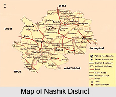
The geographical location of Nashik District is important. It covers a total area of 15,530 sq kms. Other Indian districts too form its boundaries. Instances also can be cited. On the northern part of Nashik District, Dhule district is situated; on the southeastern part lies Aurangabad district. On the south and southwestern part, districts like Ahmadnagar and Thane are situated. Valsad and Navsari districts lie on the west, and the Dangs district lie on the northwest part of Nashik District.
On the western part of Nashik District one also can find Western Ghats , also known as Sahyadri range . It extends from north to south.
Deccan Plateau of India encompasses quite a large area in the eastern part of Nashik District. It is open, lush and suitable for cultivation. The Godavari River has its origination in this Nashik District, which finally drains east towards the Bay of Bengal. To identify the true characteristics of Nashik District it becomes essential for a person to know the exact measurement of its population. As per a significant report of the year 2001, the total population of Nashik District has been enumerated to be 4,993,796. Out of it, urbanites form 38.80 %.
For better administration and controlling, the whole of the Nashik District has been divided into 15 talukas.
Again these talukas have been clubbed together under 4 sub-divisions. These are as follows:
Malegaon sub-division: Malegaon, Chandwad, Nandgaon
Nashik sub-division: Igatpuri, Dindori, Nashik, Nashik-College Road, Peint, Trimbakeshwar,
Kalwan sub-division: Kalwan, Deola, Satana, Surgana
Niphad sub-division: Sinnar, Yeola , Niphad.
 After a long drawn research eminent historians have brought forth important story that is related to the history of this Nashik District. At the time of eighteenth century this Nashik District was integrated to Maratha Confederacy, which was under the direct control of Peshwas of Maratha dynasty. Nashik District of Maharashtra is thronged with ancient hill forts, where traces of occurrence of Anglo Maratha wars are still being found. Afterwards in the year 1818 , this Nashik District is part of the British empire and Peshwas were overthrown. In the beginning it was at first divided into Kandesh and Ahmadnagar districts of Bombay Presidency.
For maintaining their living the residents of Nashik District have taken up various occupations. Agriculture is one of the main occupations. Crops like millet; wheat, pulse, oil-seeds, cotton and sugar cane are grown in abundance. . Also cultivation of vineyards, and gardening are in vogue in Nashik District. In some places people even practice professions like silk and cotton weaving. Flour mills, railway workshops, cantonments also are found in Nashik District.
For facilitating accessibility this Nashik District remains well connected with other place. As early as 1861 the chief `northeast line of the Great Indian Peninsula Railway` was finished. A chord line between Manmad, which is on the northeast line in Nashik district, and also Dhond, on the southeast line of Pune district took shape in the year 1878. .
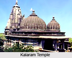
For pious devotees Nashik District provides lot many opportunities. Here , the revered Kumbh mela is feted once in every 12 years. Trimbakeshwar which is one of the twelve `Jyotirlingas` is a primary attraction . Others include Kalaram Temple, Vani or SaptaShrungi, Muktidham, Ozar ,Kalsubai, Someshwar, Mangi Tungi.


