 On May 30, 1987 Goa became an independent state. Goa was included as twenty-fifth state of India. Goa state has two districts namely North Goa headquarter at Panaji and South Goa headquarter at Margao.
Location:
South Goa District covers the entire southern part of Goa state. The boundary of South Goa district can be defined as Arabian sea is to the west of district, North Goa district to the North and Uttar Kannada district of Karnataka in the East and South. South Goa is to be found between the latitudinal parallels of 15 degree 29` 32" N and 14 degree 53` 57" N and longitudinal parallels of 73degree 46` 21" E and 74 degree 20` 11" E. The district is expanded from north to south and from east to west a distance of 86 kms and 40 kms respectively. The total geographical area of the district is known as 1966 sq kms.
Geography:
Goa is a part of Konkan area. Goa has the types of lands namely hills, low and highland areas. Geographically Goa has three natural divisions namely the Low lands, the Plateaus and the Mountain region.
Low Lands: Lowland area can be described as mainly coastal line. It is about 110 km long. Many beaches are along the coast in this area. Many rivers flow east to east in this area. Thus because of the presence of numbers of rivers, this area land is fertile. This area is thickly populated and many people live in this region as well.
Plateau Lands: The plateau region is found between the mountain region in the east and the lowlands in the west. The height of Plateau land ranges from 30 metres to 100 metres. In this region mainly plenty of laterite stone is found. It is used for building the houses. Some of the part of plateau land is called headland of Goa. Lighthouses are built on these highlands. Land in the plateau region is not fertile. Because of this reasons few crops are taken in this region.
Mountain region: Sahyadri Mountains are placed to the east of South Goa.
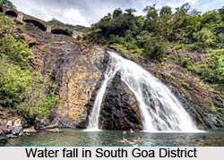
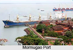
 This part is always covered with dense forest. In this area there are some of the mountains that are very steep. In the South Goa there are some peaks. Those can be named as Chandranath at Paroda, Dudhsagan in Sanguem taluka and Cormolghant in Canacona taluka. Many streams and rivers flow from this region to lowlands. In South Goa the names of Rivers can be mentioned as Zuari, Talpona, Sal and Galgibag. Rivers are also used for transportation. Inland waterways play an important role in transport of mineral ores from the mining sites in Sanguem taluka. Costi, Kirpal, Netravalim, Rivona, Ducorcond and Kuddegal transports to the Mormugao harbour for export South Goa is rich in natural resources like trees, iron and manganese ore. It is exported mainly to Japan, South Korea and some European countries as well.
Access:
Goa is well connected by road, rail, water and airways as well. In Goa there are three main national highways namely NH.4A, NH.17, NH.17A. Panaji, which is the capital city of Goa is well-connected by NH.4A that is extended from Belgaum in Karnataka. The NH.17 starts in Mahad in Maharashtra state and enters in Goa through Patradevi and passes through talukas Pernem, Bardez, Tiswadi, Salcete and Canacona talukas. Third
highway i.e. N.H.17A is from Cortalim to Mormugao harbour. Panaji and Margao which are two important cities of south Goa are well connected by road from Mumbai, Pune, Kolhapur, Miraj cities in Maharashtra and Banglore, Belgaum, Hubali cities in Karnataka.
Goa is also connected by rail route through Konkan Railway and Southern Railway from Delhi. Also, it is well connected by air routes from Bombay and Delhi. Goa has an international airport at Dabolim. The distance from Margao to Dabolim airport is only 29 kms.
Most of the rivers in Goa are used for waterways. Ferry boats were means of crossing the rivers in Goa. Rivers Mandovi and Zuari are being used for carrying ore to Mormugao harbour. Goa is also connected by waterway from Bombay.
Thus it can be seen that the transportation in this district is very developed and in all ways it is connected. That is why Goa is regarded as the best business center in earlier days.
Climate:
The climate of this region is hot as it lies within the tropics. There is no much change in climate throughout the year. Daily temperature range is not very high. Goa gets rains in the months of June, July, August and September. June-September is the monsoon season here. The rainfall is more in the mountain region than the coastal region. Goa gets heavy rain from Southwest monsoon winds. Goa has cool climate during then months October-January. It starts getting warmer from February and it remains like this till May.
Rice is the most important crop in Goa. The main crop is rice here because of the fact that due to warm humid climate rice is mainly grown here and it grown in the coastal region. After rainy season rice, chillies, onions crops are grown here. Cash crops are also grown in Goa. The plantation of Cashew, Coconut, Mangoes, Areca palm, Kokum and Jackfruit is mainly done in Goa.
Fairs and Festivals South Goa District:
 The major population in this region is Hindu. South Goa District has scores of festivals celebrated all around the year. All these festivals do not occur on fixed dates that are written on the English calendar as they are celebrated according to the Hindu calendar.
Despite the long period of Portuguese colonisation, the Hindu festivals have retained their unique Goan character and are celebrated with deep fervency. In Hindu mythology, Goa is called the land of the Gods and with good reasons. There are hundreds of Gods and Goddesses with differing names, tastes, rituals and traditions. Most of these have remained unchanged over the centuries while others have adapted to the changing times and circumstances. This is a common process, which is prevalent in all the areas.
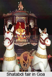
Quite a lot of the Goan festivals are actually Jatras or feasts of the local or family deity. These are celebrated at the temple of the God or Goddess called Devasthan. It is a festive and colorful occasion in the temple complex with thousands of devotees taking part in the celebrations and the palakhi or palanquin procession, which is very colourful and take the total ambience in a higher standerd.
Other festivals like Dussehra, Diwali and Holi are the same as those celebrated around India but always with the characteristic Goan flavour. The Goan Hindu community mainly celebrates Ganesh Chathurti, Gudi Padwa, Diwali, Dussehra, Holi, Rakshabandhan, Ramnavmi and Krishnajanmashtami.
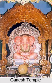
 Ganesh Chaturthi is the `numero uno` festival of South Goa. It is celebrated on and around August or September. It experiences the return of most Goans to their native place of birth or their ancestral houses to join the entire family. Thus they live the best of their time during this period. Most towns and cities in Goa put on a abandoned look as Goans return to their native places in the surroundings.
Diwali, the festival of lights is celebrated all over India. Its roots go back to the time when Lord Ram killed the demon king Ravan. Ram was welcomed in his hometown Ayodhya by a celebration of crackers and lights. In northern India, the festival ends when a statue of Ravan is burnt with an arrow of Ram. This is called as the Dasssera. This is the common style as going on in other parts of the country. But the same occasion is celebrated a day before Diwali in Goa. Not on the last day of Dussehra. This happened with the burning of the images of Narkasur as the demon King Ravan is called locally. All around Goa, huge statues of Narkasur dressed in colourful paper clothes and armed with swords and other armaments are set up in the days preceding Diwali. They are then burnt just before sunrise.
As a whole it can be said that the festivals and fairs in Goa is very colorful which is celebrated by all the citizens living there.


