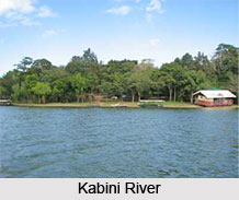
 The Kabini River also known as Kapila and Kabani is the lifeline of Wayanad district of Kerala. Along with Pamba and Bhavani, it is one of three East-flowing rivers of the state. It originates in the Wayanad District of Kerala state from the confluence of the Panamaram River and the Mananthavady River, and flows eastward to join the Kaveri River at Tirumakudalu Narasipura in Karnataka, which empties into the Bay of Bengal. Close to the town of Sargur it forms the huge Kabini Reservoir. The backwaters of the Kabini reservoir are very rich in wildlife especially in summer when the water level recedes to form rich grassy meadows.
There are many tourist spots along the river`s course. The hills surrounding it are full of wildlife - elephants, tigers and lots of birds. The Kabini Lake attracts a lot of animals, especially in the summer, when water scarcity is seen. There are four dams worth a visit, along the river - Kabini Dam, Chikkahole Dam, Banasura Sagar Dam and Karapura Irrigation Dam.
The beauty of Kabini River is best enjoyed in Nanjangud with the famous 16-pillar Mandap and 14 steps river bank where the famous Srikanteshwara Temple, Nanjangud is located. Apart from dams, two wonderful and also luxuriant forest resorts have been constructed at the border of the Kabini River. These are namely Cicada and Kabini river lodge.
Course of Kabini River
The river originates in the Pakramthalam hills at Kuttyadi-Mananthavady road. Makkiyad River and Periyar River join it near Korome and Valad respectively. After flowing through Mananthavady town, Panamaram River joins Kabini near Payyampally. After traversing 2 km from the confluence of Panamaram River, Kabini forms an island called Kuruva Island, spreading over 520 acres with diverse flora and fauna. Within 20 km it reaches the Kabini reservoir bordering Kerala and Karnataka for some distance.
 Between Kabani reservoir and Kuruva Island, Kalindi River joins Kabini. Taraka and Nugu are the two small rivers in Heggadadevana kote taluk that join the Kabini River.
Wildlife beside Kabini River
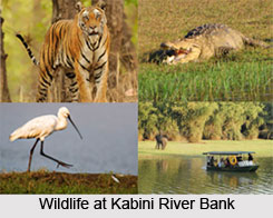
The Kabini Forest Reserve is one of the most popular wildlife destinations of Karnataka, probably because of its accessibility, lush green landscape surrounding a large lake and sightings of herds of elephants, tigers. It is 80 km away from Mysore and 205 km from Bengaluru, and comprises the south-eastern part of Nagarahole National Park. Situated on the banks of the Kabini River, the reserve is spread over 55 acres of forestland, steep valleys, and water bodies. Earlier, the park had a hunting lodge belonging to the Maharaja of Mysore. It was a popular hunting area for the British and the Indian royalty. Now the entire area is a protected wildlife sanctuary. Common Langur, Wild pig, Asian Elephant, Four horned antelope, Munjtak, Bonnet Macaque, leopard, tiger and wild dog are frequently sighted here. The wildlife here is distinct with different variety of species inhabiting the region.
Other attractions near Kabini River
The main activities that one can engage in are the Elephant Safari, Jungle safari and boating on the river. Other than these one can also choose to explore various tourist attractions, some of them are:
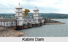
•Kabini Dam: Built across Kabini River in 1974, the dam is located near Bichanahalli village. This dam is 190 ft in height and 2,284 ft long. The catchment area of the dam is 2141.90 sq kms. It caters to the needs of around 22 villages and 14 hamlets.
•Nagarahole National Park: Declared a national park in 1974, the park is said to be the best habitat for Asian elephants. It is surrounded by shallow valleys and gentle slopes on all sides.
Dams at Kabini River
 There are a number of dams built on the river and its tributaries that are used for irrigation and other non-agricultural purposes. The Kabini Dam is built across the Kabini River between Bichanahalli and Bidarahalli villages. It is 17km from Sargur, in Heggadadevana Kote taluk, in Mysore district. The dam is a masonry gravity dam and has a gross storage capacity of 19.52 tmcft. When the water levels recede in the summer, the backwaters of the dam host a variety of wildlife.
The Banasura Sagar Dam, constructed over a tributary of the Kabini River, was established to support the Kakkayam Hydro electric power project and help lower water scarcity for irrigation and drinking purposes. There`s boating and trekking facility near the dam, as well as a children`s park. The Karapura irrigation dam is built over a tributary of the Kabini River.


