 Dharamsala is a beautiful town in the Kangra district of the northern state of India, Himachal Pradesh. Being a popular tourist destination the town has a good communication network.
The town is separated into the upper Dharamsala called Mcleodganj, the middle Kotwali Bazar and lower Kaccheri area that are located at different altitudes. Surrounded by dense pine and deodar forests, tea gardens and beautiful hills, Dharamsala covers an area of 28 sq. kilometres. On 19th January 2017, Chief Minister Virbhadra Singh confirmed Dharamshala as the second capital of Himachal Pradesh which makes it the third state of India with two capitals after Jammu and Kashmir and Maharashtra.
Location of Dharamsala
Dharamsala is situated in the upper folds of the Kangra Valley in the Dauladhar range of the Himalayas at a height of 1457 metres (4780 feet) above mean sea level.
Etymology of Dharamsala
 Dharamshala is a Hindi word which is a compound of "dharma" and "shala". Rendering a particular factual translation into English is difficult. The word dharamshala refers to a protection or rest house for religious pilgrims.
History of Dharamsala
In anticipation of the British Raj, Dharamshala and its close by area was ruled by the Katoch Dynasty of Kangra, a majestic family that ruled the area for two millennia. The native people of the Dharamshala region are the Gaddis, mostly a Hindu group who lived in Dharamshala and was annexed by the British. In 1860, the 66th Gurkha Light Infantry was moved from Kangra, Himachal Pradesh to Dharamshala, which was at first made a supplementary cantonment. The Tibetan settlement of Dharamshala began in 1959, when His Holiness the Dalai Lama had to run away from Tibet. A number of thousand Tibetan expels have now settled in the area and most reside in and around McLeodGanj in Upper Dharamshala, where they have built monasteries, temples and schools.
Geography of Dharamsala
Dharamshala has a regular altitude of 1457 meters, covering an area of almost 8.51 kilometres.
Attractions of Dharamsala
The best time to visit Dharamsala is from May to October as the climate is enjoyable during the summers and drops below freezing point during the winters and the place is covered with thick snow. The Tsuglagkhang Complex at Macleodganj, the official residence of the Dalai Lama, the Namgyal Monastery and the Chinmaya Tapovan are ideal tourist destinations. Other sites of interest are St John`s Church, Maharana Partap Sagar sanctuary, Norbulingka Institute, Nurpur Fort, the Dal Lake, and Dharamkot. This area is well suited for trekking. Visitors coming to Dharamsala can also enjoy fishing in the river Beas between Nadaun and the Pong dam. Dotted with a number of Hindu temples, Dharamsala is a major Hindu pilgrim centre, like the Kalchakra Temple, Chamunda Devi Temple, Masrur (rock temple) and the Brajeshwari Temple.
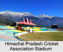
Other attractions of Dharamshala is a starting point to a number of trekking trails that particularly direct trekkers across Dhauladhar into the greater Ravi Valley and Chamba district. Himachal Pradesh Cricket Association Stadium is a cricket stadium of international status, which serves as the home ground to the Himachal Pradesh state cricket team and for the IPL team Kings XI Punjab to a limited amount.
Educational institutes of Dharamsala
The Educational institutes of Dharamsala includes Central University of Himachal Pradesh, Government College of Teacher Education Dharamsala and Himachal Pradesh University
Visiting information of Dharamsala
Buses of all classes carry out every day between Dharamshala and chief cities such as Chandigarh, Delhi, and Shimla through NH 503. Several buses each night connect McLeodGanj with Majnu Ka Tila, the Tibetan defrayal in Delhi. Dharamshala town can be reached by Kangra Gaggal Airport codes, which is about 12 kilometres to the town`s south and about 10 kilometres north of Kangra, Himachal Pradesh town. The next-door station to Dharamshala on this line is Chamunda Marg, half an hour away, where a town named Shaktipitha is located and is well connected by road to other parts of the country.


