 To discuss about the administrative system of the district Alappuzha there are three taluks that are to be mentioned. These are as follows: Cherthala Taluk, Ambalapuzha Taluk and the Kuttanad Taluk. Under each taluk there are different districts. As for example under Cherthala taluk there are 20 districts, under Ambalapuzha Taluk there are 13 villages and under the Kuttanad districts there are 14 districts.
CherthalaTaluk: There are twenty districts under this taluk. The municipality has been started since 1953. The taluk has a large area covering 320.44 Sq.Km and population is 4.78 lakhs. Sex ration in this taluk is 1030. Rural population is at least 2.79 lakhs that means density of rural population is 1465 persons per Sq.Km. Out of the 13 villages 2 are partly included in the municipality. Urban population is almost 32.54% and lowest urban density is 1530. Some of the important places of this taluk are given below:
Aroor:
Aroor is situated on the National Highway 47 between Cherthala and Kochi. Till 1960 there was no bridge. Only rafts had to be used for transporting vehicles although now there are many bridges connecting Aroor to Eda Kochi, one Rail Bridge is also there. One of the three industrial estates of this district is located here. It is also known as the one of the fish landing centres of the district.
Arthungal:
Located in Cherthala south village it is an important pilgrim centre of Christians and is famous for well-known St.Andrews Church, which was popularly known as St.Sebastuian Church. It is situated 8 Km southwest of Cherthala town facing the seacoast. Hindu pilgrims from Sabarimala used to visit Arthungal and take bath in a tank in the Church premises to formally conclude their forfeit. Though now the tank is not there.
Cherthala:
The town is famous for the well-known Devi Katthyayani temple located in the centre of the town. The image of Bhagavathy is said to have been set apart by Vilwamangalath Swamiyar. Being well connected by road and rail Cherthala is a major centre of coir industry. In Cherthala padayani and vela thullal are famous.
Kanichukulangara:
It is situated at 13 Km north of Alappuzha town. Kanichukulangara is famous for the Bhagavathy temple. It is believed that a Brahmin who happened to recognize Devi who had reached the shore sanctified the place of worship. The souls of the Brahmin and the maiden who is said to have fallen in love with Brahmin have been consecrated in small shrines inside the temple.
Kokkothamangalam:
It is situated on the western shore of Vembanad lake. It is the place of one of the two churches in Arch Diocese of Ernakulam. It is said that the apostle St. Thomas, who visited Kerala and established 7 churches there also consecrated a cross here in this district. Later the cross was missing for a long time and it was again recovered from Pallipuram and brought back to Kokkothamangalm where a church was built. The present church was built in 1900.
Pathiramanal
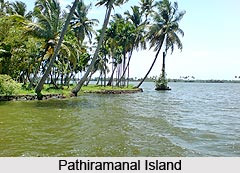
Pathiramanal, popularly known as the mysterious sand of midnight is a small beautiful island of tourist importance. This island is full of coconut trees and luxuriant vegetation and is situated in the centre of Vembanad Lake, 4 Km east of Muhamma.
Thannermukkom
It is situated on the western bank of Vembanad Lake. The Thannermukkom salt-water barrier was constructed as a part of Kuttanad Development Scheme. The Thannermukkom regulator built across Vembanad Lake between Thannermukkom and Vechur is mainly to prevent tidal action and intrusion of salt water. It is actually the largest mud regulator in India.
Thiruvizha
Thiruvizha is situated about 5 Km southwest of Cherthala and is famous for its Shiva temple. The temple attracts large number of devotees on account of the divine prasadam, which is supposed to possess medicinal and curative properties for mental illness.
 Vayalar
It is situated about 2.5 Km north of Cherthala. Vayalar is a politically important place in the history of modern Kerala. The historic struggle at Vayalar, which took place by the communist party against Sir C.P. Ramaswamy Iyer, Diwan of Travancore, resulted in the relinquishment of the rule of Diwan. As a result hundreds of communists fell victim to the tragic police firing in 1946. There is a martyrs` platform or Raktha Sakshi Mandapam erected at this place.
Ambalapuzha Taluk: There are mainly thirteen villages under this Ambalapuzha taluk. Its total area is 67.81 Sq. Km. It is mainly on the second position in population with 4.08 lakhs. The lowest rate of rural population in the district is 1.18 lakhs while most thickly populated area is having density with 1738 persons per sq. km. The total population is 117826 out of which 58099 are males and 59727 are females. Sex ratios of the district are 1038. The lowest percentage of rural area in the district is with 37.92 %, whereas urban population is more in the district with about 2.90 lakhs, which works out to be 47.56% of the total urban population of the district. This district has the second rank in urban density, which is 2612, and in the second position in highest growth rate that is 8.59%.
Some of the important places are as follows:
Alappuzha:
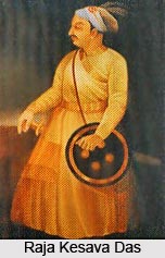
It is situated at 157 Km north of Thiruvananthapuram, which is the capital of Kerala state, and 62 Km south of Kochi on the National Highway-47. Alappuzha, which is the head quarters of both the district and the taluk is an important commercial town. The then diwan of Travancore, Raja Kesava Das founded the town in 1762. He has a view to make the place a commercial centre. Surrounded by the sea and backwaters and the canals intersecting it, Alappuzha is often referred as `the Venice of East`. The banks of these canals are the centres of many industrial and commercial establishments, particularly coir, copra, timber etc. From time behind, Alappuzha was the chief depot for sale of forest and other products. The port was opened in 1962 and canals were constructed to link the port to make commercial contacts with the interior.
In the 19th century, Velu Thampi Dalawa took keen interest in constructing road, and markets, which were later, improved by Rani Parvathi Bai. A lighthouse that is visible from a distance of 26 Km was built in 1862. For the passage of cargo nearly 1000 ft. long pier was built. Though the port has lost its maritime importance due to the nearness of Kochi port. The town still remains to be an important commercial and industrial centre of production and also supplier or coir yarn and coir products. The first modern factory for the manufacture of coir mats and matting was started here in 1859. The first post and telegraph office of the princely state of Travancore was established in Alappuzha when postal communicator was introduced in Travancore in1857.
It is the centre of a large network of inland water transport services. Well-maintained beaches are there. Among the churches The Holy Cross church established in 1400 and the Mount carmel Cathedral in 1809 are the significant one. The only one Jain temple of Travancore area is also located here.
A colourful water carnival, the Nehru Trophy Boat race, which was named after Pandit Jawaharlal Nehru to commemorate his first visit to the district, is conducted on 2nd Saturday of August every year at Punnamada Kayal or Vatta Kayal about half a Km east of town.
Ambalapuzha:
Ambalapuzha was formerly known as capital of Chempakasseri Rajas and is located about 13 Km south of Alappuzha. The place is connected with road, rail and canal. Ambalapuzha is famous for the well-known Sree Krishna Swamy temple. The architecture of the temple conforms to the typical Kerala style. Ambalapuzha `Palpayasam`, made of rice and milk, which is an important offering to this deity, still retains its flavour and sweetness. Ambalapuzha temple is closely associated with the introduction of Ottamthullal by Kunjan Nambiar.
Karumadi:
Karumadi is a quiet village in Ambalapuzha taluk surrounded by brackish water and fertile paddy fields. The place is famous for the black granite Budha temple, popularly known as `Karumadi Kuttan`, which is standing by the side of the public canal. In 1965, Kerala Government declared this temple as protected monument and the State Archaeological Department has taken the control over it.
Punnapra:
This place is situated very close to Alappuzha Municipality on Alappuzha-Kayamkulam road and now treated as an urban outgrowth of the city. As in case of Vayalar, this place is famous for the historic communist struggle in 1946 against the then Diwan of Travancore Sir C.P. Ramaswamy Iyer. The police firing that resulted in indiscriminate firing and deaths of hundreds of people. This agitation led to the termination of the rule of the Diwan.
Purakkad:
 Purakkad, whose literally meaning is `out of forest` mainly is a coastal village of Ambalapuzha Taluk. This is situated on National Highway 47 about 17 Km south of Alappuzha. The place has some historical significance, as it was the area of battle between Travancore and Kochin forces in 1754 AD and between Travancore and the forces of Zamorin in 1756 AD. There was an ancient port at Purakkad. The Dutch East India Company had a factory at that time. In the 16th Century Portuguese built a church at Purakkad. An interesting phenomenon in this seacoast is the Chakara, which is of great marine importance. Particular varieties of fish accumulate in the mud bank making it very easy for fishermen to have bountiful catch. Many fishermen of this region have converted to Christianity when St. Francis Xavier had visited this place during the 16th century.
Thottappally:
Thottappally, which lies in the vicinity of Purakkad, was the scene of battle between Travancore forces and army of Chempakassery Raja. Thus it has become the place of strategic importance. Now the place is well known for the spillway across the Vembanad Lake. The national Highway 47 passes over this spillway, which was constructed in 1954 to divert the floodwater of Kuttanad into the sea and also to prevent salinisation of fresh water.

