 Kathua District is situated in the state of Jammu and Kashmir. The district has an area of 2651 Sq Kms. The District has a population of over 5, 44,206 comprising 2, 85,308 Males and 2, 58,898 females as per 2001 census. The density of population of the district has gone up to 205 persons per Square Km. Sex ratio is 907 females per 1000 male. Literacy Rate in Kathua district is 65.29 percent. There are five Assembly Constituencies, four Tehsils and nine Blocks in Kathua District. As regards the main ethnic groups, Hindus constitutes 91 percent of the district while Muslims form 7 percent and Sikhs 2 percent.
History of Kathua District
There is no detailed or documented history of Kathua district but it is believed that Jodh Singh a famous Rajput of Andotra clan migrated from Hastinapur to Kathua nearly 2000 years ago and settled here. The three Hamlets of Taraf Tajwal, Taraf Manjali and Taraf Bhajwal were set up by his three sons Viz. Teju, Kindal and Bhaju. The accumulation of these three hamlets was loosely called "Kathai" in earlier times which with the course of time came to be called as Kathua.
Geography of Kathua District
Geographical location of Kathua district is 320 17 degree to 320 55 degree North Latitude and 750 70 degree to 760 16 degree East longitude. The District is enclosed by Punjab in the south east, Himachal Pradesh in north east, Doda and Udhampur in North and North West, Jammu in the West and Pakistan in the south west. The annual rainfall here is approx.1672 mm. Kathua District experiences rainfall during winter and early summer primarily from western disturbances and monsoon rains from second week of July onwards. The hilly areas receive more rains than the plains. The district can be divided into three different Agro-climatic regions. The areas falling in Kathua district experiences wide range of climate from sub-tropical to temperate area and even alpine in higher regions of Bani and Lohai-Malhar blocks. The summer temperature rises as high as 48 degree Celsius in the plains and winter temperature in the upper hilly areas touches sub-zero.
Culture of Kathua District
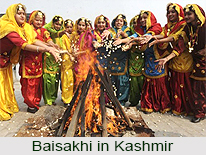
The culture of Kathua District is Pahari which bears a resemblance to the culture of Himachal Paradesh. The other part of the district has Dogra Culture. Dogri is the main language spoken by the people of the district. The district is culturally an integrated part of Jammu region and all important religious fairs like Lohri, Holi, Ramnavami, Baisakhi, Basantpanchami, Shivaratri, Mahanavami, Dussehra, Id-ul-Fitr, Raksha Bandhan, Diwali, Janmashtami, Id-ul-zuha, and Mahatama Gandhi`s birthday are celebrated. Ram Lilas are organised in every town as well as in every village of the district. 
Tourism in Kathua District
Kathua District has a lot to offer when it comes to tourism. Bani, is a small glaciated valley located at a height of 4200 ft in the lap of lofty mountains. It is well-known as Mini Kashmir of Kathua district. It is also base camp of trekkers for bhaderwah, chamba etc. Bani, is marked by waterfalls, thick forest patches, gushing streams and meadows. Banjal is a colourful area with lot of flowers blooming also known as `Garden Of Natural Flowers`. Sarthal is a beautiful meadow situated at a height of 7000 ft which remains covered with snow for six months. The virgin beauty of the area casts a fascinating spell to any visitor. The area is bounded by snow clad mountains. There are also many places in the district which are well known pilgrimage centres. Jodia Di Mata is a religious centre which is visited by hundreds of pilgrims during Navaratris. A large number of pilgrims come to Dhoula Wali Mata and offer their prayers, especially during Navaratris.
How to reach Kathua District
By Road:
Kathua District is located about 88 Kms. from Jammu, 390 Kms from Srinagar and about 500 Kms. from Delhi and 25 Kms from Pathankote. Kathua District is connected to Srinagar, Pathankote, Jammu, and Delhi through National Highway NH-1A. Regular Bus Service is available for Jammu, Udhampur, Katra, Srinagar, Delhi, Pathankote, Chandigarh, Shimla and all other major cities of Punjab, Delhi, Himachal Pradesh, Haryana, Uttar Pradesh, and Rajasthan.
By Rail:
Kathua district is linked through Rail Head to all major cities of the Country. Kathua railway Station is situated at Govindsar, 7 Kms from the City Chowk, Kathua.
By Air:
Nearest Airport to Kathua district is in Jammu.


